Subject: United States
Period: 1827 (dated)
Publication:
Color: Hand Color
Size:
6.3 x 6.3 inches
16 x 16 cm
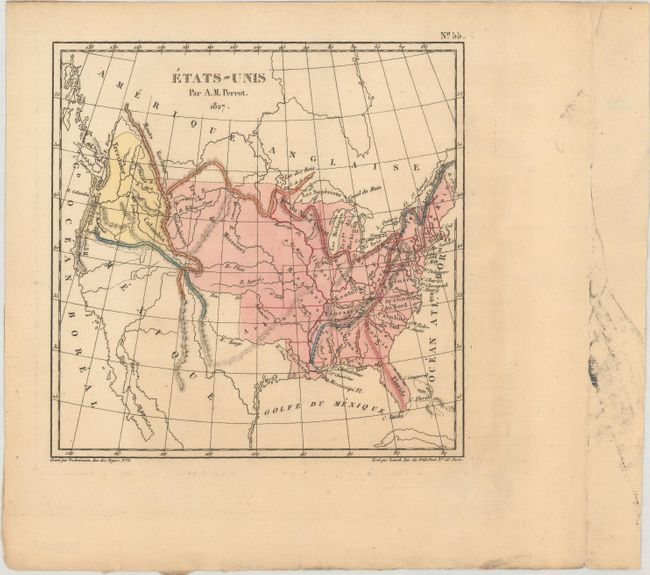
This map of the young United States extends to include much of present-day Canada and part of Mexico. It presents the state of Missouri with a flat western border along with a large Missouri Territory extending to the the Rocky Mountains. To its south is Arkansas Territory, which is depicted in its largest configuration including present-day Oklahoma. The Pacific Northwest is labeled as Columbia and extends north to the 54th parallel, a reflection of the famous 54-40 or Fight controversy. What would become the American Southwest is still a part of Mexico. The map is oddly filled with some erroneous mountain ranges including one that extends the entire length of Florida.
References:
Condition: B+
A nice impression with some minor extraneous creasing and a tear in the far right blank margin that has been closed on verso with archival tape.