Subject: United States
Period: 1834 (dated)
Publication: Stielers Hand-Atlas
Color: Hand Color
Size:
15.4 x 11.9 inches
39.1 x 30.2 cm
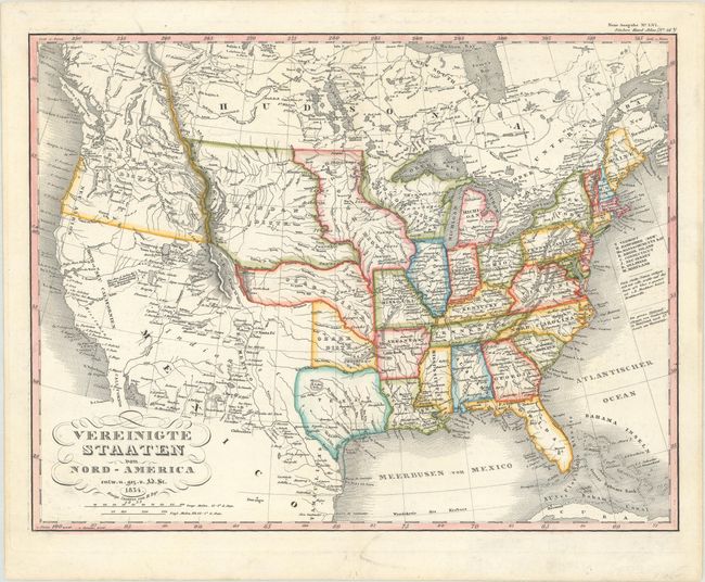
This interesting map of the United States shows the development of the United States up to the Mississippi River with Michigan and Arkansas Territories and several Indian Districts in the west. The Oregon District stretches into present-day Canada, reflecting the conflict with Britain over the region. The West Coast is labeled Californien, Hoch od. Neu Californien, andNeu Albion. There are numerous missions located throughout California. A large loop trail is shown connecting Santa Fe with several towns along the western slope of the Rocky Mountains and the Timpanogos and Tegujo seas. This loop trail is the route of Father Silvestre Velez de Escalante, a Spanish Franciscan missionary, who in 1776-77 set out from Santa Fe seeking a northern route to Monterey in California. Two conjectural rivers flow from the Great Basin into San Francisco Bay, else the region of present-day Nevada and northern California is completely blank.
References:
Condition: A
On a clean bright sheet.