Subject: Eastern United States
Period: 1814 (dated)
Publication:
Color: Hand Color
Size:
8.8 x 7.3 inches
22.4 x 18.5 cm
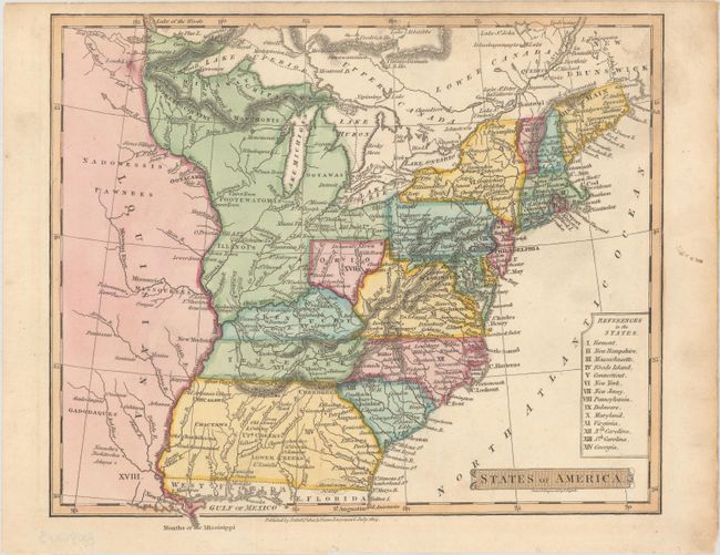
An uncommon, small map of the young nation that was published by Nuttall, Fisher & Dixon. The map extends from the Dist. of Main down to Georgia and just past the Mississippi River to show part of the expansive new Louisiana Territory. Georgia's western boundary is the Mississippi, and the large, unnamed Northwestern Territory contains the lands that would become Illinois, Michigan, Indiana, and Wisconsin. Ohio's northern border is truncated so that it is well south of Lake Erie.
References:
Condition: A
A crisp impression with a few tiny edge tears confined to the bottom blank margin.