Subject: United States, Indians
Period: 1944-60 (dated)
Publication:
Color: Printed Color
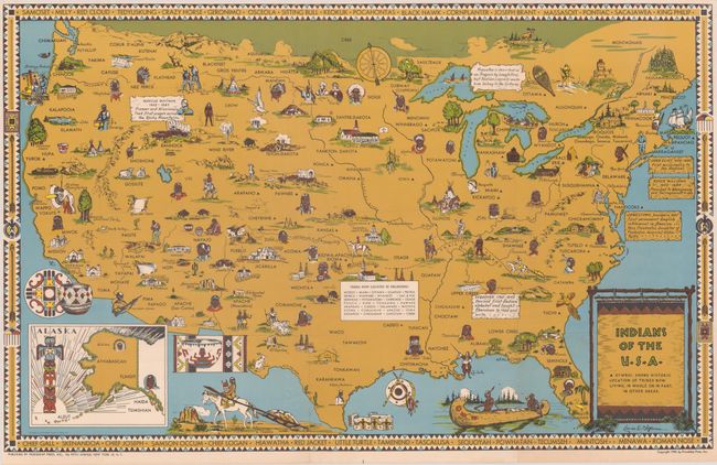
A. Indians of the U.S.A., by Louise E. Jefferson, dated 1944 (33.2 x 21.0"). This pictorial map shows the location of Native American Indian tribes throughout the United States, also noting the historic locations of tribes that have been displaced. The Trail of Tears is shown, and the map is filled with images of Native American figures, dwellings and artifacts. A few notations are included with historical facts. An inset shows Alaska and a superb totem pole. The map border includes the names of important Native American figures throughout history. Published by Friendship Press, the publishing arm of the National Council of Churches. Friendship Press produced a number of maps of various parts of the world that were designed to promote peace and tolerance. This map was created by artist Louise E. Jefferson, who became the first African American to hold a director position at a publishing firm when she was promoted to Artistic Director at Friendship Press in 1942. Jefferson illustrated numerous books for Friendship Press, including several about race, Africa, and African culture, such as Ethel J. Alpenfels Sense & Nonsense about Race (1938). Condition: Issued folding on a bright, clean sheet. Left, top and right margins have been trimmed.
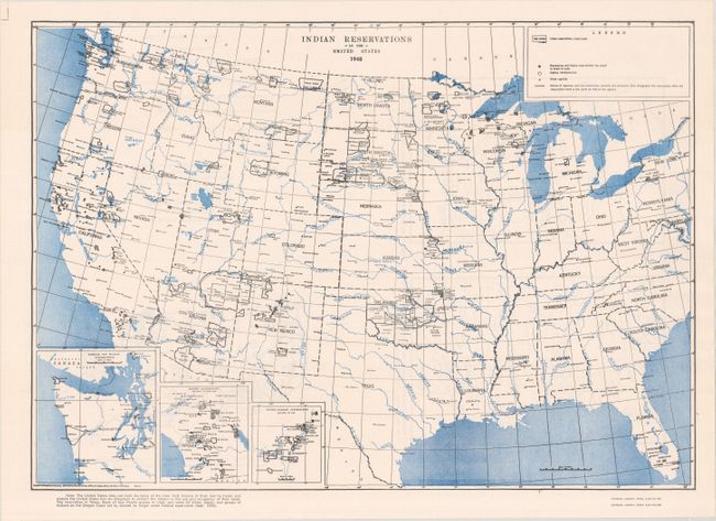
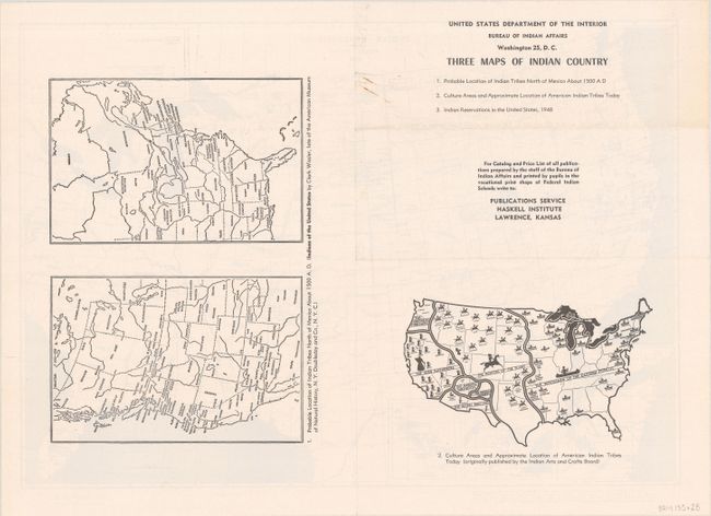
B. Indian Reservations in the United States 1948, by U.S. Department of Interior, dated 1960 (17.9 x 12.6"). Although published in 1960, this map shows the locations and names of Indian Reservations in the continental United States in 1948. Three insets give greater detail of northwest Washington State, the Mission area of California, and the area surrounding Albuquerque in New Mexico. On verso are two additional maps of the United States showing the "probable" location of Indian tribes circa 1500 and another illustrating the "culture areas and approximate location of American Indian Tribes" circa 1958. Compiled and drawn by E. H. Coulson, Chief Engineering Draftsman at the Bureau of Indian Affairs. Condition: Issued folding on a bright sheet with minor soiling on verso.
References: Rumsey #8703.
Condition: A
See description below.