Filtered by Category:United States(Show All Categories)
Showing results for:Auction 173
Catalog Archive
104 lots
Page 1 of 3
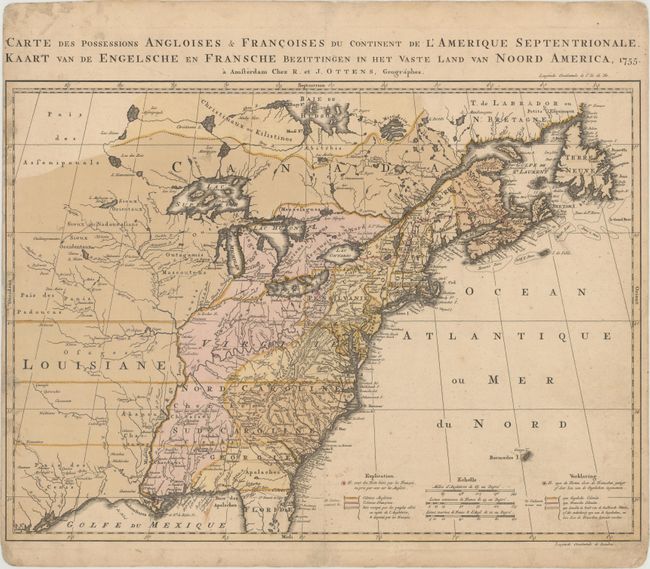
Auction 173, Lot 72
Subject: Colonial Eastern United States & Canada
Ottens, Reiner and Joshua
Carte des Possessions Angloises & Francoises du Continent de l'Amerique Septentrionale / Kaart van de Engelsche en Fransche Bezittingen in het Vaste Land van Noord America, 1755
Size: 22.4 x 16.3 inches (56.9 x 41.4 cm)
Estimate: $2,000 - $2,300
Dutch Version of an Important Map Showing Territorial Claims at the Outset of the French and Indian War
Unsold
Closed on 6/5/2019
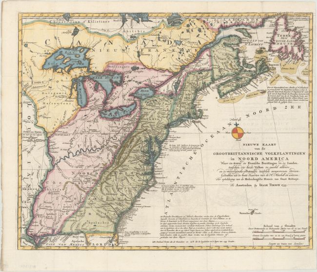
Auction 173, Lot 73
Subject: Colonial Eastern United States & Canada
Tirion, Isaac
Nieuwe Kaart van de Grootbrittannische Volkplantingen in Noord America..., 1755
Size: 17.8 x 14.3 inches (45.2 x 36.3 cm)
Estimate: $600 - $750
Sold for: $500
Closed on 6/5/2019
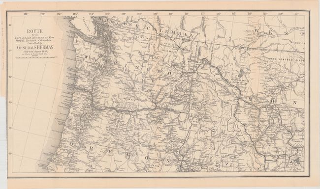
Auction 173, Lot 74
Subject: Northwestern United States, British Columbia
U.S. Government
Route from Fort Ellis Montana to Fort Hope, British Columbia, Travelled by General Sherman July and August 1883, as Shown by Heavy Black Line, 1883
Size: 27.4 x 15.2 inches (69.6 x 38.6 cm)
Estimate: $140 - $170
Sold for: $275
Closed on 6/5/2019
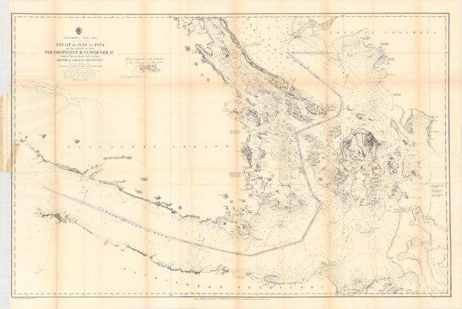
Auction 173, Lot 75
Subject: Washington, British Columbia
U.S. Hydrographic Office
Strait of Juan de Fuca and the Channels Between the Continent & Vancouver Id. Showing the Boundary Line Between British & American Possessions, 1872
Size: 44.3 x 28.8 inches (112.5 x 73.2 cm)
Estimate: $350 - $425
Sold for: $300
Closed on 6/5/2019
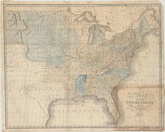
Auction 173, Lot 76
Subject: United States
Map of the United States Drawn from the Most Approved Surveys, 1826
Size: 20.4 x 16.3 inches (51.8 x 41.4 cm)
Estimate: $600 - $750
Unsold
Closed on 6/5/2019
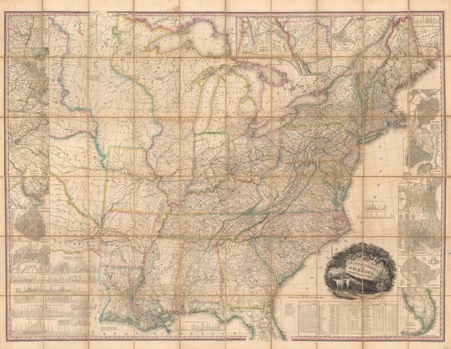
Auction 173, Lot 77
Subject: United States
Tanner, Henry Schenck
United States of America [with] Memoir on the Recent Surveys, Observations, and Internal Improvements, in the United States... [and] Memoir on the Recent Surveys ... Second Edition, 1829
Size: 61 x 45.7 inches (154.9 x 116.1 cm)
Estimate: $9,500 - $12,000
First Edition of Tanner's Important Map of the United States
Sold for: $7,000
Closed on 6/5/2019
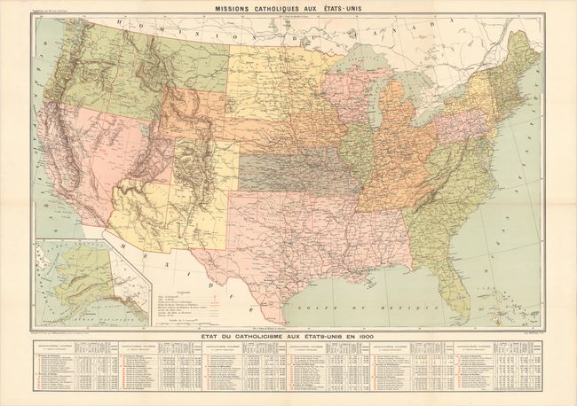
Auction 173, Lot 78
Subject: United States
Hausermann, R.
Missions Catholiques aux Etats-Unis, 1900
Size: 37.3 x 27.5 inches (94.7 x 69.9 cm)
Estimate: $275 - $350
Unsold
Closed on 6/5/2019
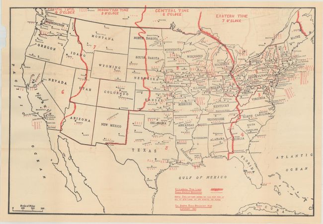
Auction 173, Lot 79
Subject: United States
[Lot of 2] The Duston Radio Broadcast Map [with] Radio Log and Call Book [and] Radio Map of United States and Canada, 1923-24
Size: See Description
Estimate: $160 - $190
Two Rare, Early Radio Maps
Sold for: $80
Closed on 6/5/2019
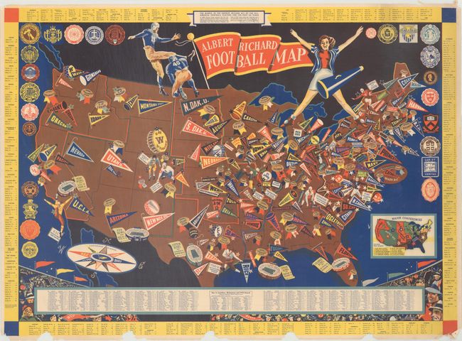
Auction 173, Lot 80
Subject: United States, Football
Albert Richard Football Map, 1940
Size: 25.5 x 18.5 inches (64.8 x 47 cm)
Estimate: $300 - $400
A WWII-Era Map Celebrating College Football
Sold for: $500
Closed on 6/5/2019
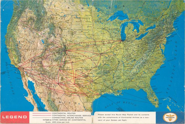
Auction 173, Lot 81
Subject: United States, Flight Maps
[Lot of 3] Welcome Aboard! [and] Air Atlas [and] Delta System Route Map, 1964-89
Size: See Description
Estimate: $50 - $70
NO RESERVE
Sold for: $45
Closed on 6/5/2019
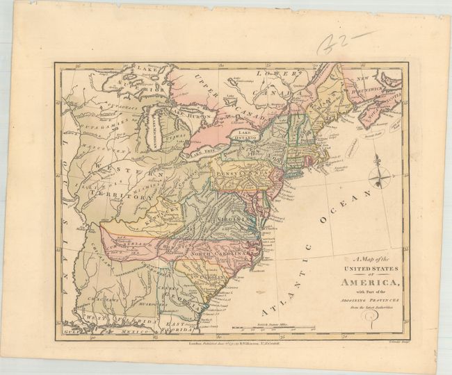
Auction 173, Lot 82
Subject: Eastern United States
Wilkinson, Robert
A Map of the United States of America, with Part of the Adjoining Provinces from the Latest Authorities, 1794
Size: 10.8 x 8.5 inches (27.4 x 21.6 cm)
Estimate: $220 - $250
Sold for: $160
Closed on 6/5/2019
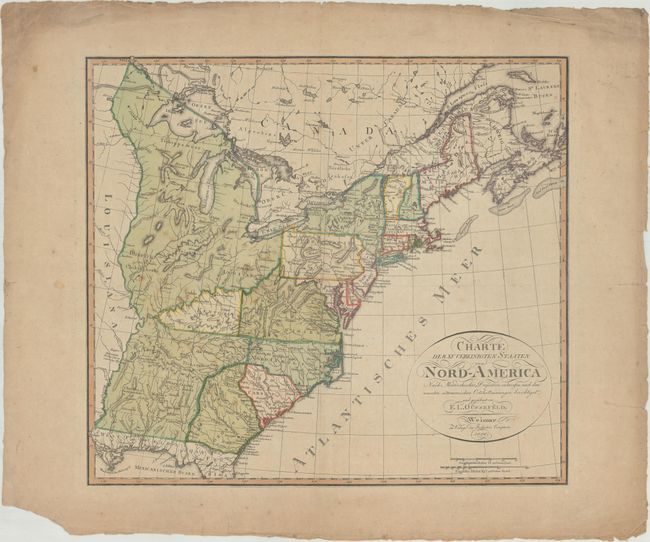
Auction 173, Lot 83
Subject: Eastern United States, Franklin
Gussefeld, Franz Ludwig
Charte der XV Vereinigten Staaten von Nord-America Nach Murdochischer Projection..., 1800
Size: 20.4 x 18.4 inches (51.8 x 46.7 cm)
Estimate: $1,000 - $1,300
Map Depicting the Proposed State of Franklin
Sold for: $850
Closed on 6/5/2019
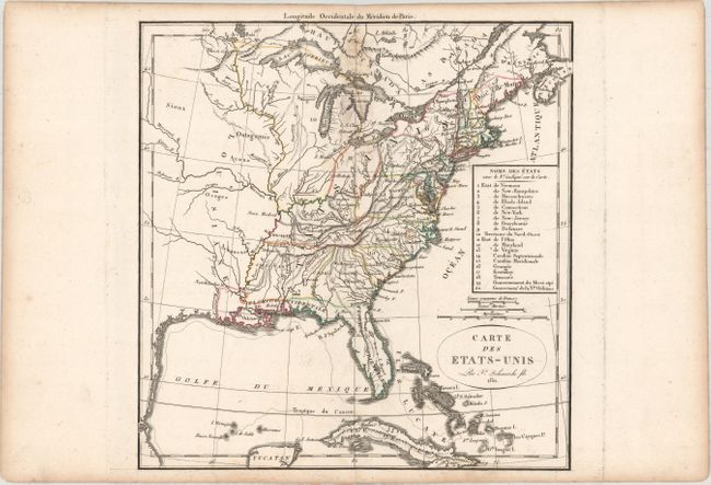
Auction 173, Lot 84
Subject: Eastern United States
Delamarche, Felix
Carte des Etats-Unis, 1811
Size: 10.9 x 11.4 inches (27.7 x 29 cm)
Estimate: $250 - $325
Sold for: $85
Closed on 6/5/2019
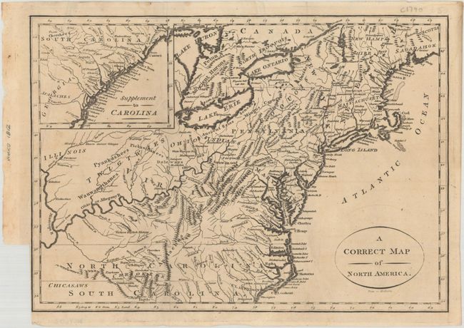
Auction 173, Lot 85
Subject: Eastern United States
A Correct Map of North America, 1812
Size: 11.4 x 8.1 inches (29 x 20.6 cm)
Estimate: $220 - $250
NO RESERVE
Sold for: $55
Closed on 6/5/2019
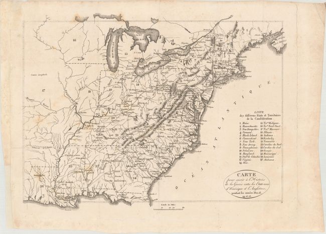
Auction 173, Lot 86
Subject: Eastern United States
Carte pour Servir a l'Historie de la Guerre Entre les Etats-Unis d'Amerique et l'Angleterre, Pendant les Annees 1812, 13, 14 et 15 [with] Histoire de la Guerre Entre les Etats-Unis d'Amerique et l'Angleterre, 1820
Size: 13.1 x 9.8 inches (33.3 x 24.9 cm)
Estimate: $200 - $230
Sold for: $100
Closed on 6/5/2019
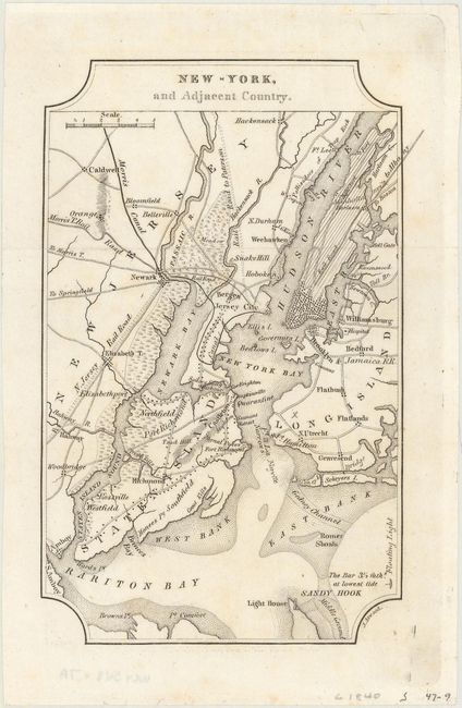
Auction 173, Lot 87
Subject: Eastern United States Cities
Melish, John
[Lot of 7] New-York, and Adjacent Country [and] District of Columbia [and] Boston... [and] Baltimore, Annapolis... [and] Charleston... [and] View of the Country Round the Falls of Niagara [and] Ballston & Saratoga Springs, City of Albany..., 1822
Size: 4 x 6.4 inches (10.2 x 16.3 cm)
Estimate: $300 - $400
NO RESERVE
Sold for: $110
Closed on 6/5/2019
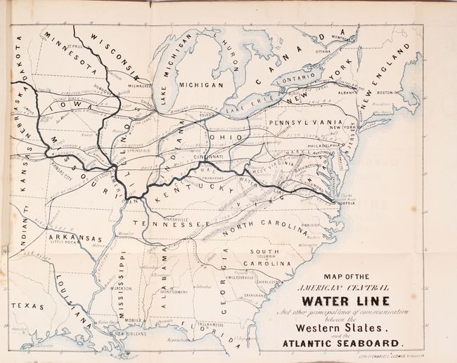
Auction 173, Lot 88
Subject: Eastern United States
Map of the American Central Water Line and Other Principal Lines of Communication Between the Western States, and the Atlantic Seaboard [bound in] The Central Water-Line from the Ohio River to the Virginia Capes..., 1869
Size: 13.5 x 10.9 inches (34.3 x 27.7 cm)
Estimate: $200 - $230
Unsold
Closed on 6/5/2019
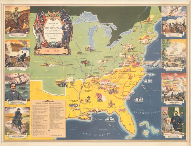
Auction 173, Lot 89
Subject: Eastern United States, Civil War
The Picture Map of the Civil War Showing Nearly 100 Places, Events and Campaigns of Decisive Importance in the Nation's Epic Struggle, 1956
Size: 29.7 x 22 inches (75.4 x 55.9 cm)
Estimate: $160 - $200
NO RESERVE
Sold for: $160
Closed on 6/5/2019
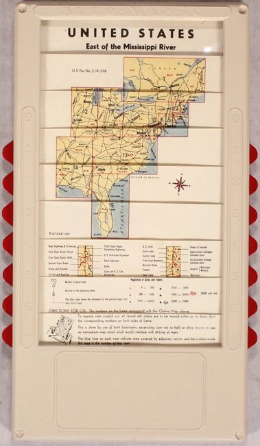
Auction 173, Lot 90
Subject: Eastern United States
Auto-Map-Ic - United States East of the Mississippi River, 1965
Size: 7.3 x 12.5 inches (18.5 x 31.8 cm)
Estimate: $140 - $180
Unusual "Automatic Road Map" of the Eastern United States
Sold for: $100
Closed on 6/5/2019
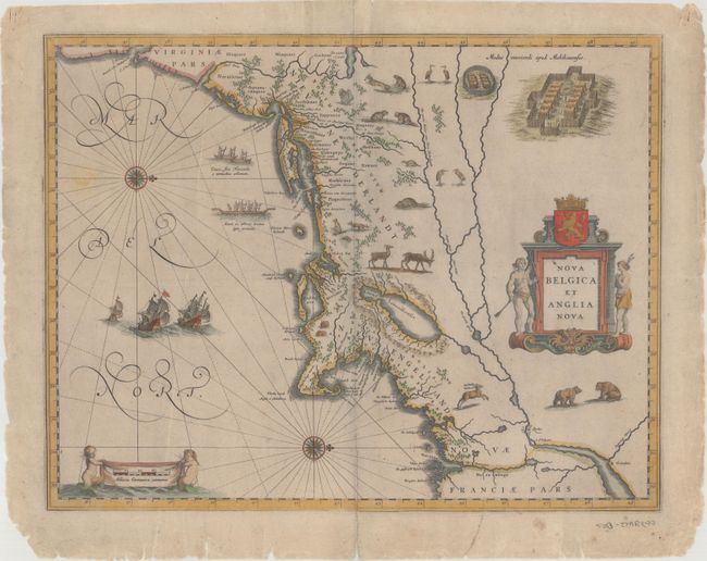
Auction 173, Lot 91
Subject: Colonial New England & Mid-Atlantic United States
Blaeu, Willem
Nova Belgica et Anglia Nova, 1635
Size: 19.5 x 15.3 inches (49.5 x 38.9 cm)
Estimate: $2,200 - $2,500
Important Map of Colonial New England and the Mid-Atlantic - Rare Example with Blank Verso
Sold for: $1,600
Closed on 6/5/2019
Auction 173, Lot 92
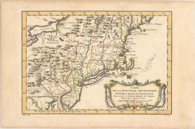
Subject: Colonial New England & Mid-Atlantic United States
Bellin, Jacques Nicolas
Carte de la Nouvelle Angleterre Nouvelle Yorck et Pensilvanie pour Servir a l'Histoire Generale des Voyages, 1757
Size: 11.8 x 8.1 inches (30 x 20.6 cm)
Estimate: $200 - $230
Sold for: $150
Closed on 6/5/2019
Auction 173, Lot 93
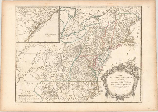
Subject: Colonial New England & Mid-Atlantic United States
Robert de Vaugondy
Partie de l'Amerique Septentrionale, qui Comprend le Cours de l'Ohio, la Nlle. Angleterre, la Nlle York, le New Jersey, la Pensylvanie, le Maryland la Virginie, la Caroline, 1788
Size: 24.4 x 18.8 inches (62 x 47.8 cm)
Estimate: $600 - $750
Unsold
Closed on 6/5/2019
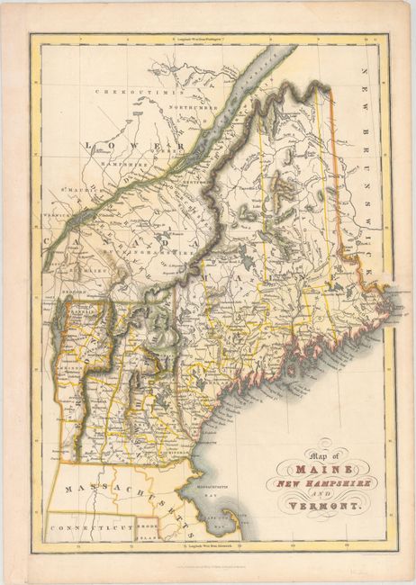
Auction 173, Lot 94
Subject: Maine, New Hampshire & Vermont
Hinton, Simpkin & Marshall
Map of Maine New Hampshire and Vermont, 1832
Size: 10.4 x 14.1 inches (26.4 x 35.8 cm)
Estimate: $120 - $150
Sold for: $65
Closed on 6/5/2019
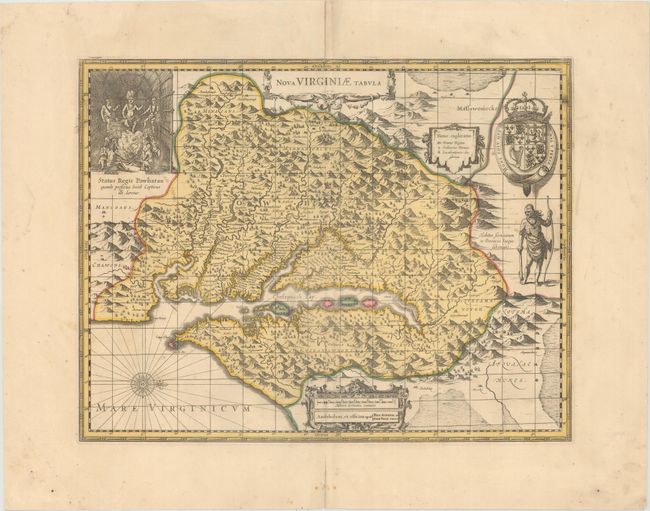
Auction 173, Lot 95
Subject: Colonial Mid-Atlantic United States
Hondius/Schenk & Valck
Nova Virginiae Tabula, 1700
Size: 19.2 x 14.8 inches (48.8 x 37.6 cm)
Estimate: $1,100 - $1,400
One of the Most Important 17th Century Maps of the Chesapeake Bay
Sold for: $750
Closed on 6/5/2019
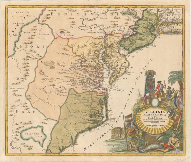
Auction 173, Lot 96
Subject: Colonial Mid-Atlantic United States
Homann, Johann Baptist
Virginia Marylandia et Carolina in America Septentrionali Britannorum Industria Excultae, 1730
Size: 22.8 x 19.2 inches (57.9 x 48.8 cm)
Estimate: $1,900 - $2,200
Map Created to Promote German Immigration to the New World
Sold for: $1,175
Closed on 6/5/2019
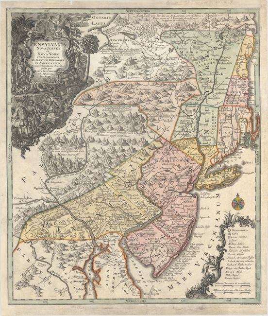
Auction 173, Lot 97
Subject: Colonial Mid-Atlantic United States
Seutter/Lotter
Pensylvania Nova Jersey et Nova York cum Regionibus ad Fluvium Delaware in America Sitis, Nova Delineatione ob Oculos Posita, 1750
Size: 19.3 x 22.4 inches (49 x 56.9 cm)
Estimate: $1,400 - $1,700
Unsold
Closed on 6/5/2019
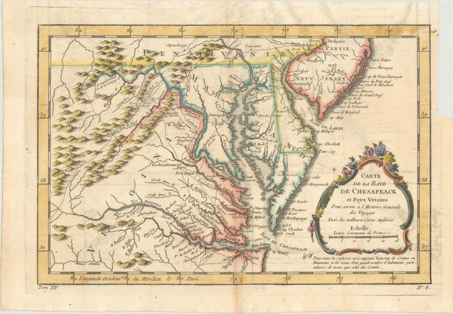
Auction 173, Lot 98
Subject: Colonial Mid-Atlantic United States
Bellin, Jacques Nicolas
Carte de la Baye de Chesapeack et Pays Voisins pour Servir a l'Histoire Generale des Voyages..., 1757
Size: 11.4 x 7.5 inches (29 x 19.1 cm)
Estimate: $220 - $250
Sold for: $120
Closed on 6/5/2019
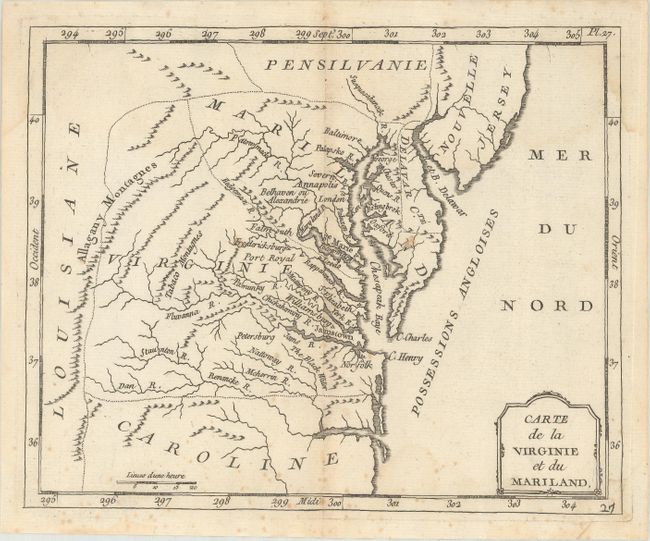
Auction 173, Lot 99
Subject: Colonial Mid-Atlantic United States
Laporte, Joseph de
Carte de la Virginie et du Mariland, 1770
Size: 8.6 x 7 inches (21.8 x 17.8 cm)
Estimate: $220 - $250
Unsold
Closed on 6/5/2019
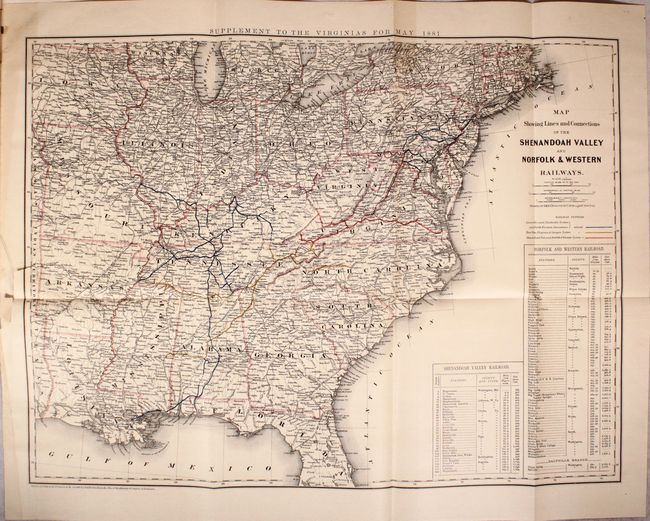
Auction 173, Lot 100
Subject: Virginia & West Virginia
The Virginias, A Mining, Industrial and Scientific Journal, Devoted to the Development of Virginia and West Virginia, 1881
Size: 10.3 x 13.8 inches (26.2 x 35.1 cm)
Estimate: $140 - $170
Sold for: $160
Closed on 6/5/2019
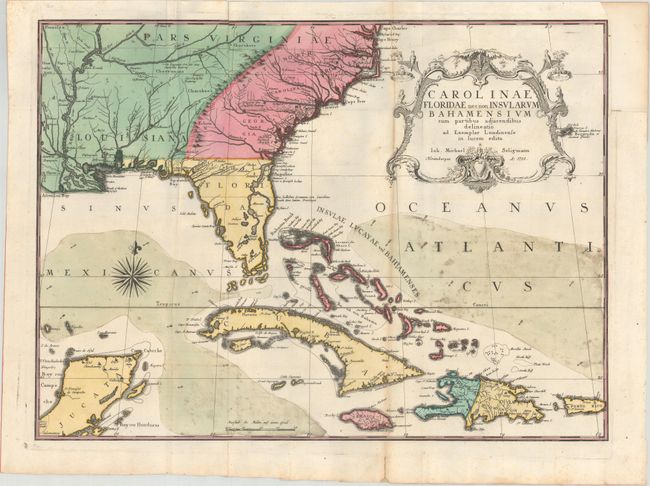
Auction 173, Lot 101
Subject: Colonial Southeast United States, Bahamas & Greater Antilles
Seligmann, Johann Michael
Carolinae Floridae nec non Insularum Bahamensium cum Partibus Adjacendibus Delineatio ad Exemplar Londinense in Lucem Edita, 1755
Size: 23 x 16.8 inches (58.4 x 42.7 cm)
Estimate: $2,750 - $3,500
German Edition of Catesby's Scarce and Important Map of the Southeastern United States
Unsold
Closed on 6/5/2019
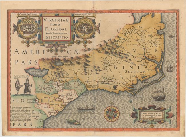
Auction 173, Lot 102
Subject: Colonial Southeast United States
Mercator/Hondius
Virginiae Item et Floridae Americae Provinciarum, Nova Descriptio, 1623
Size: 19.1 x 13.5 inches (48.5 x 34.3 cm)
Estimate: $1,800 - $2,100
A Seminal Map of the Southeast and Early American Cartography
Sold for: $1,300
Closed on 6/5/2019
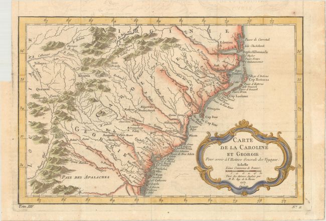
Auction 173, Lot 103
Subject: Colonial Southeast United States
Bellin, Jacques Nicolas
Carte de la Caroline et Georgie pour Servir a l'Histoire Generale des Voyages, 1757
Size: 11.2 x 7.4 inches (28.4 x 18.8 cm)
Estimate: $220 - $250
Sold for: $120
Closed on 6/5/2019
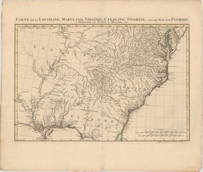
Auction 173, Lot 104
Subject: Colonial Southeast United States
Covens & Mortier
Carte de la Louisiane, Maryland, Virginie, Caroline, Georgie, avec une Partie de la Floride, 1758
Size: 23.3 x 15.4 inches (59.2 x 39.1 cm)
Estimate: $1,500 - $1,800
Covens & Mortier's Map of the Southeast Issued During the French and Indian War
Sold for: $850
Closed on 6/5/2019
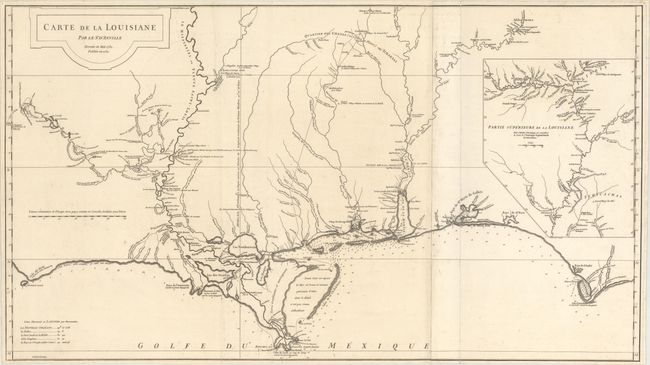
Auction 173, Lot 105
Subject: Colonial Southern United States
Anville, Jean Baptiste Bourguignon d'
Carte de la Louisiane par Le Sr. D'Anville Dressee en Mai 1732. Publiee en 1752., 1752
Size: 36.4 x 20.4 inches (92.5 x 51.8 cm)
Estimate: $1,600 - $2,000
An Early, Detailed Depiction of the Gulf Coast
Sold for: $1,000
Closed on 6/5/2019
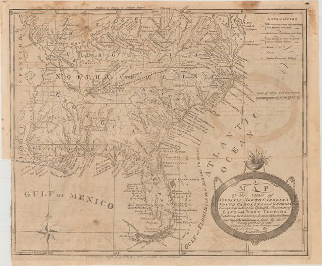
Auction 173, Lot 106
Subject: Southern United States
Purcell, Joseph
A Map of the States of Virginia North Carolina South Carolina and Georgia Comprehending the Spanish Provinces of East and West Florida..., 1793
Size: 14.8 x 12.4 inches (37.6 x 31.5 cm)
Estimate: $800 - $1,000
Second State of Purcell's Map Locating the Proposed State of Frankland
Sold for: $650
Closed on 6/5/2019
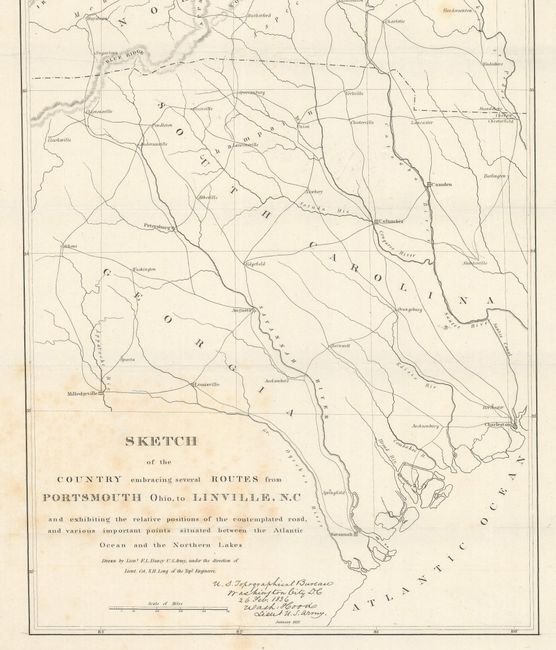
Auction 173, Lot 107
Subject: Central & Southeast United States
U.S. Corps of Engineers
Sketch of the Country Embracing Several Routes from Portsmouth Ohio, to Linville, N.C and Exhibiting the Relative Positions of the Contemplated Road..., 1836
Size: 12.1 x 40.9 inches (30.7 x 103.9 cm)
Estimate: $160 - $200
Sold for: $80
Closed on 6/5/2019
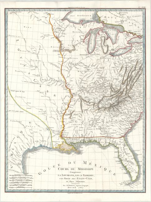
Auction 173, Lot 108
Subject: Central United States
Poirson, Jean Baptiste
Cours du Mississipi Comprenant la Louisiane, les 2 Florides, une Partie des Etats-Unis et Pays Adjacents, 1803
Size: 16.3 x 21.3 inches (41.4 x 54.1 cm)
Estimate: $400 - $500
Sold for: $550
Closed on 6/5/2019
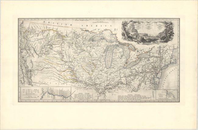
Auction 173, Lot 109
Subject: Central United States
Maximilian zu Wied-Neuwied
Map to Illustrate the Route of Prince Maximilian of Wied... in North America / Carte Itineraire de Prince Maximilien de Wied dans l'Interieur de l'Amerique Septentrionale... / Reise Charte des Prinzen Maximilian zu Wied..., 1993
Size: 31.9 x 16.6 inches (81 x 42.2 cm)
Estimate: $500 - $650
Sold for: $300
Closed on 6/5/2019
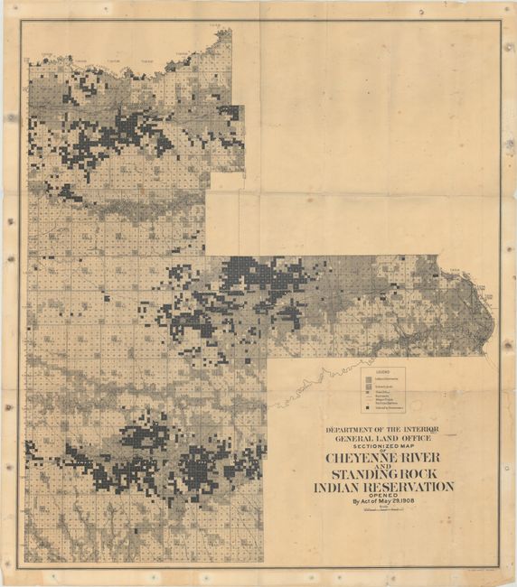
Auction 173, Lot 110
Subject: Dakotas
General Land Office
Sectionized Map of Cheyenne River and Standing Rock Indian Reservation Opened by Act of May 29, 1908, 1908
Size: 28 x 31.5 inches (71.1 x 80 cm)
Estimate: $180 - $220
Sold for: $120
Closed on 6/5/2019
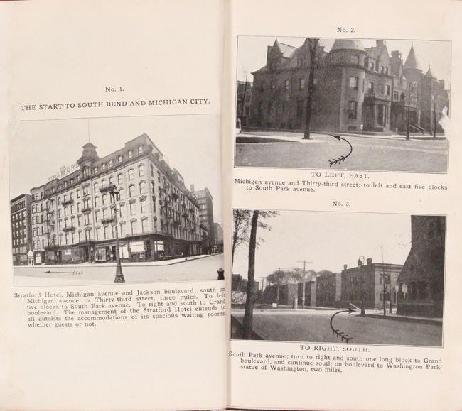
Auction 173, Lot 111
Subject: Chicago, South Bend, Central United States
Photographic Runs Series "D" Chicago to South Bend and Michigan City, 1905
Size: 4.9 x 7.9 inches (12.4 x 20.1 cm)
Estimate: $350 - $425
A Rare, Pioneering Photographic Road Guide
Sold for: $650
Closed on 6/5/2019

Auction 173, Lot 112
Subject: Western United States
La Perouse, Comte Jean F. Galoup, de
Carte Particuliere de la Cote du Nord-Ouest de l'Amerique Reconnue par les Fregates Francaises la Boussole et l'Astrolabe en 1786. 3e. Feuille, 1797
Size: 27.4 x 19.7 inches (69.6 x 50 cm)
Estimate: $140 - $170
Unsold
Closed on 6/5/2019
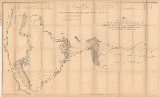
Auction 173, Lot 113
Subject: Western United States
Fremont, John Charles
Map of an Exploring Expedition to the Rocky Mountains in the Year 1842 and to Oregon & North California in the Years 1843-4, 1845
Size: 51.5 x 30.6 inches (130.8 x 77.7 cm)
Estimate: $750 - $900
Fremont's Large Map of the American West
Sold for: $375
Closed on 6/5/2019
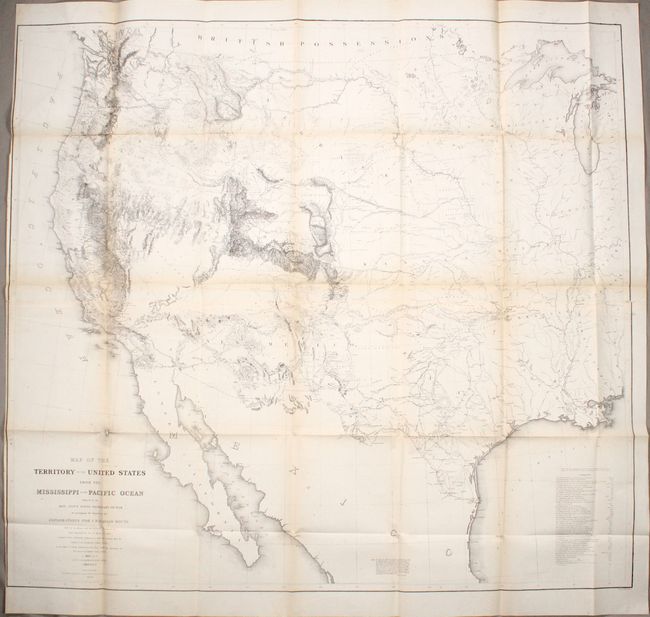
Auction 173, Lot 114
Subject: Western United States
Warren, Lieut. G. K.
Map of the Territory of the United States from the Mississippi to the Pacific Ocean Ordered by the Hon. Jeff'n Davis, Secretary of War..., 1857
Size: 46.3 x 42.1 inches (117.6 x 106.9 cm)
Estimate: $950 - $1,100
Warren's General Map - One of the Most Important Maps of the American West
Sold for: $700
Closed on 6/5/2019
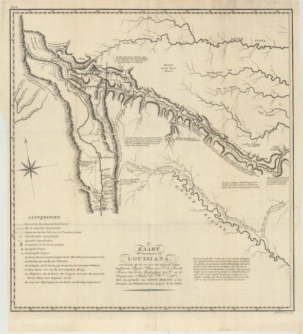
Auction 173, Lot 115
Subject: Southwestern United States
Pike, Zebulon
Kaart der Binnenlanden van Louisiana, Vervattende alle de tot dien tijd Onbekende Landen..., 1812
Size: 14.7 x 15.6 inches (37.3 x 39.6 cm)
Estimate: $1,800 - $2,200
A Cornerstone Map of Early Western Exploration
Sold for: $900
Closed on 6/5/2019
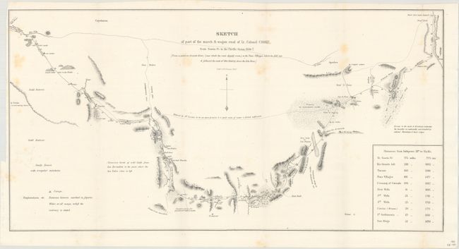
Auction 173, Lot 116
Subject: Southwestern United States
U.S. War Department
Sketch of Part of the March & Wagon Road of Lt. Colonel Cooke, from Santa Fe to the Pacific Ocean, 1846-7, 1847
Size: 22.8 x 11.6 inches (57.9 x 29.5 cm)
Estimate: $180 - $220
Sold for: $95
Closed on 6/5/2019

Auction 173, Lot 117
Subject: Southwestern United States
U.S. State Surveys
Sketch of Public Surveys in New Mexico, to Accompany Report of Surveyor General, 1856
Size: 32.7 x 22.4 inches (83.1 x 56.9 cm)
Estimate: $160 - $190
Sold for: $75
Closed on 6/5/2019
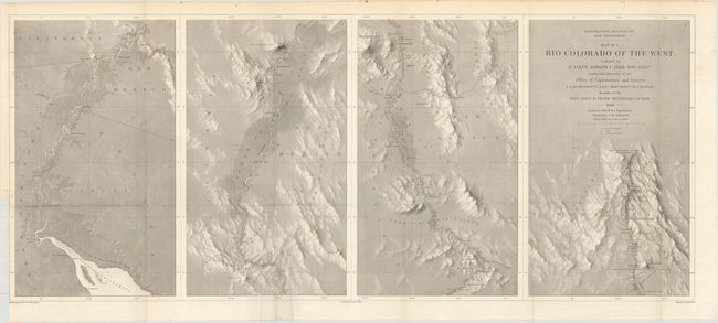
Auction 173, Lot 118
Subject: Southwestern United States
Ives, Joseph C. (Lt.)
[Lot of 2] Map No. 1. [and] Map No. 2. Rio Colorado of the West..., 1858
Size: 34.8 x 14.6 inches (88.4 x 37.1 cm)
Estimate: $250 - $325
Sold for: $180
Closed on 6/5/2019
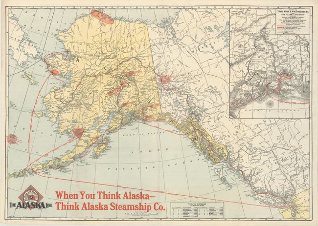
Auction 173, Lot 119
Subject: Alaska
Poole Bros.
[The Alaska Line Map of Alaska], 1917
Size: 30.5 x 21.4 inches (77.5 x 54.4 cm)
Estimate: $100 - $130
Sold for: $75
Closed on 6/5/2019
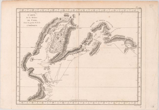
Auction 173, Lot 120
Subject: Southern Alaska
Cook/Benard
Carte de la Riviere de Cook, dans la Partie N.O. de l'Amerique, 1785
Size: 11.9 x 9.3 inches (30.2 x 23.6 cm)
Estimate: $90 - $120
NO RESERVE
Sold for: $8
Closed on 6/5/2019
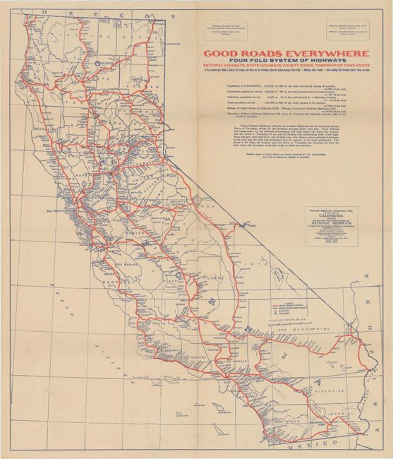
Auction 173, Lot 121
Subject: California
National Highways Preliminary Map of the State of California Showing Sixty-Two Hundred Miles of National Highways..., 1916
Size: 18.9 x 22.2 inches (48 x 56.4 cm)
Estimate: $160 - $190
Sold for: $325
Closed on 6/5/2019
104 lots
Page 1 of 3