Catalog Archive
Auction 173, Lot 119

"[The Alaska Line Map of Alaska]", Poole Bros.
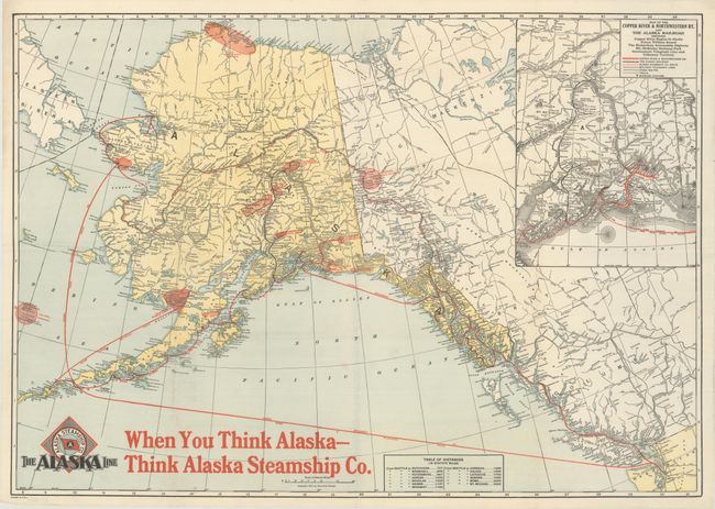
Subject: Alaska

Period: 1917 (dated)

Publication:

Color: Printed Color

Size:
30.5 x 21.4 inches
77.5 x 54.4 cm
Download High Resolution Image
(or just click on image to launch the Zoom viewer)

This map of Alaska was published for the Alaska Steamship Company and features its colorful logo at lower left. The map identifies towns and cities, rivers, mountains (with elevations), coal fields, oil fields, gold regions, Mt. McKinley National Park, and more. An inset at top right shows the route of the Copper River & Northwestern Railway in red overprinting, plus the stage routes, telegraphs, etc. Along the bottom, there is bold red overprinting: "When You Think Alaska - Think Alaska Steamship Co."

References:

Condition: A

Issued folding with minor extraneous creasing.

Estimate: $100 - $130

Sold for: $75

Closed on 6/5/2019

Archived