Subject: Colonial Eastern United States & Canada
Period: 1755 (dated)
Publication:
Color: Hand Color
Size:
17.8 x 14.3 inches
45.2 x 36.3 cm
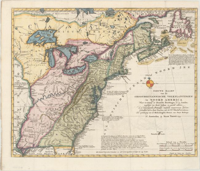
This is a handsome illustration of the British and French possessions at the beginning of the French and Indian War. It is a very detailed map of the disputed region between the Mississippi River and the Appalachian and Allegheny Mountains, which is graphically depicted and delineated by a dashed line for the French claims and a dotted line for the British claims. The frontier forts of both nations are located, as are colonial settlements and Indian villages. The imaginary islands in Lake Superior are evident, including I. Philippeaux, Ponchartrain, and St. Anne. The map was based on information from John Mitchell's great map of North America. This map first appeared in Tirion's Hedendaagsche Historie, of Tegenwoordige Staat van Groot Brittannie, a two-volume set that was published in 1754-55.
References: McCorkle #755.39 &769.1; Sellers and Van Ee #63.
Condition: A
A crisp impression on a bright sheet, issued folding, with minor offsetting and a narrow right margin. A binding tear that just enters the border at right has been professionally repaired.