Subject: Colonial Mid-Atlantic United States
Period: 1730 (circa)
Publication:
Color: Hand Color
Size:
22.8 x 19.2 inches
57.9 x 48.8 cm
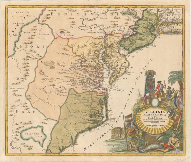
This handsome map of the mid-Atlantic colonies is balanced with an exquisite pictorial cartouche filling the lower right. It locates the large hypothetical lake (Apalache Lacus) west of Craven County, Carolina. Some counties and many rivers of eastern Virginia are shown, but western Virginia is vague with only Germantown, Mister Krug's Plantation and Fort Christ Anna named. Florida is shown extending west of Virginia, all the way north to Lake Erie. Maryland along Cheseapeake Bay [sic] shows many rivers and towns with soundings in most bays, and the coastline of North Carolina is fairly accurate. Philadelphia is shown correctly in this second state (Williams & Johnson) as a block plan resting between the Schuylkill River and another branch, not divided by the rambling Sasquesahanag River as in earlier editions. New Jersey is divided vertically into west and east sections. There is a large Sandy Hook, a minuscule Manhattan, and a thin Long Island Sound. The huge title cartouche depicts European merchants, Indians, trade goods, and the fruits of land and sea -- imagery intended to attract people to the New World.
References: Cumming (SE) #156, Williams & Johnson #7.
Condition: A
Watermarked paper with professionally repaired centerfold separations and very minor soiling.