Subject: Eastern United States
Period: 1811 (dated)
Publication:
Color: Hand Color
Size:
10.9 x 11.4 inches
27.7 x 29 cm
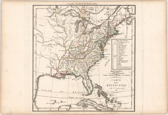
This uncommon map lists the twenty political divisions of the United States in 1811. Besides the seventeen states, the map also identifies the Territory of the North-West, and the Governments of Mississippi and New Orleans. The list is keyed to the map. The organized New Orleans is a large region occupying much of today's Louisiana. Only Ohio (1803) has been formed from NW Territory, but with significantly different borders than we see today. Each political entity is identified with engraved line and hand coloring, and many frontier towns are named and located. The map extends roughly to the center of Texas (unnamed) with some watershed information in the mostly blank Louisiana Territory. There is good detail of the Great Lakes and the course of the St. Laurence River.
References:
Condition: B+
A dark impression with minor soiling along the upper centerfold. An extraneous crease is confined to the right blank margin.