Filtered by Category:Canada(Show All Categories)
Showing results for:Auction 173
Catalog Archive
8 lots
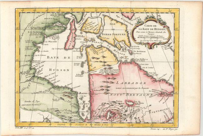
Auction 173, Lot 68
Subject: Eastern Canada, Hudson Bay
Bellin, Jacques Nicolas
Carte de la Baye de Hudson, pour Servir a l'Histoire Generale des Voyages, 1757
Size: 12 x 8.8 inches (30.5 x 22.4 cm)
Estimate: $110 - $140
Sold for: $80
Closed on 6/5/2019
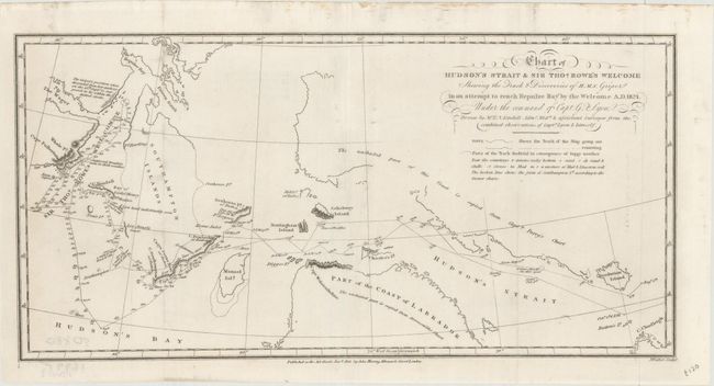
Auction 173, Lot 69
Subject: Eastern Canada, Hudson Bay
Murray, John
Chart of Hudson's Strait & Sir Thos. Rowe's Welcome Shewing the Track & Discoveries of H.M.S. Griper in an Attempt to Reach Repulse Bay by the Welcome A.D. 1824..., 1825
Size: 14.3 x 7 inches (36.3 x 17.8 cm)
Estimate: $120 - $150
Sold for: $90
Closed on 6/5/2019
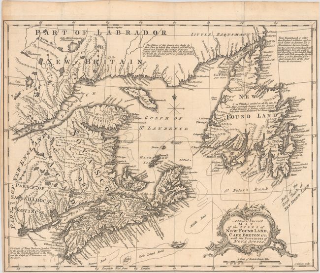
Auction 173, Lot 70
Subject: Eastern Canada
Gibson, John
A New & Correct Map of the Isles of New Found Land, Cape Breton &c: with the Provinces of Nova Scotia, 1762
Size: 13.6 x 10.9 inches (34.5 x 27.7 cm)
Estimate: $160 - $190
Sold for: $170
Closed on 6/5/2019
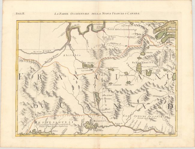
Auction 173, Lot 71
Subject: Eastern Canada
Zatta, Antonio
La Parte Occidentale della Nuova Francia o Canada, 1785
Size: 16.6 x 12 inches (42.2 x 30.5 cm)
Estimate: $120 - $150
Sold for: $60
Closed on 6/5/2019
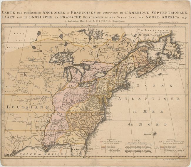
Auction 173, Lot 72
Subject: Colonial Eastern United States & Canada
Ottens, Reiner and Joshua
Carte des Possessions Angloises & Francoises du Continent de l'Amerique Septentrionale / Kaart van de Engelsche en Fransche Bezittingen in het Vaste Land van Noord America, 1755
Size: 22.4 x 16.3 inches (56.9 x 41.4 cm)
Estimate: $2,000 - $2,300
Dutch Version of an Important Map Showing Territorial Claims at the Outset of the French and Indian War
Unsold
Closed on 6/5/2019
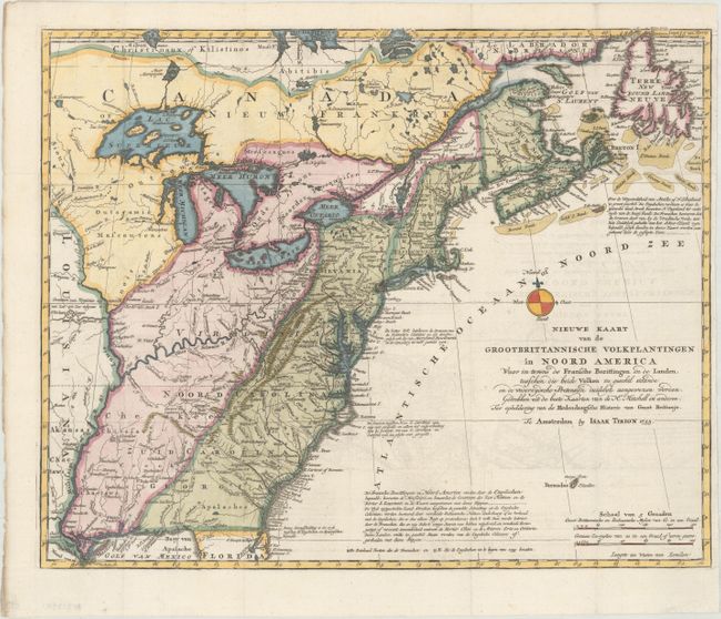
Auction 173, Lot 73
Subject: Colonial Eastern United States & Canada
Tirion, Isaac
Nieuwe Kaart van de Grootbrittannische Volkplantingen in Noord America..., 1755
Size: 17.8 x 14.3 inches (45.2 x 36.3 cm)
Estimate: $600 - $750
Sold for: $500
Closed on 6/5/2019
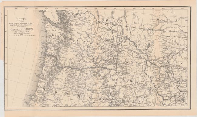
Auction 173, Lot 74
Subject: Northwestern United States, British Columbia
U.S. Government
Route from Fort Ellis Montana to Fort Hope, British Columbia, Travelled by General Sherman July and August 1883, as Shown by Heavy Black Line, 1883
Size: 27.4 x 15.2 inches (69.6 x 38.6 cm)
Estimate: $140 - $170
Sold for: $275
Closed on 6/5/2019
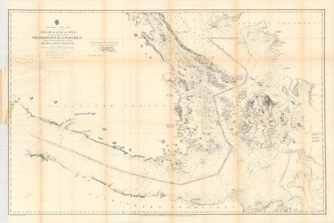
Auction 173, Lot 75
Subject: Washington, British Columbia
U.S. Hydrographic Office
Strait of Juan de Fuca and the Channels Between the Continent & Vancouver Id. Showing the Boundary Line Between British & American Possessions, 1872
Size: 44.3 x 28.8 inches (112.5 x 73.2 cm)
Estimate: $350 - $425
Sold for: $300
Closed on 6/5/2019
8 lots