Filtered by Category:United States(Show All Categories)
Showing results for:Auction 157
Catalog Archive
228 lots
Page 1 of 5
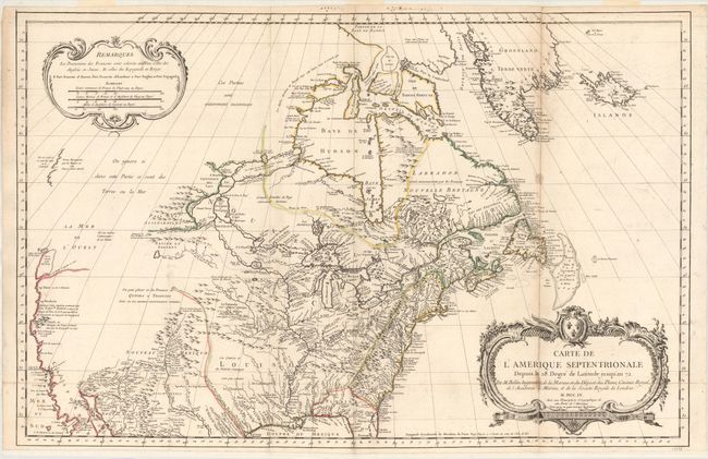
Auction 157, Lot 127
Subject: Colonial United States & Canada
Bellin, Jacques Nicolas
Carte de l'Amerique Septentrionale Depuis le 28 Degre de Latitude Jusqu'au 72, 1755
Size: 34 x 22 inches (86.4 x 55.9 cm)
Estimate: $1,500 - $1,800
NO RESERVE - Bellin's Important, Large Format Map of North America
Sold for: $950
Closed on 5/4/2016
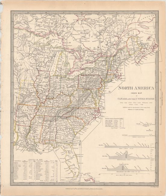
Auction 157, Lot 128
Subject: United States & Canada
SDUK Society for the Diffusion of Useful Knowledge
[Lot of 15 - North America], 1832-34
Size: 12.3 x 15.1 inches (31.2 x 38.4 cm)
Estimate: $950 - $1,200
Matching Set of North America SDUK Maps
Sold for: $1,200
Closed on 5/4/2016
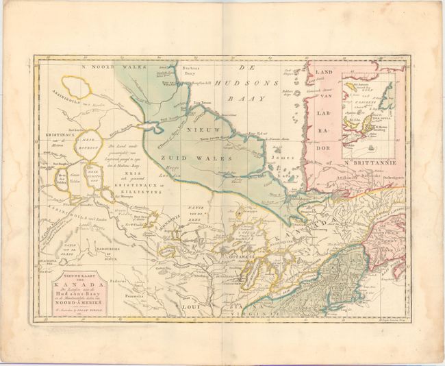
Auction 157, Lot 129
Subject: Colonial Northern United States & Canada
Tirion, Isaac
Nieuwe Kaart van Kanada, de Landen aan de Hudsons-Baay en de Noordwestelyke Deelen van Noord-Amerika, 1769
Size: 17.2 x 12.2 inches (43.7 x 31 cm)
Estimate: $275 - $350
Sold for: $140
Closed on 5/4/2016
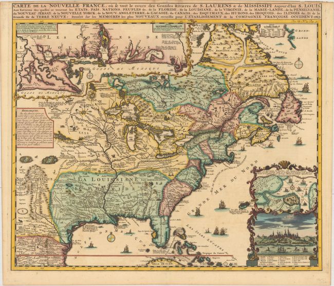
Auction 157, Lot 130
Subject: Colonial Eastern United States & Canada
Chatelain, Henry Abraham
Carte de la Nouvelle France, ou se voit le Cours des Grandes Rivieres de S. Laurens & de Mississipi Aujour d'hui S. Louis, aux Environs des Quelles se Trouvent les Etats, Pais, Nations, Peuples &c..., 1719
Size: 19.1 x 16.6 inches (48.5 x 42.2 cm)
Estimate: $2,200 - $2,500
One of the Most Informative 18th Century Maps of the French Possessions in North America
Sold for: $2,400
Closed on 5/4/2016
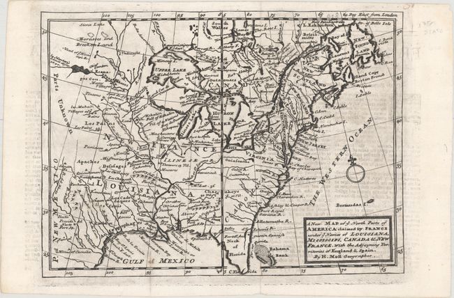
Auction 157, Lot 131
Subject: Colonial Eastern United States & Canada
Moll, Herman
A New Map of ye North Parts of America Claimed by France under ye Names of Louisiana, Mississipi, Canada & New France, with the Adjoyning Territories of England & Spain, 1735
Size: 10.8 x 7.8 inches (27.4 x 19.8 cm)
Estimate: $450 - $550
Unsold
Closed on 5/4/2016
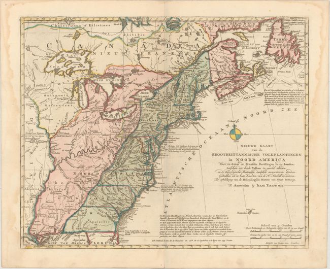
Auction 157, Lot 132
Subject: Colonial Eastern United States & Canada
Tirion, Isaac
Nieuwe Kaart van de Grootbrittannische Volkplantingen in Noord America..., 1755
Size: 17.7 x 14.4 inches (45 x 36.6 cm)
Estimate: $650 - $750
Sold for: $450
Closed on 5/4/2016
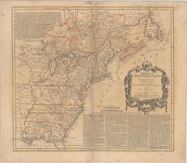
Auction 157, Lot 133
Subject: Colonial Eastern United States & Canada
Homann Heirs
America Septentrionalis a Domino d'Anville in Galliis Edita nunc in Anglia Coloniis in Interiorem Virginiam Deductis nec non Fluvii Ohio Cursu..., 1777
Size: 20 x 18 inches (50.8 x 45.7 cm)
Estimate: $550 - $700
Sold for: $300
Closed on 5/4/2016
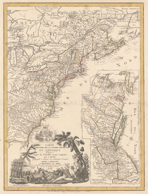
Auction 157, Lot 134
Subject: Colonial Eastern United States & Canada
Denis, Louis
Carte du Theatre de la Guerre Presente en Amerique Dressee d'Apres les Nouvelles Cartes Anglaises..., 1779
Size: 19.8 x 26.3 inches (50.3 x 66.8 cm)
Estimate: $4,750 - $6,000
Scarce American Revolutionary War Map
Sold for: $3,000
Closed on 5/4/2016
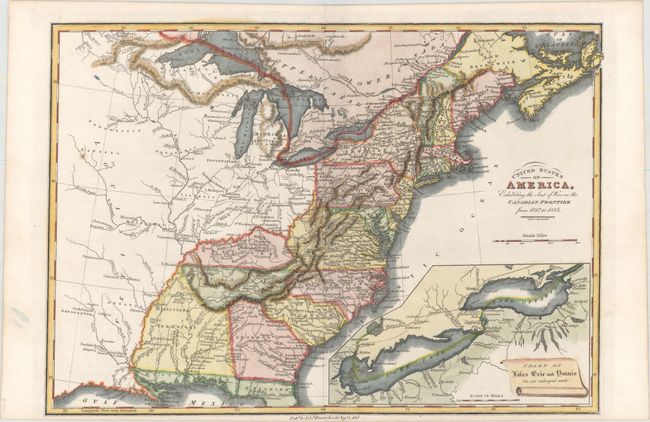
Auction 157, Lot 135
Subject: Eastern United States & Canada
Baines, Edward
United States of America, Exhibiting the Seat of War on the Canadian Frontier from 1812 to 1815, 1816
Size: 13.5 x 9.5 inches (34.3 x 24.1 cm)
Estimate: $350 - $425
Sold for: $475
Closed on 5/4/2016
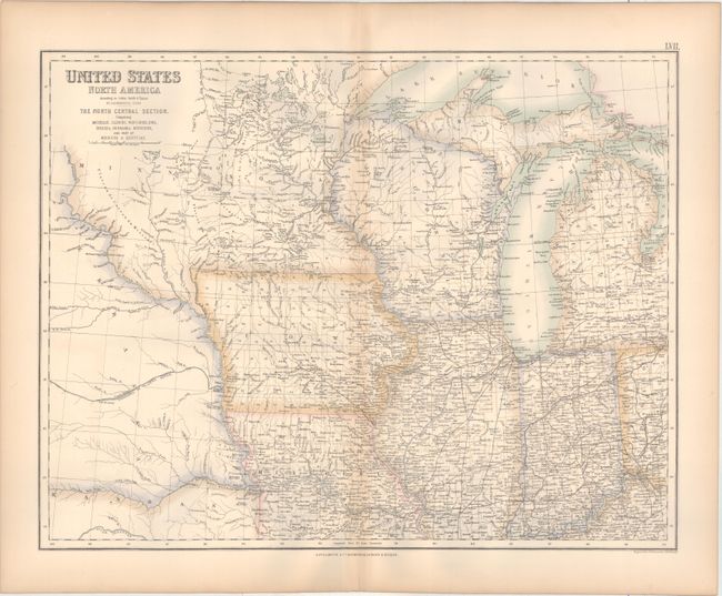
Auction 157, Lot 136
Subject: Eastern United States & Canada
Fullarton, Archibald & Co.
[Lot of 3] United States North America ... The North Eastern States... [and] ... The South Eastern States... [and] ... The North Central Section..., 1857
Size: 20.8 x 15.8 inches (52.8 x 40.1 cm)
Estimate: $160 - $190
Sold for: $100
Closed on 5/4/2016
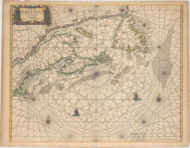
Auction 157, Lot 137
Subject: Canadian Maritimes & New England
Loon, Jan van
Pas-caerte van Terra Nova, Nova Francia, Nieuw Engeland en de Grote Rivier van Canada, 1666
Size: 21.2 x 16.8 inches (53.8 x 42.7 cm)
Estimate: $4,000 - $5,500
Very Influential Dutch Sea Chart of the Canadian Maritimes
Unsold
Closed on 5/4/2016
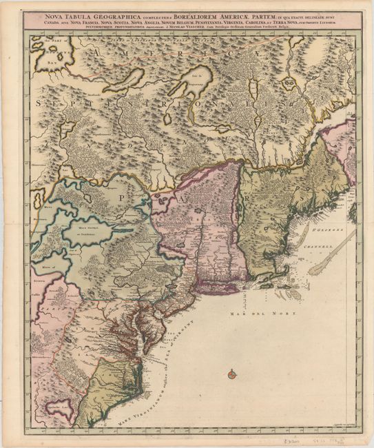
Auction 157, Lot 138
Subject: Colonial Northeastern United States & Canada
Visscher, Nicolas
Nova Tabula Geographica Complectens Borealiorem Americae Partem; in qua Exacte Delineatae sunt Canada sive Nova Francia, Nova Scotia, Nova Anglia, Novum Belgium, Pensylvania, Virginia..., 1696
Size: 18.5 x 23.3 inches (47 x 59.2 cm)
Estimate: $1,600 - $1,900
Sold for: $1,200
Closed on 5/4/2016
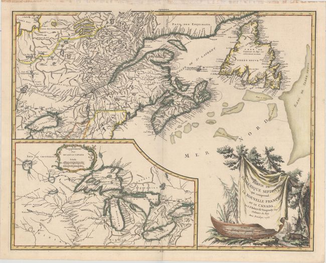
Auction 157, Lot 139
Subject: Colonial Northeastern United States & Canada, Great Lakes
Robert de Vaugondy, Didier
Partie de l'Amerique Septent? qui Comprend la Nouvelle France ou le Canada, 1755
Size: 23.6 x 18.7 inches (59.9 x 47.5 cm)
Estimate: $700 - $850
Unsold
Closed on 5/4/2016
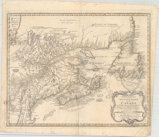
Auction 157, Lot 140
Subject: Colonial Northeastern United States & Canada
Bellin/Homann Heirs
Partie Orientale de la Nouvelle France ou du Canada, 1755
Size: 21.1 x 16.9 inches (53.6 x 42.9 cm)
Estimate: $550 - $700
Unsold
Closed on 5/4/2016
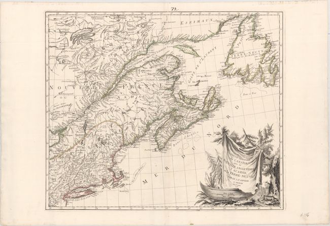
Auction 157, Lot 141
Subject: Colonial Northeastern United States & Canada
D'Anville/Santini
Partie Orientale du Canada, avec la Nouvelle Angleterre, l'Acadie, et la Terre-Neuve..., 1776
Size: 22.8 x 19.2 inches (57.9 x 48.8 cm)
Estimate: $750 - $900
Sold for: $650
Closed on 5/4/2016
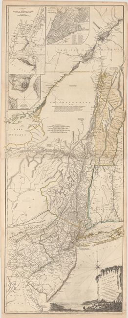
Auction 157, Lot 142
Subject: Colonial Northeastern United States & Quebec
Holland/Pownal
The Provinces of New York and New Jersey; with Part of Pensilvania, and the Province of Quebec, 1776
Size: 21.3 x 52.9 inches (54.1 x 134.4 cm)
Estimate: $5,500 - $7,000
Thomas Jefferys' Important Revolutionary War Period Map
Unsold
Closed on 5/4/2016
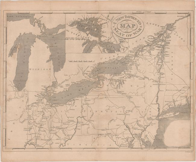
Auction 157, Lot 143
Subject: Northeastern United States & Canada
Haines, D.
A New Improved Map of the Seat of War, 1817
Size: 17.9 x 13.4 inches (45.5 x 34 cm)
Estimate: $200 - $250
Sold for: $275
Closed on 5/4/2016
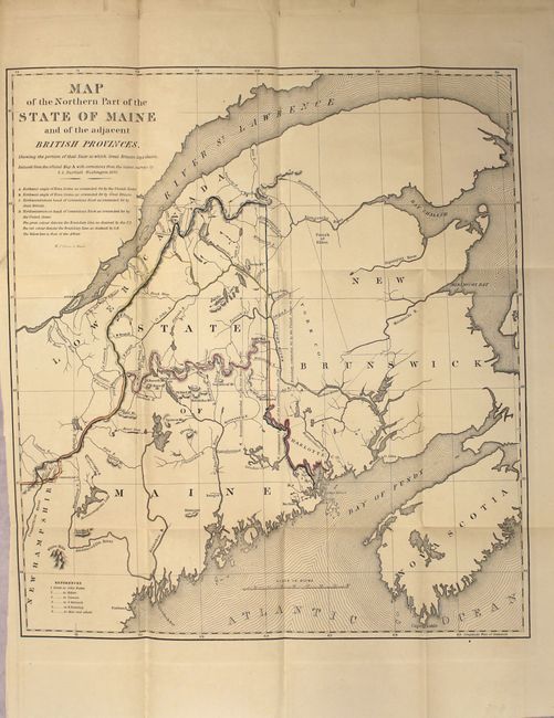
Auction 157, Lot 144
Subject: Northeastern United States & Canada
[Lot of 3] Map of the Northern Part of the State of Maine and the Adjacent British Provinces... [and] Extract from a Map of the British and French Dominions in North America [and] Part of the United States, Lower Canada & New Brunswick, 1838-40
Size: See Description
Estimate: $275 - $350
Sold for: $180
Closed on 5/4/2016
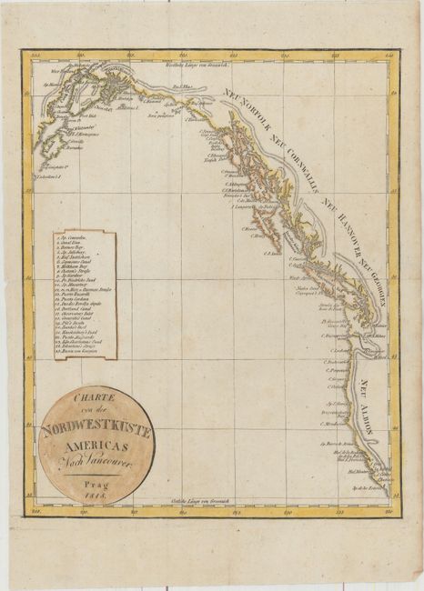
Auction 157, Lot 145
Subject: Western United States & Canada
Anon.
Charte von der Nordwestkuste Americas nach Vancouver, 1818
Size: 7.9 x 9.8 inches (20.1 x 24.9 cm)
Estimate: $180 - $210
Unsold
Closed on 5/4/2016
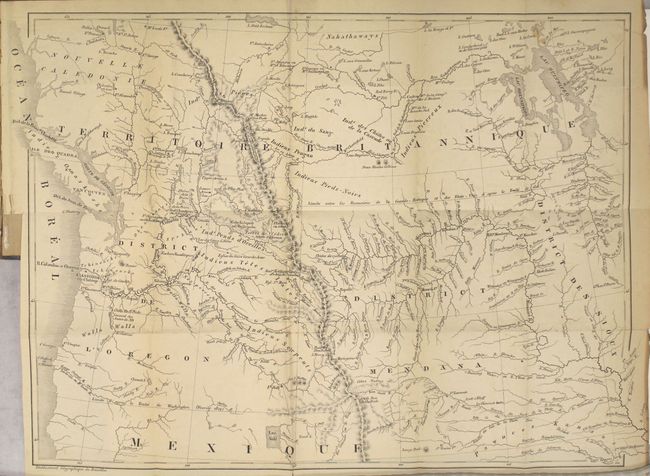
Auction 157, Lot 146
Subject: Western United States & Canada
De Smet, Father Pierre-Jean
Voyages aux Montagnes Rocheuses, et une Annee de Sejour chez les Tribus Indiennes du Vaste Territoire de l'Oregon, Defendant des Etats-Unis d'Amerique, 1844
Size: 15.5 x 12 inches (39.4 x 30.5 cm)
Estimate: $450 - $550
Sold for: $325
Closed on 5/4/2016
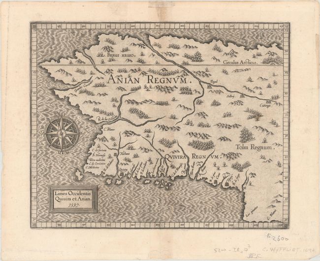
Auction 157, Lot 147
Subject: Alaska & Western Canada
Wytfliet, Cornelis
Limes Occidentis Quivira et Anian, 1597
Size: 11.4 x 9.2 inches (29 x 23.4 cm)
Estimate: $2,200 - $2,500
Early and Imaginary Map of Alaska and the Northwest Passage
Sold for: $1,500
Closed on 5/4/2016
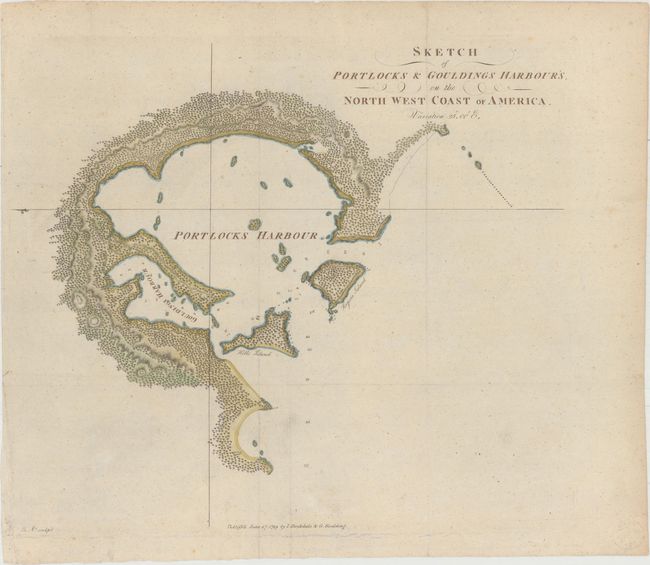
Auction 157, Lot 148
Subject: Alaska, Nootka Sound
[Lot of 2] Sketch of Portlocks & Gouldings Harbour's, on the North West Coast of America [and] Sketch of Nootka Sound, 1778-89
Size: See Description
Estimate: $300 - $400
NO RESERVE
Unsold
Closed on 5/4/2016
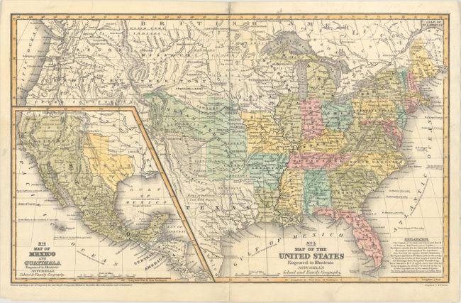
Auction 157, Lot 149
Subject: United States, Texas, Mexico
Mitchell, Samuel Augustus
No. 5 Map of the United States Engraved to Illustrate Mitchell's School and Family Geography, 1839
Size: 16.7 x 10.3 inches (42.4 x 26.2 cm)
Estimate: $190 - $220
Sold for: $325
Closed on 5/4/2016
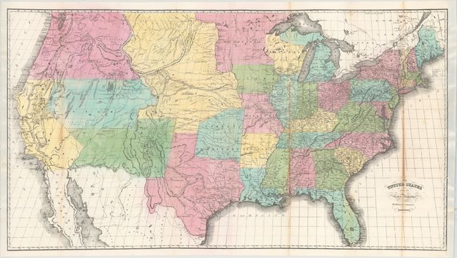
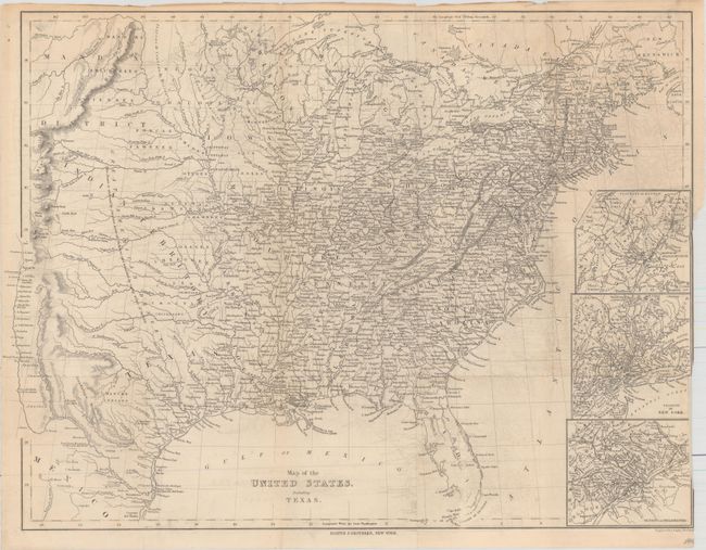
Auction 157, Lot 150
Subject: United States
Hayward, George
The United States from the Latest Authorities for Haywood's Gazetteer, 1853
Size: 40 x 21.5 inches (101.6 x 54.6 cm)
Estimate: $400 - $500
Sold for: $475
Closed on 5/4/2016
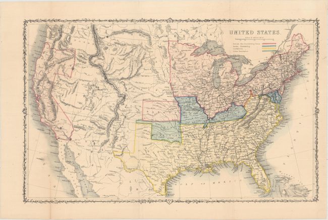
Auction 157, Lot 151
Subject: United States, Civil War
[Lot of 2] United States [and] Verein-Staaten von Nord-America mit Ausnahme Florida's und der Westlichen Territorien, 1861-62
Size: See Description
Estimate: $300 - $375
Sold for: $180
Closed on 5/4/2016
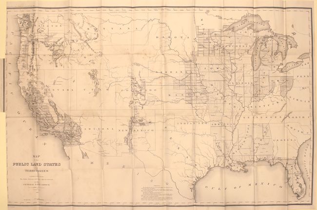
Auction 157, Lot 152
Subject: United States
General Land Office
Map of the Public Land States and Territories Constructed from the Public Surveys and Other Official Sources in the General Land Office, 1865
Size: 44.6 x 28.3 inches (113.3 x 71.9 cm)
Estimate: $200 - $250
Sold for: $100
Closed on 5/4/2016
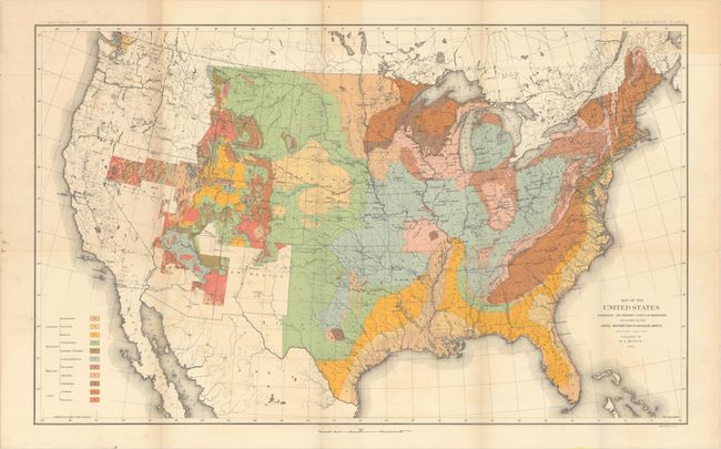
Auction 157, Lot 153
Subject: United States
U.S. Geological Survey (USGS)
[Lot of 2] Map of the United States Exhibiting the Present Status of Knowledge Relating to the Areal Distribution of Geologic Groups [and] Map of the United States Exhibiting the Progress Made in the Geographic Survey, 1884
Size: 28 x 18 inches (71.1 x 45.7 cm)
Estimate: $275 - $350
Sold for: $160
Closed on 5/4/2016
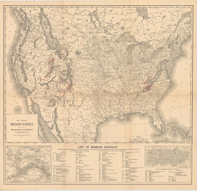
Auction 157, Lot 154
Subject: United States
[Lot of 3] Map Locating Mission Schools Under the Care of Woman's Board of Home Missions of the Presbyterian Church... [and] Map Showing Indian Reservations Within the Limits of the United States... [and] Indian Reservations West of the Mississippi River, 1889-1920
Size: See Description
Estimate: $150 - $180
Sold for: $100
Closed on 5/4/2016
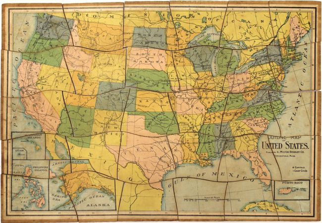
Auction 157, Lot 155
Subject: United States
Milton Bradley Co.
[Puzzle Map] Outline Map of United States, 1900
Size: 13.4 x 9.1 inches (34 x 23.1 cm)
Estimate: $120 - $150
Sold for: $75
Closed on 5/4/2016
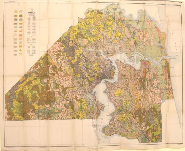
Auction 157, Lot 156
Subject: United States
U.S.D.A.
[Lot of 49 - U.S.D.A. Soil Maps], 1922
Size: 6.5 x 9.5 inches (16.5 x 24.1 cm)
Estimate: $350 - $450
Sold for: $180
Closed on 5/4/2016
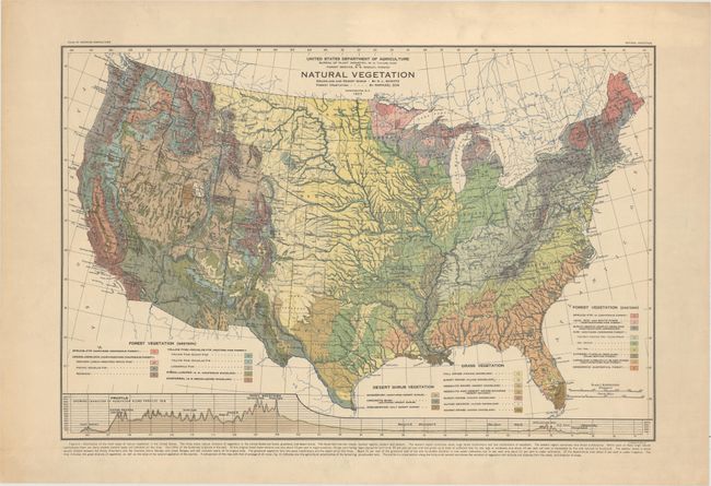
Auction 157, Lot 157
Subject: United States
U.S.D.A.
Natural Vegetation, 1923
Size: 24 x 16 inches (61 x 40.6 cm)
Estimate: $140 - $170
Sold for: $100
Closed on 5/4/2016
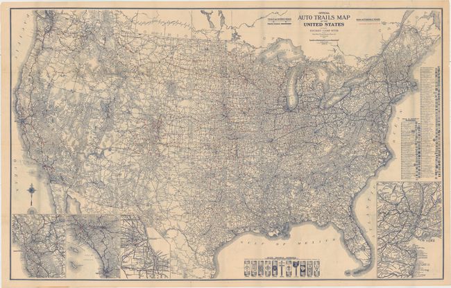
Auction 157, Lot 158
Subject: United States
Rand McNally & Co.
Aviation Map of United States Featuring Landing Fields [on verso] Official Auto Trails Map of the United States Featuring Tourist Camp Sites [together with] The Complete Camp Site Guide Including All Airplane Landings..., 1923
Size: 40.4 x 25.9 inches (102.6 x 65.8 cm)
Estimate: $240 - $300
Sold for: $325
Closed on 5/4/2016
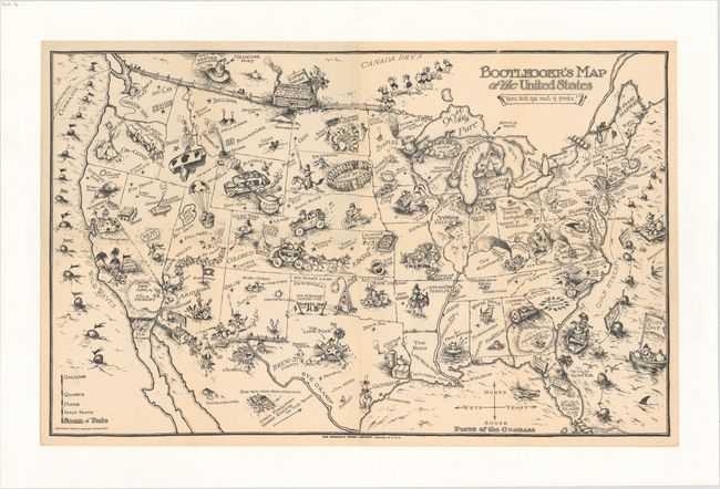
Auction 157, Lot 159
Subject: United States
Bootlegger's Map of the United States, 1926
Size: 34.1 x 21.4 inches (86.6 x 54.4 cm)
Estimate: $1,400 - $1,700
McCandlish's Humorous Prohibition Map
Sold for: $2,000
Closed on 5/4/2016
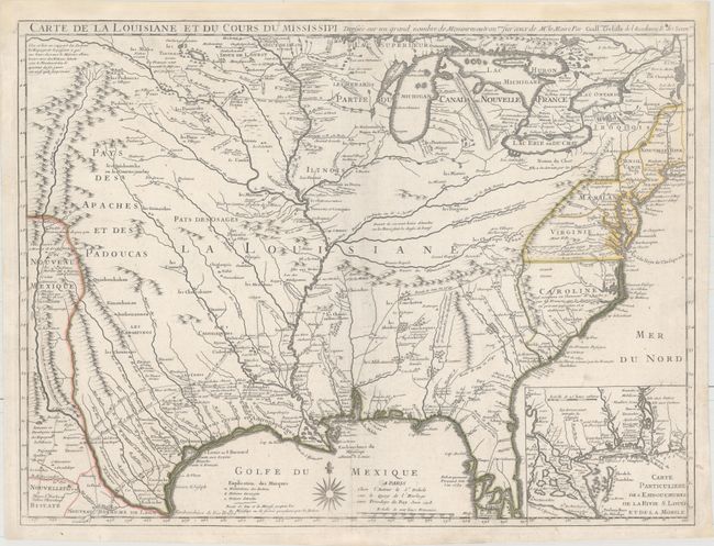
Auction 157, Lot 160
Subject: Colonial Eastern United States
Delisle, Guillaume
Carte de la Louisiane et du Cours du Mississipi Dressee sur un Grand Nombre de Memoires Entr'autres sur ceux de Mr. le Maire, 1718
Size: 25.5 x 19.2 inches (64.8 x 48.8 cm)
Estimate: $10,000 - $12,000
A Foundation Map for the Mississippi Valley and the First Appearance of Texas on a Printed Map
Sold for: $6,000
Closed on 5/4/2016
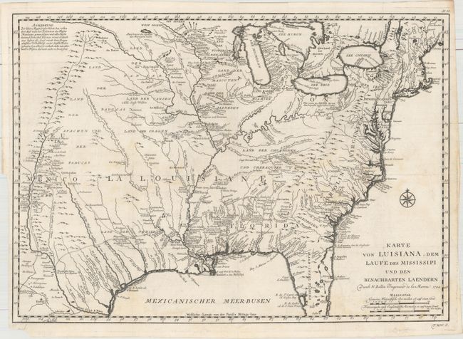
Auction 157, Lot 161
Subject: Colonial Eastern United States
Bellin, Jacques Nicolas
Karte von Luisiana, dem Laufe des Mississipi und den Benachbarten Laendern, 1744
Size: 21.7 x 15.4 inches (55.1 x 39.1 cm)
Estimate: $1,100 - $1,400
Scarce German Issue of Bellin's Louisiana Map
Unsold
Closed on 5/4/2016
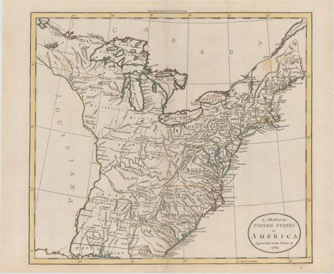
Auction 157, Lot 162
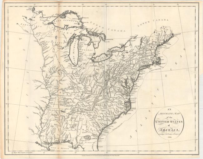
Subject: Eastern United States
Guthrie, William
A Map of the United States of America Agreeable to the Peace of 1783, 1783
Size: 15.5 x 13.8 inches (39.4 x 35.1 cm)
Estimate: $500 - $650
Sold for: $300
Closed on 5/4/2016
Auction 157, Lot 163
Subject: Eastern United States
Russell, John C.
An Accurate Map of the United States of America, According to the Treaty of Peace of 1783, 1794
Size: 18.4 x 14.5 inches (46.7 x 36.8 cm)
Estimate: $550 - $700
Unsold
Closed on 5/4/2016
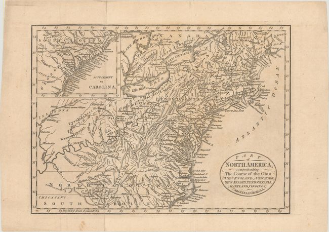
Auction 157, Lot 164
Subject: Eastern United States
Cary, John
Part of North America, Comprehending the Course of the Ohio, New England, New York, New Jersey, Pennsylvania, Maryland, Virginia, Carolina & Georgia, 1795
Size: 11.6 x 8.3 inches (29.5 x 21.1 cm)
Estimate: $350 - $450
Unsold
Closed on 5/4/2016
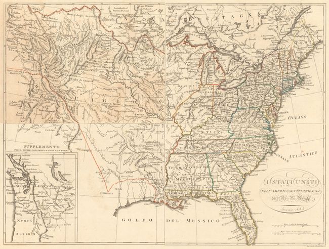
Auction 157, Lot 165
Subject: Eastern United States
Borghi, Bartolomeo
[On 4 Sheets] I Stati Uniti nell' America Settentrionale, 1818
Size: 11.4 x 8.7 inches (29 x 22.1 cm)
Estimate: $600 - $800
Sold for: $300
Closed on 5/4/2016
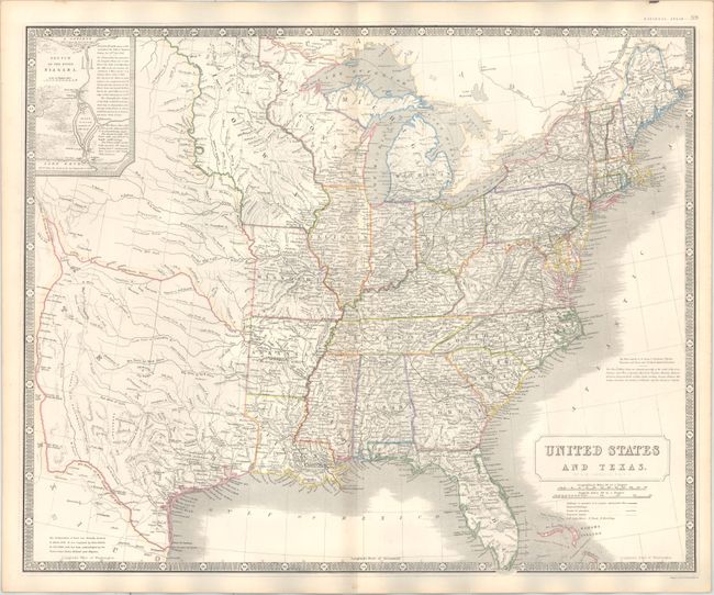
Auction 157, Lot 166
Subject: Eastern United States, Texas
Johnston, Alexander K.
United States and Texas, 1842
Size: 24 x 19.6 inches (61 x 49.8 cm)
Estimate: $1,200 - $1,400
Sold for: $1,100
Closed on 5/4/2016
Auction 157, Lot 167
Subject: Eastern United States, Republic of Texas
Harper Bros.
Map of the United States, Including Texas, 1844
Size: 23.5 x 17.7 inches (59.7 x 45 cm)
Estimate: $170 - $200
Sold for: $120
Closed on 5/4/2016
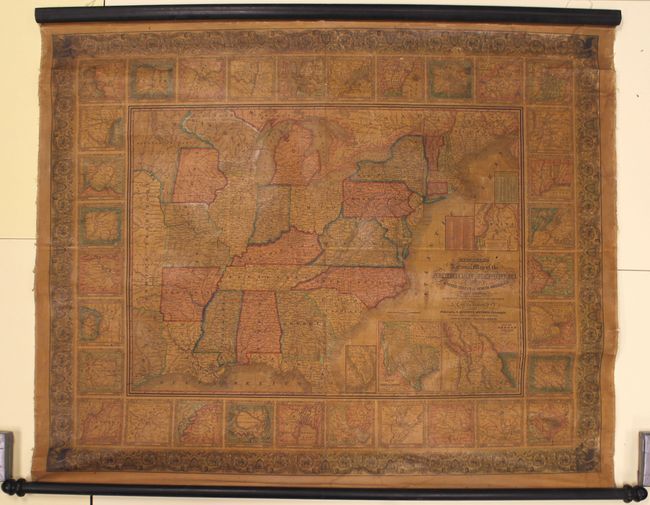
Auction 157, Lot 168
Subject: Eastern United States
Mitchell, Samuel Augustus
Mitchell's National Map of the American Republic or United States of North America, Together with Maps of the Vicinities of Thirty-Two of the Principal Cities and Towns in the Union, 1846
Size: 47 x 38 inches (119.4 x 96.5 cm)
Estimate: $1,200 - $1,500
Sold for: $800
Closed on 5/4/2016
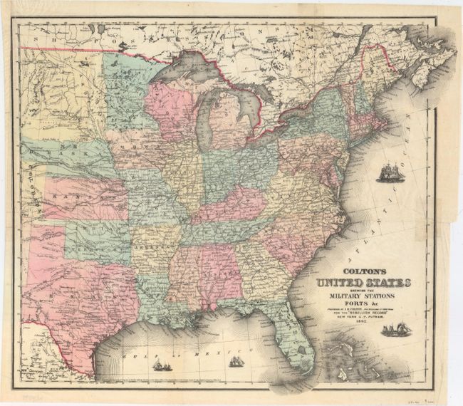
Auction 157, Lot 169
Subject: Eastern United States, Civil War
Colton, Joseph Hutchins
Colton's United States Shewing the Military Stations Forts &c., 1861
Size: 16.3 x 14.5 inches (41.4 x 36.8 cm)
Estimate: $180 - $220
Sold for: $300
Closed on 5/4/2016
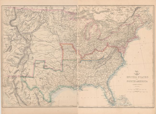
Auction 157, Lot 170
Subject: Eastern United States, Civil War
Ettling, Theodor
[On 2 Sheets] United States of North America (Eastern & Central), 1862
Size: 12.9 x 16.9 inches (32.8 x 42.9 cm)
Estimate: $150 - $180
Sold for: $80
Closed on 5/4/2016
Auction 157, Lot 171
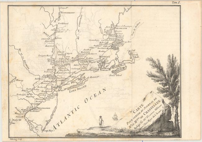
Subject: Northeastern United States, American Revolution
Chastellux, Francois Jean, Marquis de
[Lot of 2 - Northeast, Mid-Atlantic] Carte pour Servir au Journal de Mr. le Mquis. de Chastellux..., 1786
Size: 9.6 x 7.4 inches (24.4 x 18.8 cm)
Estimate: $350 - $450
Unsold
Closed on 5/4/2016
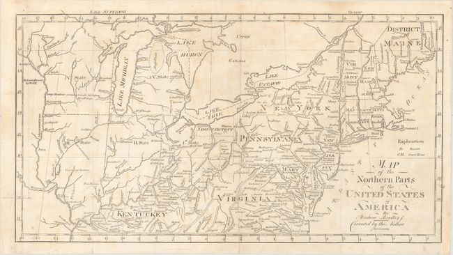
Auction 157, Lot 172
Subject: Northeastern United States
Bradley, Abraham Jr.
Map of the Northern Parts of the United States of America, 1804
Size: 15 x 8 inches (38.1 x 20.3 cm)
Estimate: $230 - $275
Sold for: $230
Closed on 5/4/2016
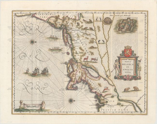
Auction 157, Lot 173
Subject: Colonial New England & Mid-Atlantic
Blaeu, Willem
Nova Belgica et Anglia Nova, 1642
Size: 19.9 x 15.3 inches (50.5 x 38.9 cm)
Estimate: $2,750 - $3,500
Important Map of Colonial New England and the Mid-Atlantic
Sold for: $2,000
Closed on 5/4/2016
Auction 157, Lot 174
Subject: Colonial New England & Mid-Atlantic
Montanus/Ogilby
Novi Belgii, quod nunc Novi Jorck Vocatur, Novae qz. Angliae & Partis Virginiae Accuratissima et Novissima Delineatio, 1671
Size: 14.4 x 11.4 inches (36.6 x 29 cm)
Estimate: $1,200 - $1,500
Sold for: $600
Closed on 5/4/2016
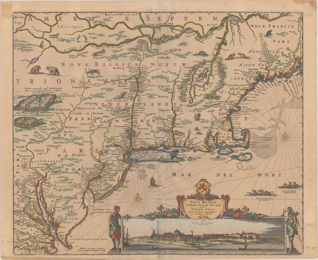
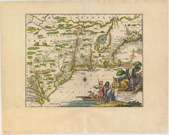
Auction 157, Lot 175
Subject: Colonial New England & Mid-Atlantic
Visscher, Nicolas
Novi Belgii Novaeque Angliae nec non Partis Virginiae Tabula Multis in Locis Emendata, 1684
Size: 21.8 x 18.4 inches (55.4 x 46.7 cm)
Estimate: $6,000 - $7,500
Visscher's Influential Map with Early View of New York City
Sold for: $4,500
Closed on 5/4/2016
Auction 157, Lot 176
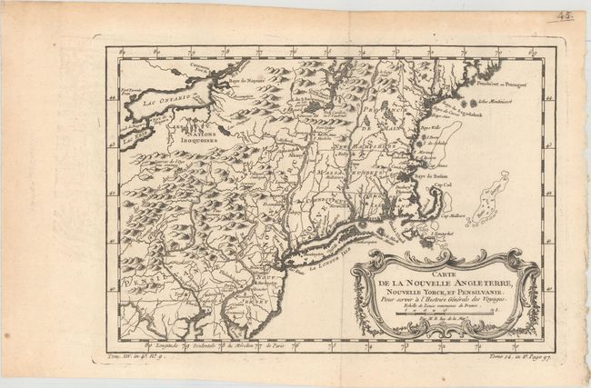
Subject: Colonial New England & Mid-Atlantic
Bellin, Jacques Nicolas
Carte de la Nouvelle Angleterre, Nouvelle Yorck, et Pensilvanie. Pour Servir a l'Histoire Generale des Voyages, 1757
Size: 11.7 x 8.1 inches (29.7 x 20.6 cm)
Estimate: $160 - $190
Sold for: $120
Closed on 5/4/2016
228 lots
Page 1 of 5