Filtered by Category:Canada(Show All Categories)
Showing results for:Auction 157
Catalog Archive
33 lots
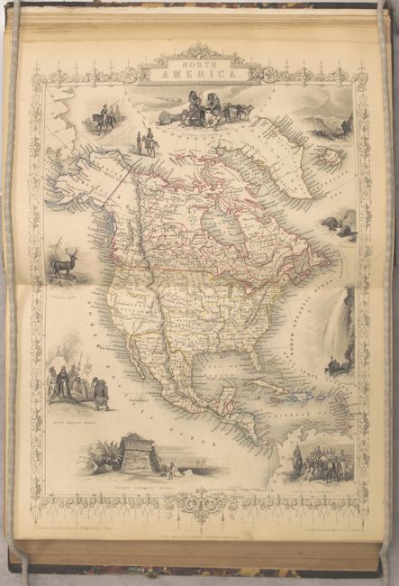
Auction 157, Lot 116
Subject: Canada
Martin, Montgomery
The British Colonies; Their History, Extent, Condition, and Resources Vol. I. British North America, 1850
Size: 7.8 x 11.1 inches (19.8 x 28.2 cm)
Estimate: $700 - $900
Sold for: $500
Closed on 5/4/2016
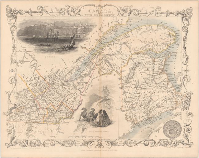
Auction 157, Lot 117
Subject: Canada
[Lot of 3] East Canada, and New Brunswick [and] Johnson's Lower Canada and New Brunswick [on sheet with] Johnson's Upper Canada [and] Johnson's New Brunswick, Nova Scotia, Newfoundland. And Prince Edward Id., 1850-65
Size: See Description
Estimate: $140 - $170
NO RESERVE
Unsold
Closed on 5/4/2016
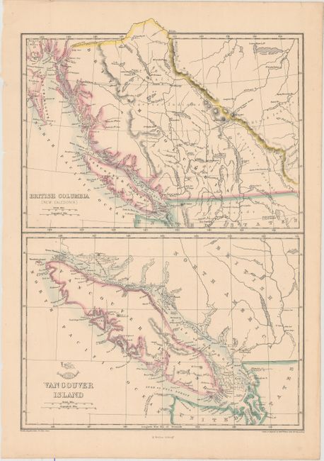
Auction 157, Lot 118
Subject: Canada
Weller, Edward
[Lot of 3] British Columbia (New Caledonia) [on sheet with] Vancouver Island [and] Upper Canada [and] Lower Canada, New Brunswick, Nova Scotia &c., 1860
Size: 11.9 x 17.1 inches (30.2 x 43.4 cm)
Estimate: $120 - $150
Sold for: $90
Closed on 5/4/2016
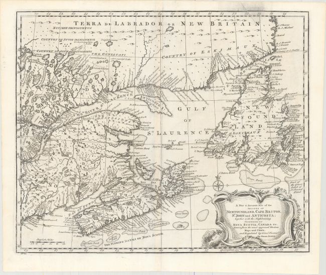
Auction 157, Lot 119
Subject: Colonial Eastern Canada
Bowen, Emanuel
A New & Accurate Map of the Islands of Newfoundland, Cape Briton, St. John and Anticosta; Together with the Neighbouring Countries of Nova Scotia, Canada &c. Drawn from the Most Approved Moderns Maps and Charts, and Regulated by Astronl. Observatns., 1747
Size: 16.8 x 13.7 inches (42.7 x 34.8 cm)
Estimate: $325 - $400
Sold for: $220
Closed on 5/4/2016
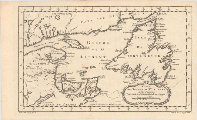
Auction 157, Lot 120
Subject: Colonial Eastern Canada
Bellin, Jacques Nicolas
[Lot of 2] Carte du Golphe de St. Laurent et Pays Voisins pour Servir a l'Histoire Generale des Voyages [and] Carte de l'Acadie, Isle Royale, et Pais Voisins. Pour Servir a l'Histoire Generale des Voyages, 1757
Size: See Description
Estimate: $180 - $220
Sold for: $130
Closed on 5/4/2016
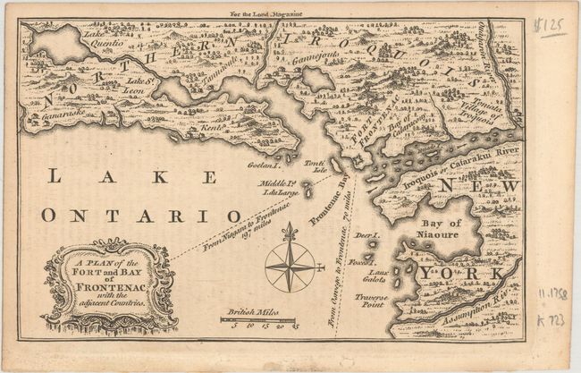
Auction 157, Lot 121
Subject: Colonial Eastern Canada
Anon.
[Lot of 2] A Plan of the Fort and Bay of Frontenac, with the Adjacent Countries [and] A Map of the Harbour of Louisburg and Parts Adjacent, 1758
Size: 7.1 x 4.6 inches (18 x 11.7 cm)
Estimate: $140 - $170
Sold for: $150
Closed on 5/4/2016
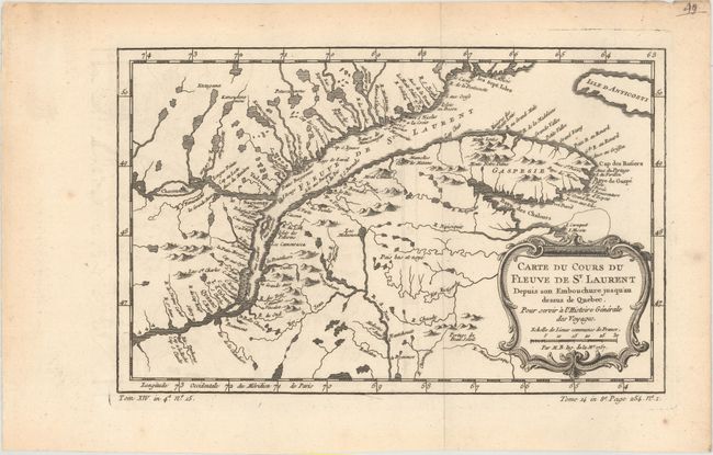
Auction 157, Lot 122
Subject: St. Lawrence River, Canada
Bellin, Jacques Nicolas
[Lot of 2] Carte du Cours du Fleuve de St. Laurent Depuis son Embouchure Jusqu'au Dessus de Quebec. Pour Servir a l'Histoire Generale des Voyages [and] Suite du Cours du Fleuve de St. Laurent, Depuis Quebec Jusqu'au Lac Ontario..., 1757
Size: 11.9 x 7.6 inches (30.2 x 19.3 cm)
Estimate: $140 - $170
Sold for: $140
Closed on 5/4/2016
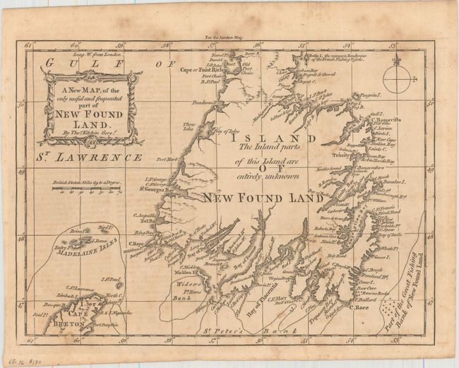
Auction 157, Lot 123
Subject: Newfoundland, Canada
Kitchin, Thomas
A New Map of the Only Useful and Frequented Part of New Found Land, 1762
Size: 9.5 x 7 inches (24.1 x 17.8 cm)
Estimate: $140 - $170
Sold for: $130
Closed on 5/4/2016
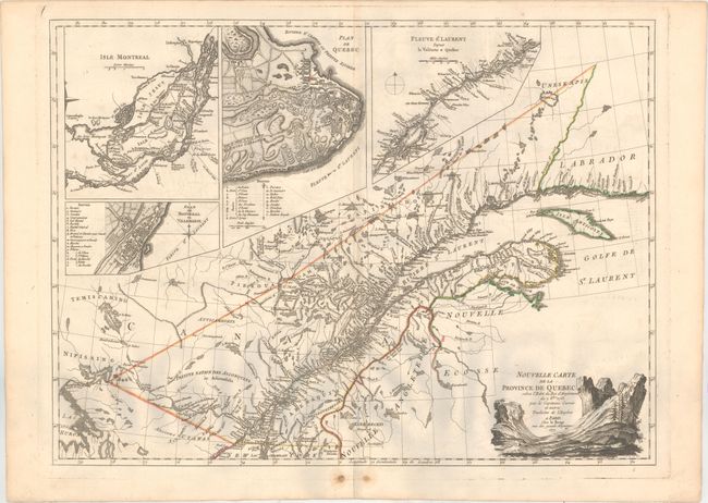
Auction 157, Lot 124
Subject: Quebec, Eastern Canada
Le Rouge, George Louis
Nouvelle Carte de la Province de Quebec Selon l'Edit du Roi d'Angleterre..., 1777
Size: 25.9 x 19 inches (65.8 x 48.3 cm)
Estimate: $1,100 - $1,400
Sold for: $650
Closed on 5/4/2016
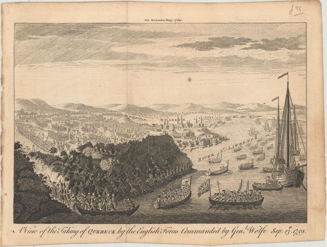
Auction 157, Lot 125
Subject: Quebec City, Canada
[Lot of 2] A View of the Taking of Quebeck by the English Forces Commanded by Genl. Wolfe Sep: 13th. 1759 [and] A View of Quebec from the Bason, 1760
Size: 9.9 x 6.8 inches (25.1 x 17.3 cm)
Estimate: $100 - $130
Sold for: $240
Closed on 5/4/2016
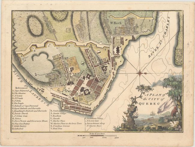
Auction 157, Lot 126
Subject: Quebec City, Canada
Weld, Isaac
A Plan of the City of Quebec, 1798
Size: 9.4 x 6.8 inches (23.9 x 17.3 cm)
Estimate: $160 - $190
Sold for: $275
Closed on 5/4/2016
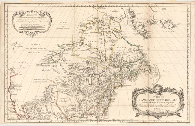
Auction 157, Lot 127
Subject: Colonial United States & Canada
Bellin, Jacques Nicolas
Carte de l'Amerique Septentrionale Depuis le 28 Degre de Latitude Jusqu'au 72, 1755
Size: 34 x 22 inches (86.4 x 55.9 cm)
Estimate: $1,500 - $1,800
NO RESERVE - Bellin's Important, Large Format Map of North America
Sold for: $950
Closed on 5/4/2016
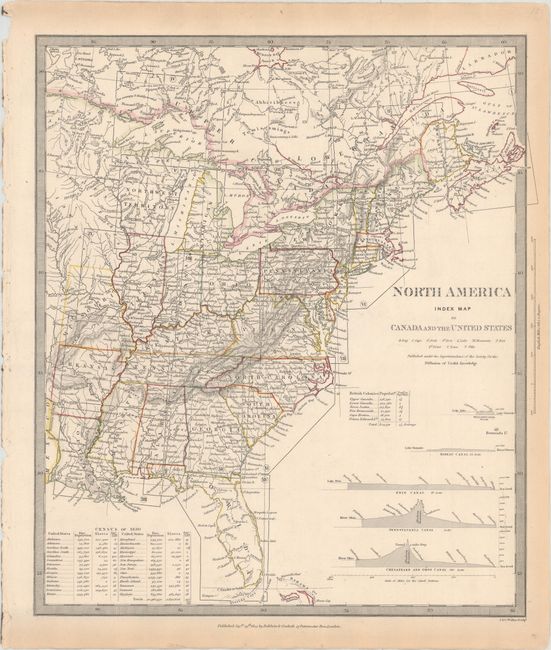
Auction 157, Lot 128
Subject: United States & Canada
SDUK Society for the Diffusion of Useful Knowledge
[Lot of 15 - North America], 1832-34
Size: 12.3 x 15.1 inches (31.2 x 38.4 cm)
Estimate: $950 - $1,200
Matching Set of North America SDUK Maps
Sold for: $1,200
Closed on 5/4/2016
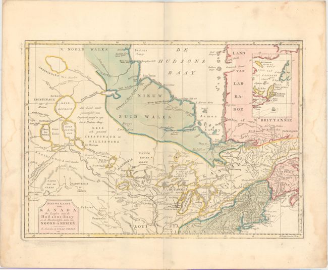
Auction 157, Lot 129
Subject: Colonial Northern United States & Canada
Tirion, Isaac
Nieuwe Kaart van Kanada, de Landen aan de Hudsons-Baay en de Noordwestelyke Deelen van Noord-Amerika, 1769
Size: 17.2 x 12.2 inches (43.7 x 31 cm)
Estimate: $275 - $350
Sold for: $140
Closed on 5/4/2016
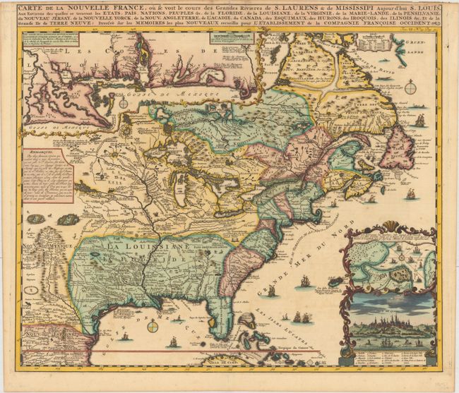
Auction 157, Lot 130
Subject: Colonial Eastern United States & Canada
Chatelain, Henry Abraham
Carte de la Nouvelle France, ou se voit le Cours des Grandes Rivieres de S. Laurens & de Mississipi Aujour d'hui S. Louis, aux Environs des Quelles se Trouvent les Etats, Pais, Nations, Peuples &c..., 1719
Size: 19.1 x 16.6 inches (48.5 x 42.2 cm)
Estimate: $2,200 - $2,500
One of the Most Informative 18th Century Maps of the French Possessions in North America
Sold for: $2,400
Closed on 5/4/2016
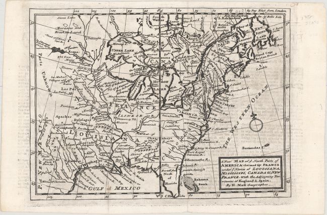
Auction 157, Lot 131
Subject: Colonial Eastern United States & Canada
Moll, Herman
A New Map of ye North Parts of America Claimed by France under ye Names of Louisiana, Mississipi, Canada & New France, with the Adjoyning Territories of England & Spain, 1735
Size: 10.8 x 7.8 inches (27.4 x 19.8 cm)
Estimate: $450 - $550
Unsold
Closed on 5/4/2016
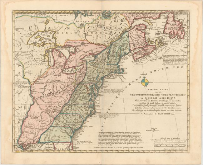
Auction 157, Lot 132
Subject: Colonial Eastern United States & Canada
Tirion, Isaac
Nieuwe Kaart van de Grootbrittannische Volkplantingen in Noord America..., 1755
Size: 17.7 x 14.4 inches (45 x 36.6 cm)
Estimate: $650 - $750
Sold for: $450
Closed on 5/4/2016
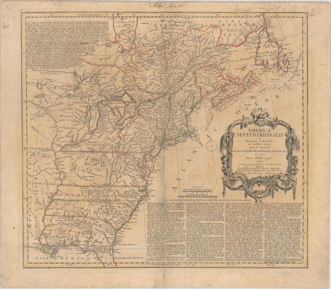
Auction 157, Lot 133
Subject: Colonial Eastern United States & Canada
Homann Heirs
America Septentrionalis a Domino d'Anville in Galliis Edita nunc in Anglia Coloniis in Interiorem Virginiam Deductis nec non Fluvii Ohio Cursu..., 1777
Size: 20 x 18 inches (50.8 x 45.7 cm)
Estimate: $550 - $700
Sold for: $300
Closed on 5/4/2016
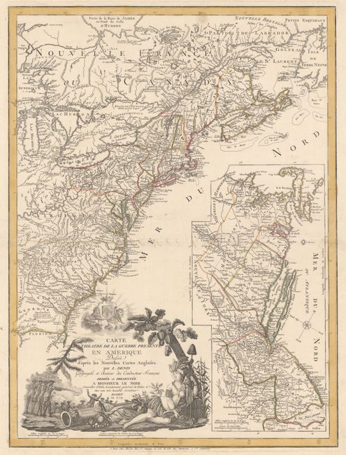
Auction 157, Lot 134
Subject: Colonial Eastern United States & Canada
Denis, Louis
Carte du Theatre de la Guerre Presente en Amerique Dressee d'Apres les Nouvelles Cartes Anglaises..., 1779
Size: 19.8 x 26.3 inches (50.3 x 66.8 cm)
Estimate: $4,750 - $6,000
Scarce American Revolutionary War Map
Sold for: $3,000
Closed on 5/4/2016
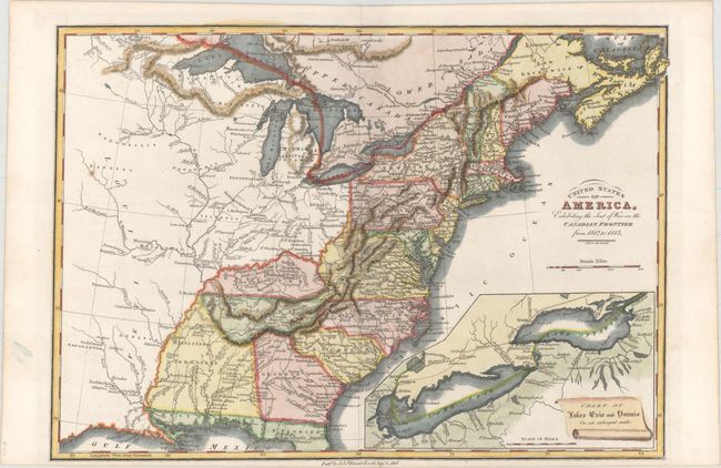
Auction 157, Lot 135
Subject: Eastern United States & Canada
Baines, Edward
United States of America, Exhibiting the Seat of War on the Canadian Frontier from 1812 to 1815, 1816
Size: 13.5 x 9.5 inches (34.3 x 24.1 cm)
Estimate: $350 - $425
Sold for: $475
Closed on 5/4/2016
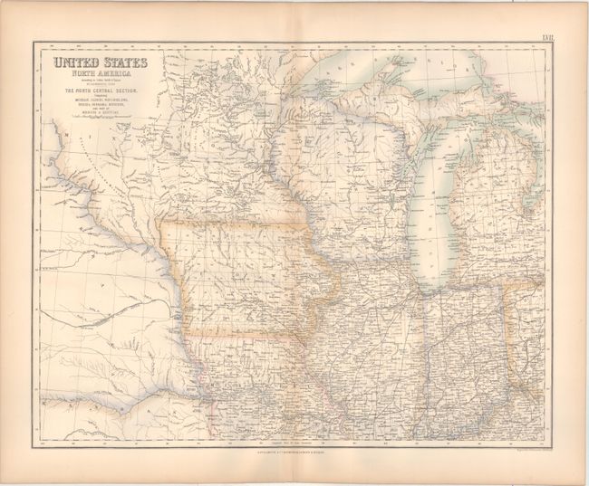
Auction 157, Lot 136
Subject: Eastern United States & Canada
Fullarton, Archibald & Co.
[Lot of 3] United States North America ... The North Eastern States... [and] ... The South Eastern States... [and] ... The North Central Section..., 1857
Size: 20.8 x 15.8 inches (52.8 x 40.1 cm)
Estimate: $160 - $190
Sold for: $100
Closed on 5/4/2016
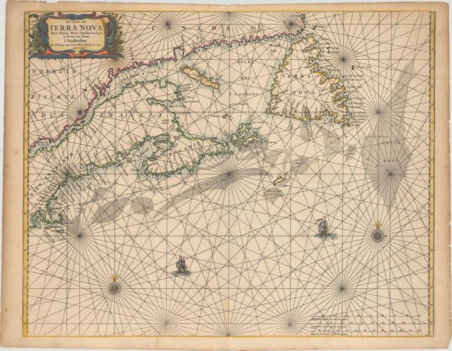
Auction 157, Lot 137
Subject: Canadian Maritimes & New England
Loon, Jan van
Pas-caerte van Terra Nova, Nova Francia, Nieuw Engeland en de Grote Rivier van Canada, 1666
Size: 21.2 x 16.8 inches (53.8 x 42.7 cm)
Estimate: $4,000 - $5,500
Very Influential Dutch Sea Chart of the Canadian Maritimes
Unsold
Closed on 5/4/2016
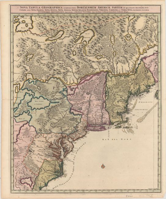
Auction 157, Lot 138
Subject: Colonial Northeastern United States & Canada
Visscher, Nicolas
Nova Tabula Geographica Complectens Borealiorem Americae Partem; in qua Exacte Delineatae sunt Canada sive Nova Francia, Nova Scotia, Nova Anglia, Novum Belgium, Pensylvania, Virginia..., 1696
Size: 18.5 x 23.3 inches (47 x 59.2 cm)
Estimate: $1,600 - $1,900
Sold for: $1,200
Closed on 5/4/2016
Auction 157, Lot 139
Subject: Colonial Northeastern United States & Canada, Great Lakes
Robert de Vaugondy, Didier
Partie de l'Amerique Septent? qui Comprend la Nouvelle France ou le Canada, 1755
Size: 23.6 x 18.7 inches (59.9 x 47.5 cm)
Estimate: $700 - $850
Unsold
Closed on 5/4/2016
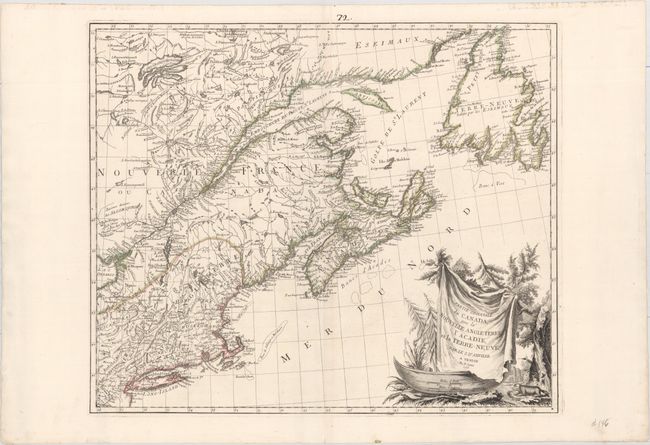
Auction 157, Lot 140
Subject: Colonial Northeastern United States & Canada
Bellin/Homann Heirs
Partie Orientale de la Nouvelle France ou du Canada, 1755
Size: 21.1 x 16.9 inches (53.6 x 42.9 cm)
Estimate: $550 - $700
Unsold
Closed on 5/4/2016
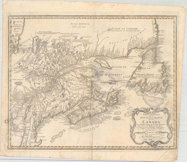
Auction 157, Lot 141
Subject: Colonial Northeastern United States & Canada
D'Anville/Santini
Partie Orientale du Canada, avec la Nouvelle Angleterre, l'Acadie, et la Terre-Neuve..., 1776
Size: 22.8 x 19.2 inches (57.9 x 48.8 cm)
Estimate: $750 - $900
Sold for: $650
Closed on 5/4/2016
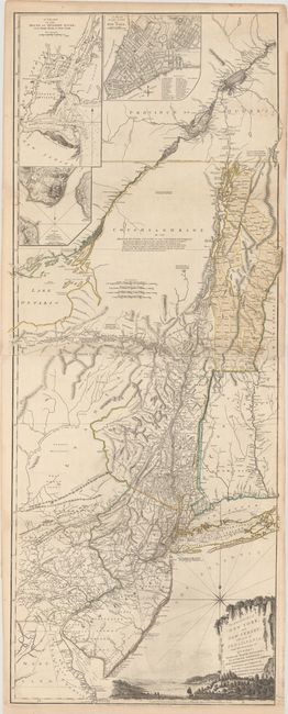
Auction 157, Lot 142
Subject: Colonial Northeastern United States & Quebec
Holland/Pownal
The Provinces of New York and New Jersey; with Part of Pensilvania, and the Province of Quebec, 1776
Size: 21.3 x 52.9 inches (54.1 x 134.4 cm)
Estimate: $5,500 - $7,000
Thomas Jefferys' Important Revolutionary War Period Map
Unsold
Closed on 5/4/2016
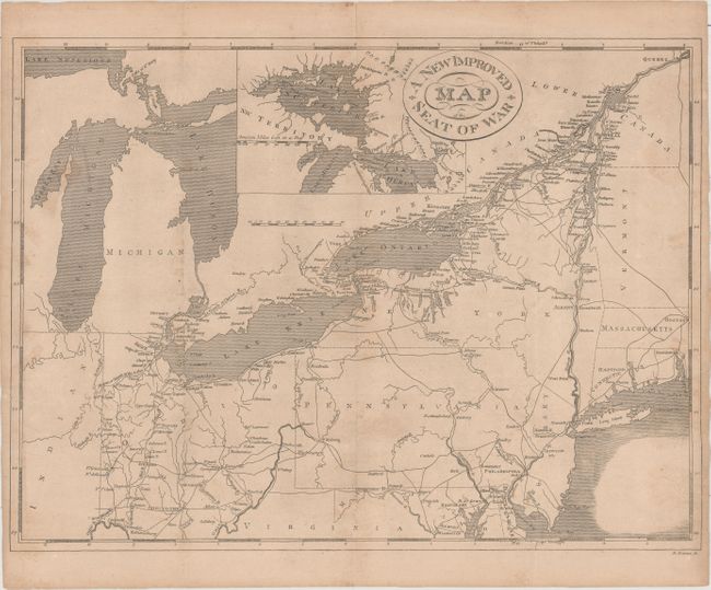
Auction 157, Lot 143
Subject: Northeastern United States & Canada
Haines, D.
A New Improved Map of the Seat of War, 1817
Size: 17.9 x 13.4 inches (45.5 x 34 cm)
Estimate: $200 - $250
Sold for: $275
Closed on 5/4/2016
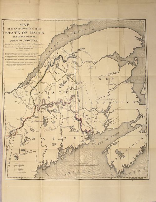
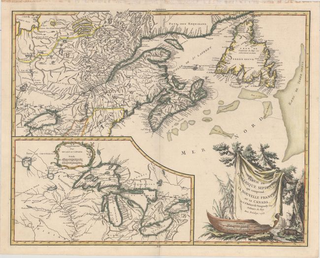
Auction 157, Lot 144
Subject: Northeastern United States & Canada
[Lot of 3] Map of the Northern Part of the State of Maine and the Adjacent British Provinces... [and] Extract from a Map of the British and French Dominions in North America [and] Part of the United States, Lower Canada & New Brunswick, 1838-40
Size: See Description
Estimate: $275 - $350
Sold for: $180
Closed on 5/4/2016
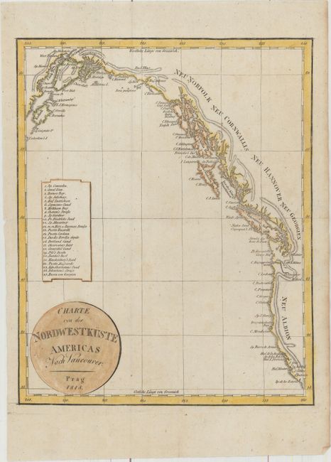
Auction 157, Lot 145
Subject: Western United States & Canada
Anon.
Charte von der Nordwestkuste Americas nach Vancouver, 1818
Size: 7.9 x 9.8 inches (20.1 x 24.9 cm)
Estimate: $180 - $210
Unsold
Closed on 5/4/2016
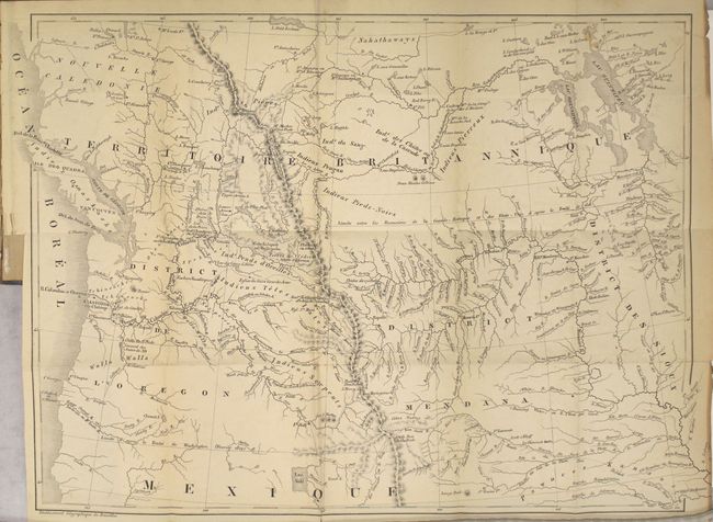
Auction 157, Lot 146
Subject: Western United States & Canada
De Smet, Father Pierre-Jean
Voyages aux Montagnes Rocheuses, et une Annee de Sejour chez les Tribus Indiennes du Vaste Territoire de l'Oregon, Defendant des Etats-Unis d'Amerique, 1844
Size: 15.5 x 12 inches (39.4 x 30.5 cm)
Estimate: $450 - $550
Sold for: $325
Closed on 5/4/2016
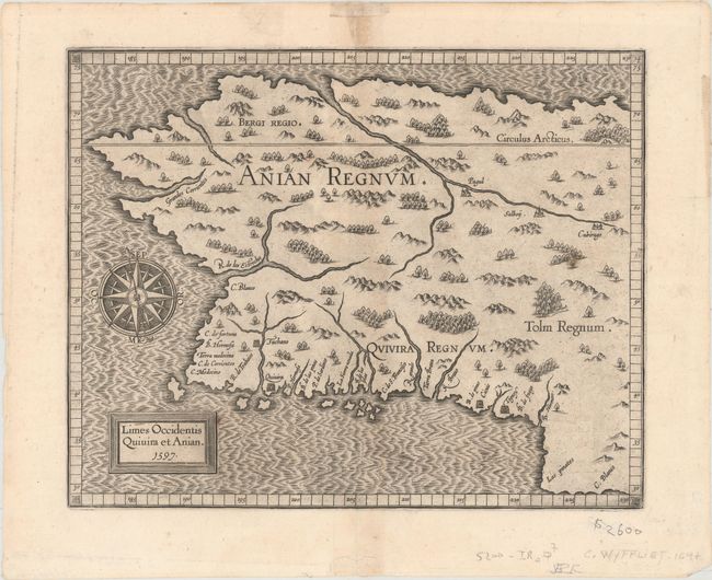
Auction 157, Lot 147
Subject: Alaska & Western Canada
Wytfliet, Cornelis
Limes Occidentis Quivira et Anian, 1597
Size: 11.4 x 9.2 inches (29 x 23.4 cm)
Estimate: $2,200 - $2,500
Early and Imaginary Map of Alaska and the Northwest Passage
Sold for: $1,500
Closed on 5/4/2016
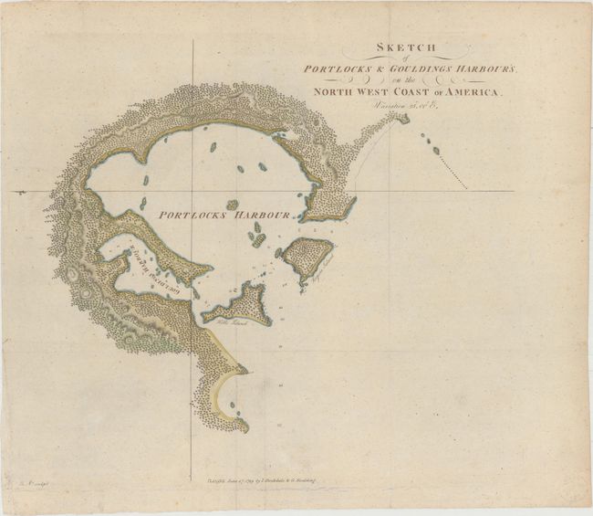
Auction 157, Lot 148
Subject: Alaska, Nootka Sound
[Lot of 2] Sketch of Portlocks & Gouldings Harbour's, on the North West Coast of America [and] Sketch of Nootka Sound, 1778-89
Size: See Description
Estimate: $300 - $400
NO RESERVE
Unsold
Closed on 5/4/2016
33 lots