Subject: Alaska, Nootka Sound
Period: 1778-89 (dated)
Publication:
Color:
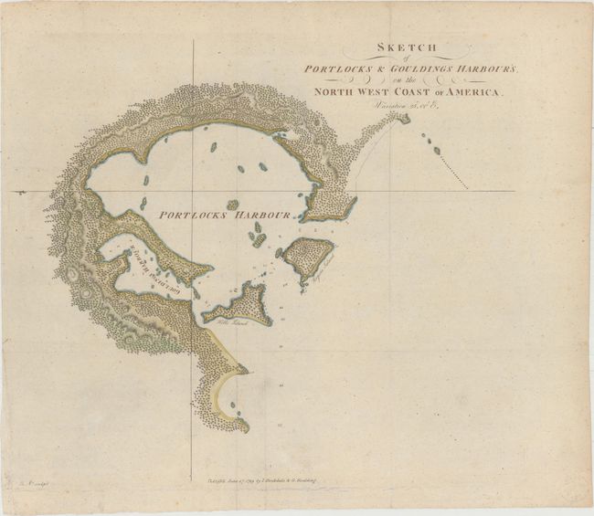
A. Sketch of Portlocks & Gouldings Harbour's, on the North West Coast of America, by Capt. George Dixon , from A Voyage Round the World but More Particularly to the North-West Coast of America..., dated 1789, hand color (14.8 x 12.8"). This uncommon chart is one of the first available maps of an Alaskan harbor. Portlock and Goulding harbors are located off Chichagof Island, just southwest of Juneau. The chart shows topography, hazards, depth soundings, an anchorage, and smaller nearby islands. Published by John Stockdale and George Goulding in 1789 in A Voyage Round the World but More Particularly to the North-West Coast of America.... This book chronicled the three year voyage (1785-88) of Nathaniel Portlock and George Dixon, two traders who, after accompanying Captain Cook on his third voyage, struck out for the northwest coast of North America once again to establish a stake in the region's fur trade. Conditon: Issued folding, now flat, with minor foxing.
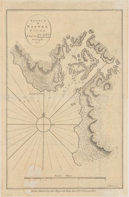
B. Sketch of Nootka Sound, by Cook/Hogg, dated 1778, black & white (8.4 x 12.8"). This detailed chart of the inlet to the sound is complete with a large compass rose, rhumb lines, and nautical scale of miles. The map locates Breakers Point, shoals, and numerous soundings, with good topographical detail on land as well. This chart represents the first mapping of Nootka Sound and was finely engraved by Thomas Bowen. Condition: Issued folding on watermarked paper with light stains at bottom and a hint of offsetting. The sheet has been remargined at right with old paper.
References:
Condition: B+
See description above.