Subject: United States, Civil War
Period: 1861-62 (circa)
Publication:
Color: Hand Color
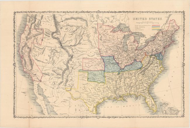
A. United States, by London Printing & Publishing, circa 1861 (16.9 x 10.7"). This great Civil War map covers the entire United States and depicts the Union states, Confederate states, border states and Indian Territory. A large section from Texas to California is left uncolored with the Missouri Compromise line following the 36th parallel in this region. Arizona is shown occupying the southern section of New Mexico territory, likely referencing the Confederate Territory of Arizona. The detailed map shows railroads, rivers and topography via hachure. Condition: Issued folding with a few extraneous creases and one short fold separation confined to the lower blank margin closed on verso with archival tape. (B+)
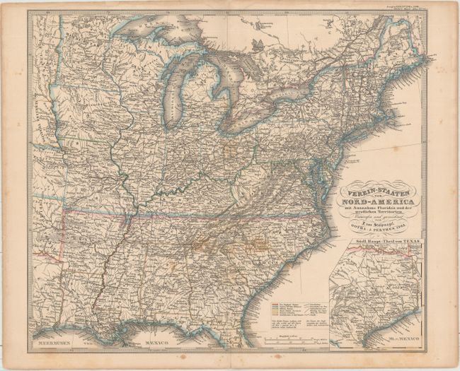
B. Verein-Staaten von Nord-America mit Ausnahme Florida's und der Westlichen Territorien, by F. von Stulpnagel, from Stieler's Hand-Atlas, dated 1862 (16.1 x 13.6"). This uncommon German map shows the eastern United States and is also color-coded to differentiate the slave-holding from the non-slave states. Includes an inset of Texas at bottom. Condition: Scattered light staining. (B)
References:
Condition:
See description above.