Catalog Archive
Auction 157, Lot 136

"[Lot of 3] United States North America ... The North Eastern States... [and] ... The South Eastern States... [and] ... The North Central Section...", Fullarton, Archibald & Co.

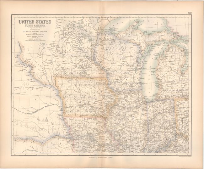
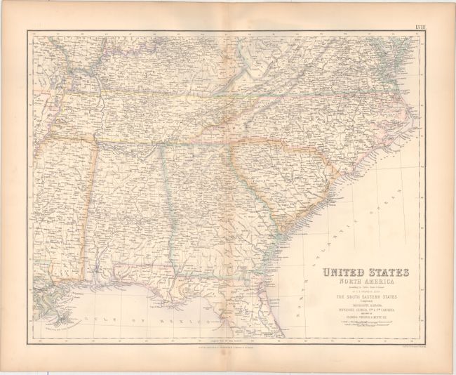
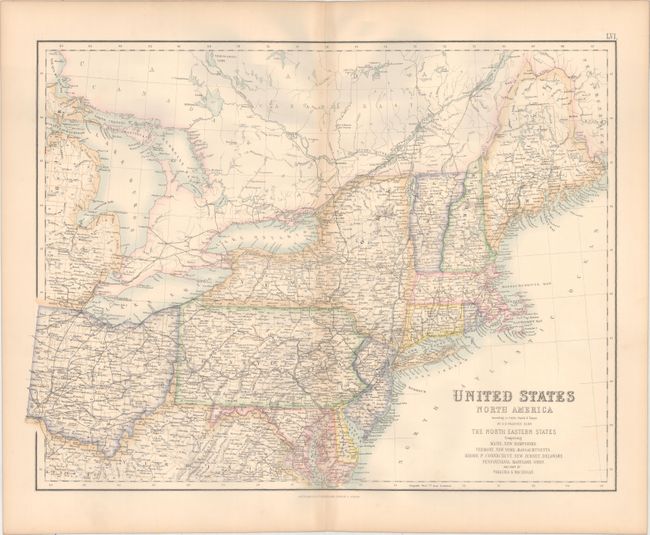
Subject: Eastern United States & Canada

Period: 1857 (circa)

Publication: Royal Illustrated Atlas of Modern Geography

Color: Hand Color

Size:
20.8 x 15.8 inches
52.8 x 40.1 cm
Download High Resolution Image
(or just click on image to launch the Zoom viewer)

These three maps comprise the eastern portion of the United States to the Mississippi River, extending west to as far as Minnesota, Nebraska and Kansas territories. There is extensive detail of county development, roads, railroads, and more. The large Minnesota territory extends west to the Missouri River with some county development in the southeast. Nebraska encompasses the region between the Smoky Hill and Missouri Rivers. The river systems are the only detail given west of the Missouri River. Engraved by G. H. Swanston.

References:

Condition: B+

Original color with light toning along the centerfolds and edges of the sheets.

Estimate: $160 - $190

Sold for: $100

Closed on 5/4/2016

Archived