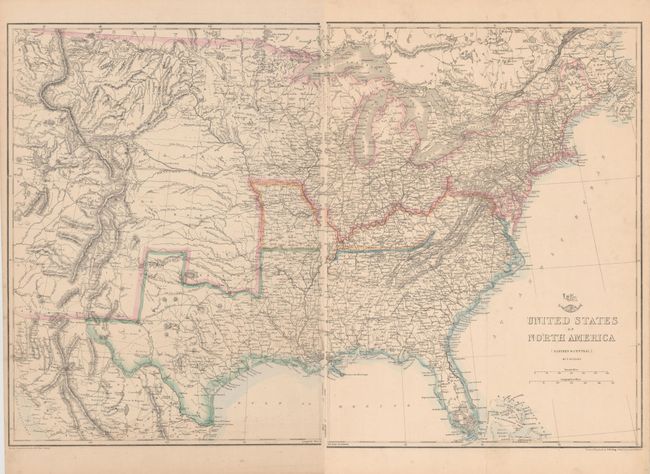
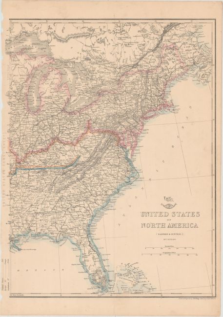
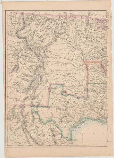
Subject: Eastern United States, Civil War
Period: 1862 (circa)
Publication: Weekly Dispatch Atlas
Color: Hand Color
Size:
12.9 x 16.9 inches
32.8 x 42.9 cm
This great Civil War map covers the country from the Rocky Mountains to the Atlantic seaboard. Of importance is the designation of the separate Confederate and Union states via hand coloring. The states of Missouri and Kentucky are colored differently to indicate their status as border states containing both pro-Confederate and pro-Union government factions. The Confederate Territory of Arizona is shown in the south of New Mexico Territory. The map is finely engraved and detailed, and it shows existing railroads and several possible routes explored for the proposed Pacific Railroads. The tracks of Fremont, Gunnison and others are shown, as are numerous roads, marshes, forts and Indian tribes.
References:
Condition: A
Original color with minor soiling and faint vertical creases on each sheet.