Subject: Colonial Northern United States & Canada
Period: 1769 (dated)
Publication: Hedendaagsche Historie of Tegenwoordige Staat van Amerika…
Color: Hand Color
Size:
17.2 x 12.2 inches
43.7 x 31 cm
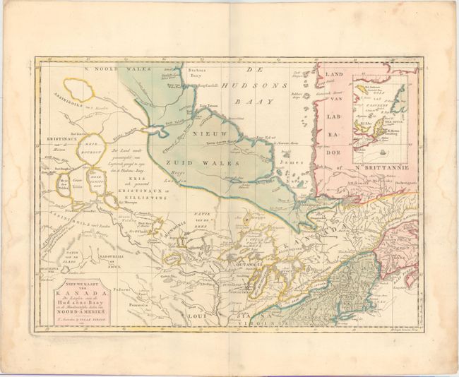
This attractive and detailed map is based on Jefferys' important map of Canada in 1760. It covers from Hudson Bay, through the Great Lakes, to Philadelphia and west to include Lake Winnipeg. There is an interesting array of speculative cartography in the lakes and rivers. While there is a realistic interpretation of Lake Winnipeg, it connects via the Rivier Bourbon to Hudson Bay, and also gives rise to the Mississippi River. The St. Charles River, which connects with the Mississippi, flows off the map to the west with a notation in Dutch, "the length of which is unknown, this is the route the Indians follow coming from the West." Several Hudson Bay Company forts and numerous Indian villages are located. An inset illustrates the Gulf of St. Lawrence.
References: Kershaw #375; McCorkle #769.2; Shirley (BL Atlases) G.TIR-1a #24.
Condition: A
Full original color on watermarked paper with faint damp stains confined to the right and left blank margins and a separation along the plate mark in the left blank margin.