Subject: Colonial United States & Canada
Period: 1755 (dated)
Publication:
Color: Hand Color
Size:
34 x 22 inches
86.4 x 55.9 cm
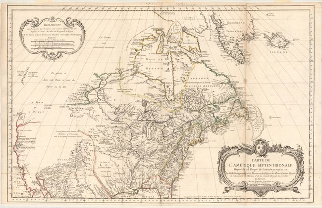
First edition of this large chart that covers nearly all of North America. The West is mostly blank, coastlines are only partially delineated, the Sea of the West (La Mer de l'Ouest) is named but not delineated. There is also a River of the West flowing westward from Lake Winnipeg but ceasing near the Montagne de Pierre brillante suivant le report des Sauvages (mountain of brilliant stones as reported by the savages). The names of explorers responsible for discoveries are noted along the coasts. There is good detail of rivers, lakes, Indian nations, and forts in the interior. The handsome chart is adorned with a large, beautifully engraved title cartouche and a second cartouche contains the legend and three distance scales.
References: McGuirk #46; Tooley, MCC #96-762.
Condition: B
Original outline color on a bright sheet with a few faint stains and light toning along one fold. Professionally backed with tissue to reattach a complete separation of the sheet below the bottom fold and to repair a long vertical fold separation.