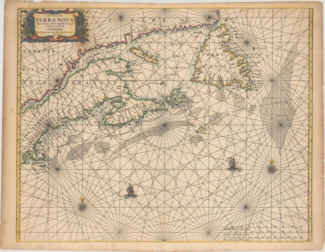
Subject: Canadian Maritimes & New England
Period: 1666 (circa)
Publication: Klaer Lichtende Noort-Ster ofte Zee-Atlas
Color: Hand Color
Size:
21.2 x 16.8 inches
53.8 x 42.7 cm
This rare chart covers from Rhode Island and Martha's Vineyard to Newfoundland and is the first Dutch sea chart of the Canadian Maritimes. It is based on the work of several important sources including Blaeu, Champlain, Sanson, and the manuscripts of Gerritsz. It is notable that Van Loon chose not to show the English settlements in Newfoundland, particularly on the Avalon peninsula, even though that information was used by Blaeu. Prince Edward Island is noticeably missing and the Grand Banks are drawn from Champlain. This important chart became the prototype of the region for the rest of the 17th century. Second state with Gieles van Loon removed from the imprint.
References: Burden #365; Kershaw #179; McCorkle #661.3.
Condition: B+
A dark impression with minor scattered foxing, a light stain below the title cartouche, and remnants of hinge tape on verso. There is light toning along the edges of the sheet along with some minute chips.