Filtered by Category:United States(Show All Categories)
Showing results for:Auction 150
Catalog Archive
190 lots
Page 1 of 4
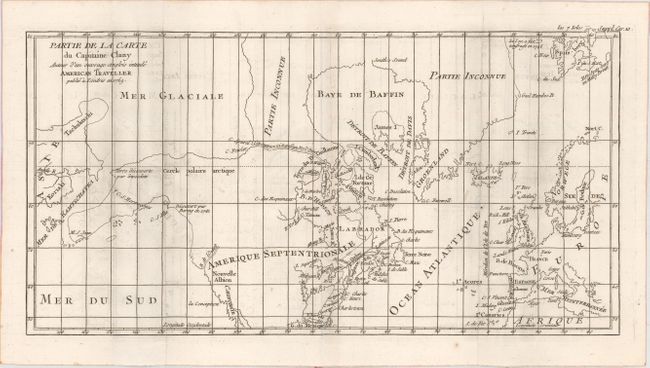
Auction 150, Lot 123
Subject: Colonial United States, Canada & Arctic
Robert de Vaugondy, Didier
Partie de la Carte du Capitaine Cluny Auteur d'un Ouvrage Anglois Intitule American Traveller Publie a Londres en 1769, 1769
Size: 16.2 x 8.5 inches (41.1 x 21.6 cm)
Estimate: $140 - $180
Sold for: $80
Closed on 9/17/2014
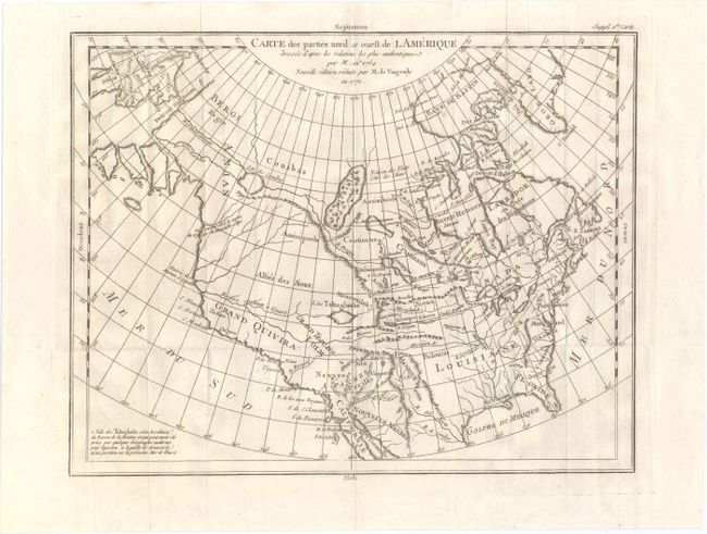
Auction 150, Lot 124
Subject: Colonial United States & Canada
Robert de Vaugondy, Didier
Carte des Parties Nord et Ouest de l'Amerique Dressee d'Apres les Relations les Plus Authentiques par M... en 1764, 1772
Size: 14.9 x 11.7 inches (37.8 x 29.7 cm)
Estimate: $200 - $240
Sold for: $150
Closed on 9/17/2014
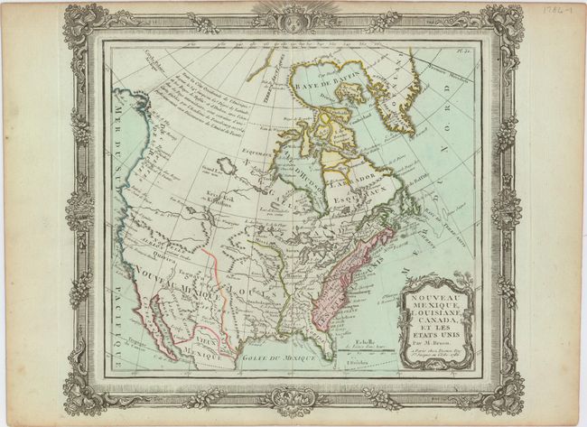
Auction 150, Lot 125
Subject: United States & Canada
Brion de la Tour/Desnos
Nouveau Mexique, Louisiane, Canada, et les Etats Unis, 1786
Size: 12.5 x 11 inches (31.8 x 27.9 cm)
Estimate: $180 - $220
Sold for: $160
Closed on 9/17/2014
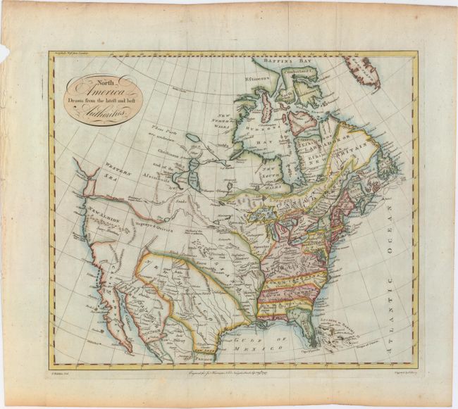
Auction 150, Lot 126
Subject: United States & Canada
Kitchin, Thomas
North America Drawn from the Latest and Best Authorities, 1787
Size: 15.4 x 13.3 inches (39.1 x 33.8 cm)
Estimate: $400 - $475
Sold for: $1,500
Closed on 9/17/2014
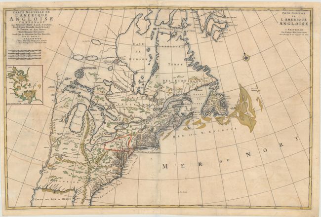
Auction 150, Lot 127
Subject: Colonial Eastern United States & Canada
Mortier, Pierre
Carte Nouvelle de l'Amerique Angloise Contenant la Virginie, Mary-Land, Caroline, Pensylvania, Nouvelle Iorck, N: Iarsey N: France, et les Terres Nouvellement Decouerte..., 1700
Size: 36 x 23.5 inches (91.4 x 59.7 cm)
Estimate: $2,500 - $3,250
A Map Showing Fascinating Geographic Misconceptions
Unsold
Closed on 9/17/2014
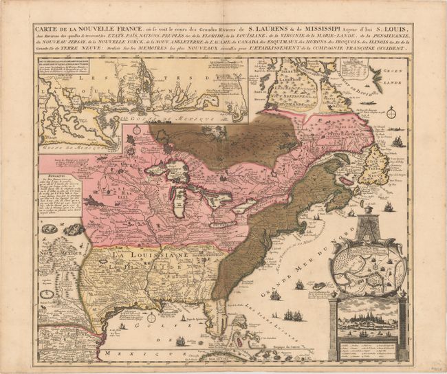
Auction 150, Lot 128
Subject: Colonial Eastern United States & Canada
Fer, Nicolas de
Carte de la Nouvelle France, ou se voit le cours des Grandes Rivieres de S. Laurens & de Mississipi, Aujour d'hui S. Louis…, 1719
Size: 21.7 x 19.6 inches (55.1 x 49.8 cm)
Estimate: $1,600 - $1,900
Striking Map of French Colonial Possessions
Sold for: $1,900
Closed on 9/17/2014
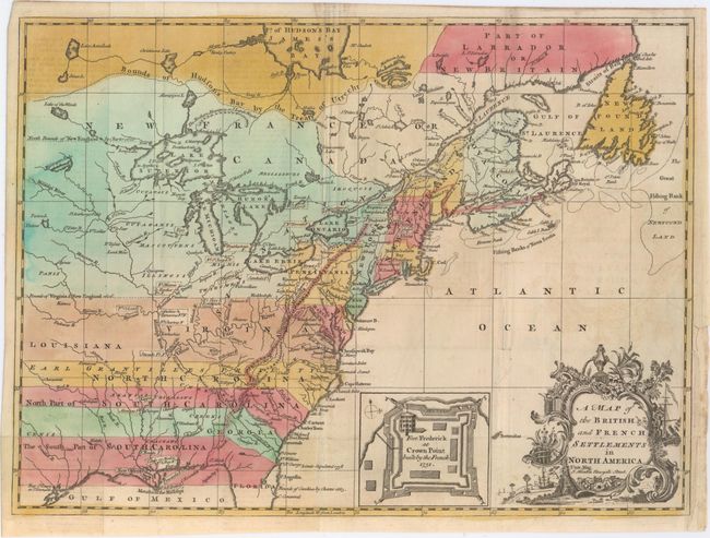
Auction 150, Lot 129
Subject: Colonial Eastern United States & Canada
Hinton, John
A Map of the British and French Settlements in North America, 1755
Size: 14.8 x 10.8 inches (37.6 x 27.4 cm)
Estimate: $550 - $650
Sold for: $2,300
Closed on 9/17/2014
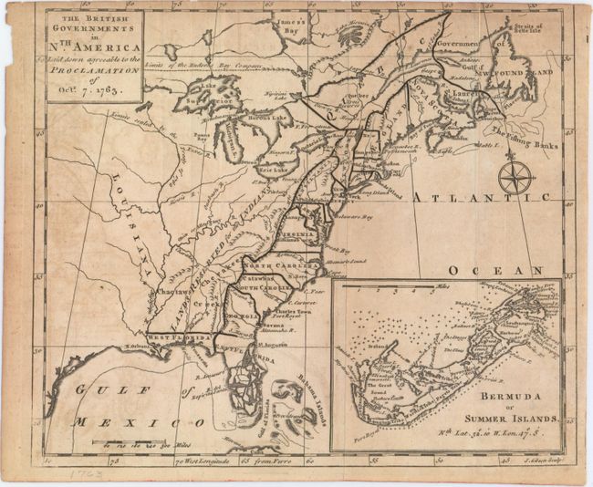
Auction 150, Lot 130
Subject: Colonial Eastern United States & Canada
Gibson, John
The British Governments in Nth. America Laid Down Agreeable to the Proclamation of Oct. 7. 1763, 1763
Size: 9.3 x 7.9 inches (23.6 x 20.1 cm)
Estimate: $275 - $375
Sold for: $400
Closed on 9/17/2014
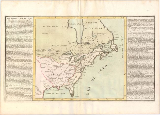
Auction 150, Lot 131
Subject: Eastern United States & Canada
Clouet, Jean Baptiste Louis
Des Possessions Francoises Aujourd'hui sous la Domination Angloises..., 1787
Size: 13.8 x 12.5 inches (35.1 x 31.8 cm)
Estimate: $200 - $240
Sold for: $120
Closed on 9/17/2014
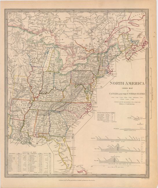
Auction 150, Lot 132
Subject: Eastern United States & Canada
SDUK Society for the Diffusion of Useful Knowledge
[Lot of 15 - North America], 1832-34
Size: 12 x 15 inches (30.5 x 38.1 cm)
Estimate: $1,500 - $2,000
Matching Set of North America SDUK Maps
Sold for: $800
Closed on 9/17/2014
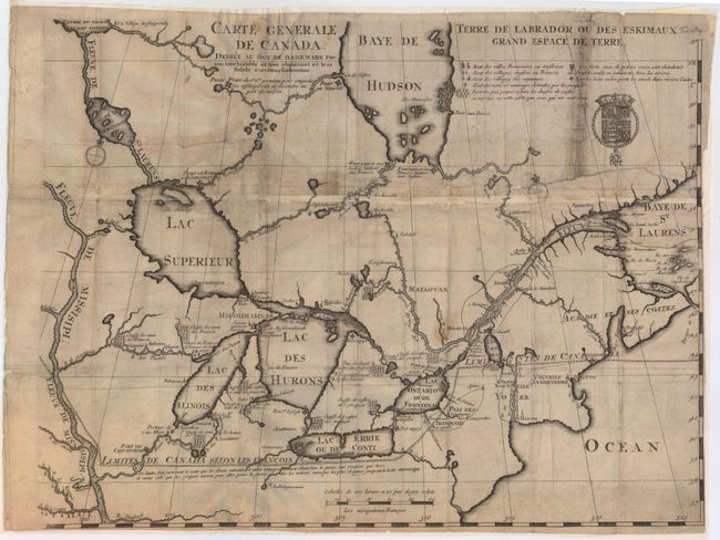
Auction 150, Lot 133
Subject: Colonial Northeastern United States & Canada, Great Lakes
Lahontan, Louis Armand, Baron de
Carte Generale de Canada. Dediee au Roy de Danemark par Son Tres Humble et Tres Obeissant et Tres Fidele Serviteur Lahontan, 1705
Size: 21.5 x 16.6 inches (54.6 x 42.2 cm)
Estimate: $2,000 - $2,400
Lahontan's Map of Canada and the Great Lakes
Sold for: $1,200
Closed on 9/17/2014
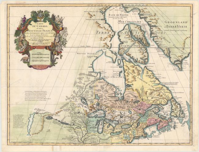
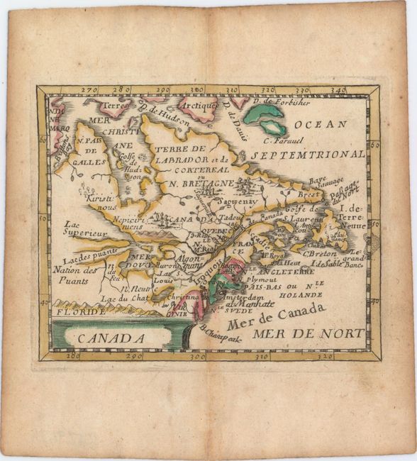
Auction 150, Lot 134
Subject: Colonial Northeastern United States & Canada, Great Lakes
Delisle/Buache
Carte du Canada ou de la Nouvelle France et des Decouvertes qui y ont ete Faites…, 1745
Size: 25.5 x 19.5 inches (64.8 x 49.5 cm)
Estimate: $1,200 - $1,500
One of the Most Influential Maps of Canada, the Great Lakes and Upper Midwest
Unsold
Closed on 9/17/2014
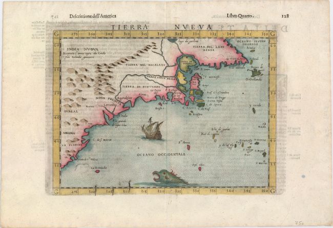
Auction 150, Lot 135
Subject: Northeastern United States & Canada
Ruscelli, Girolamo
Tierra Nueva, 1599
Size: 9.6 x 7.1 inches (24.4 x 18 cm)
Estimate: $1,100 - $1,300
Sold for: $800
Closed on 9/17/2014
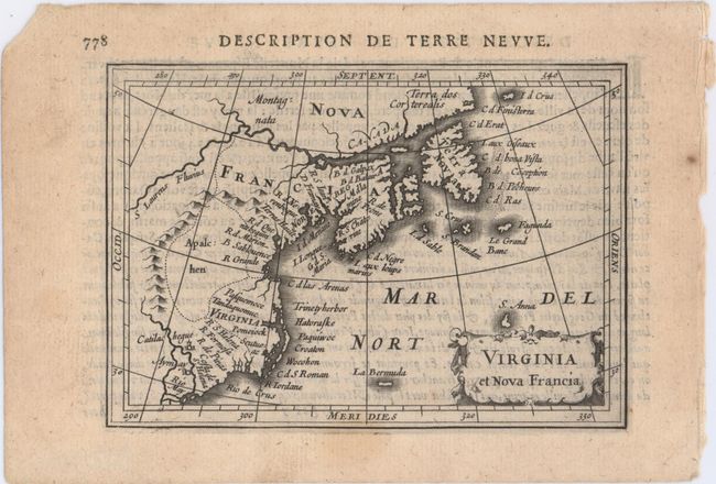
Auction 150, Lot 136
Subject: Colonial Northeastern United States & Canada
Hondius/Bertius
Virginia et Nova Francia, 1618
Size: 5.4 x 3.8 inches (13.7 x 9.7 cm)
Estimate: $475 - $600
Sold for: $325
Closed on 9/17/2014
Auction 150, Lot 137
Subject: Colonial Northeastern United States & Canada
Duval, Pierre
Canada, 1682
Size: 4.8 x 3.9 inches (12.2 x 9.9 cm)
Estimate: $400 - $500
Sold for: $300
Closed on 9/17/2014
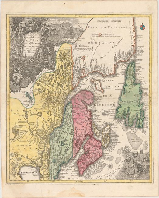
Auction 150, Lot 138
Subject: Colonial New England & Canada
Seutter/Lotter
Partie Orientale de la Nouvelle France ou du Canada avec l'Isle de Terre-Neuve et de Nouvelle Escosse, Acadie et Nouv. Angleterre avec Fleuve de St. Laurence, 1740
Size: 19.6 x 22.7 inches (49.8 x 57.7 cm)
Estimate: $1,000 - $1,300
Sold for: $575
Closed on 9/17/2014
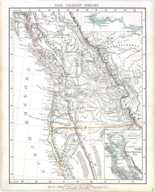
Auction 150, Lot 139
Subject: Western United States & Canada
Flemming, Carl
Das Oregon-Gebiet, 1848
Size: 12.6 x 16.4 inches (32 x 41.7 cm)
Estimate: $230 - $300
Sold for: $170
Closed on 9/17/2014
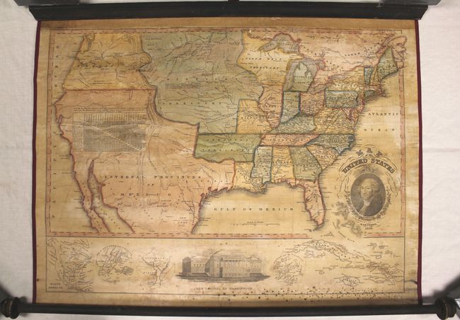
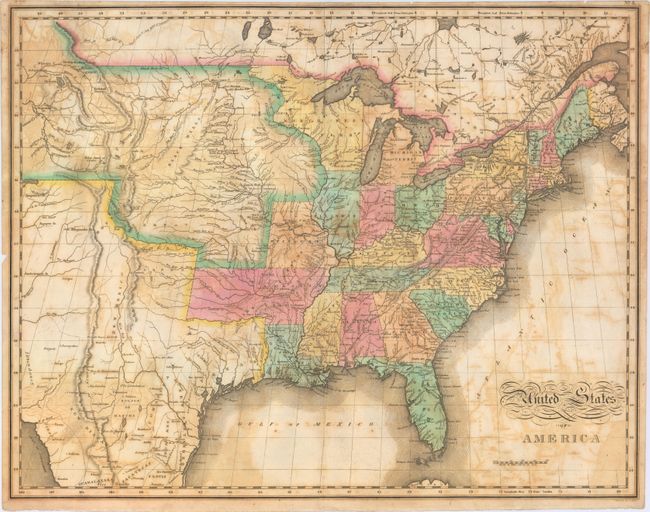
Auction 150, Lot 140
Subject: United States
Thrall, Willis
Map of the United States, 1828
Size: 28 x 21 inches (71.1 x 53.3 cm)
Estimate: $1,500 - $1,800
Sold for: $4,750
Closed on 9/17/2014
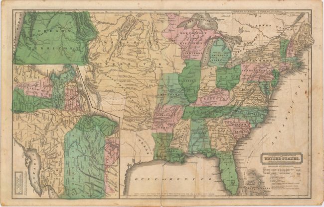
Auction 150, Lot 141
Subject: United States
Woodbridge, William Channing
Geographical & Statistical Map of the United States. Adapted to Woodbridge's Geography, 1831
Size: 16.7 x 10.3 inches (42.4 x 26.2 cm)
Estimate: $110 - $140
Sold for: $600
Closed on 9/17/2014
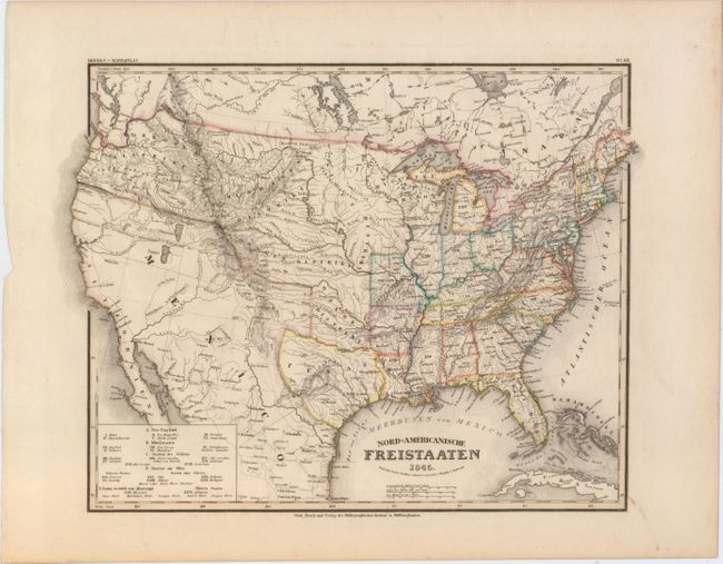
Auction 150, Lot 142
Subject: United States, Texas
Radefeld, Carl Christian Franz
Nord-Americanische Freistaaten, 1845
Size: 14.5 x 11.8 inches (36.8 x 30 cm)
Estimate: $275 - $350
Sold for: $180
Closed on 9/17/2014
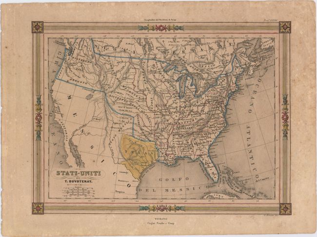
Auction 150, Lot 143
Subject: United States, Texas
Duvotenay, Thunot
Stati-Uniti, 1845
Size: 12 x 8.8 inches (30.5 x 22.4 cm)
Estimate: $160 - $200
Sold for: $120
Closed on 9/17/2014
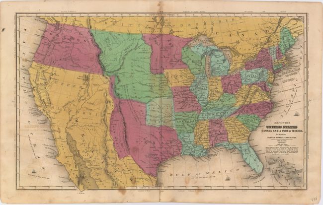
Auction 150, Lot 144
Subject: United States
Robinson, D.F. & Co.
Map of the United States Canada and a Part of Mexico to Illustrate Olney's School Geography, 1846
Size: 17.3 x 10.4 inches (43.9 x 26.4 cm)
Estimate: $200 - $250
Sold for: $240
Closed on 9/17/2014
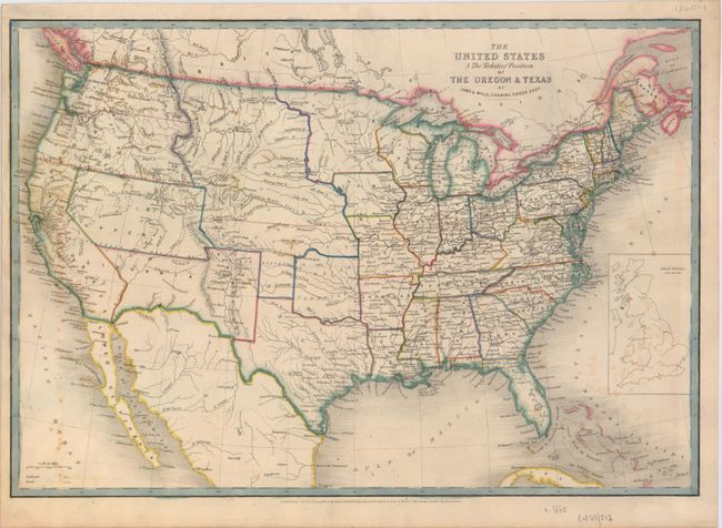
Auction 150, Lot 145
Subject: United States
Wyld, James
The United States & the Relative Position of the Oregon & Texas, 1853
Size: 21.5 x 14.8 inches (54.6 x 37.6 cm)
Estimate: $400 - $500
Sold for: $300
Closed on 9/17/2014
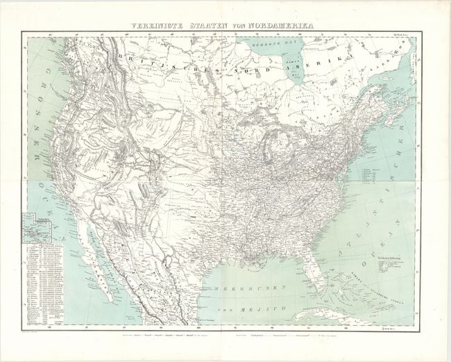
Auction 150, Lot 146
Subject: United States
Flemming, Carl
Vereinigte Staaten von Nordamerika, 1857
Size: 27.3 x 20.6 inches (69.3 x 52.3 cm)
Estimate: $230 - $275
Unsold
Closed on 9/17/2014
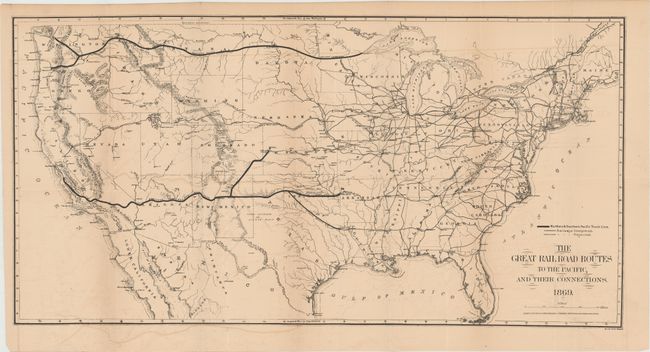
Auction 150, Lot 147
Subject: United States
Gorlinski, Joseph
The Great Railroad Routes to the Pacific, and Their Connections, 1869
Size: 27.5 x 14 inches (69.9 x 35.6 cm)
Estimate: $275 - $350
Sold for: $200
Closed on 9/17/2014
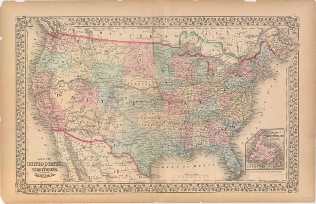
Auction 150, Lot 148
Subject: United States
Mitchell, Samuel Augustus
Map of the United States, and Territories. Together with Canada &c., 1870
Size: 21.4 x 13.4 inches (54.4 x 34 cm)
Estimate: $120 - $150
Sold for: $75
Closed on 9/17/2014
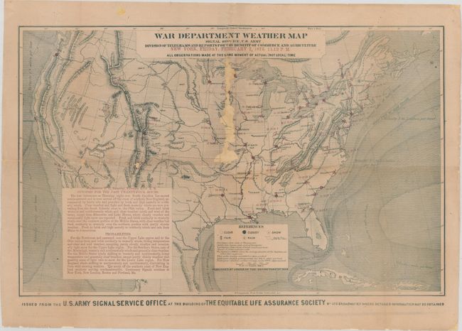
Auction 150, Lot 149
Subject: United States
U.S. War Department
War Department Weather Map Signal Service, U.S. Army Division of Telegrams and Reports for the Benefit of Commerce and Agriculture…, 1873
Size: 22.3 x 14.1 inches (56.6 x 35.8 cm)
Estimate: $200 - $300
Unsold
Closed on 9/17/2014
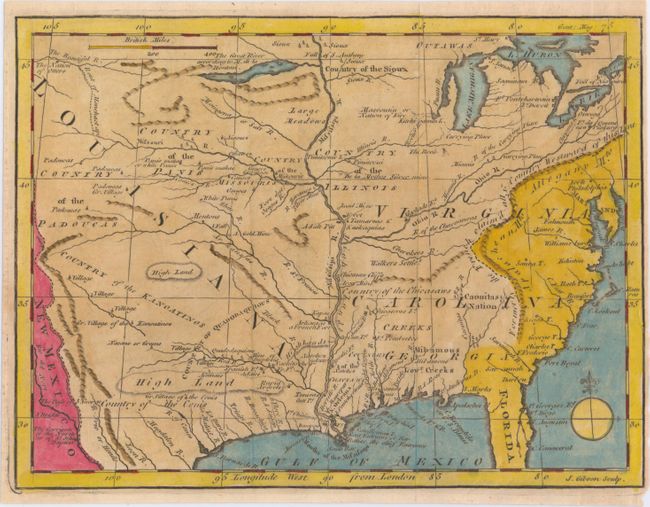
Auction 150, Lot 150
Subject: Colonial Eastern United States
Gibson, John
[Untitled - North America, Louisiana, Virginia & Carolina], 1763
Size: 9.5 x 7.1 inches (24.1 x 18 cm)
Estimate: $275 - $375
Unsold
Closed on 9/17/2014
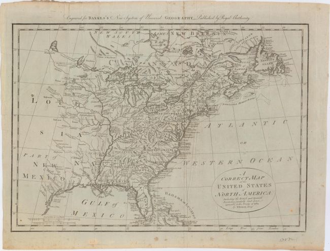
Auction 150, Lot 151
Subject: Eastern United States
Bowen, Thomas
A Correct Map of the United States of North America, Including the British and Spanish Territories, Carefully Laid Down Agreeable to the Treaty of 1784, 1787
Size: 17.5 x 12.5 inches (44.5 x 31.8 cm)
Estimate: $275 - $350
Sold for: $220
Closed on 9/17/2014
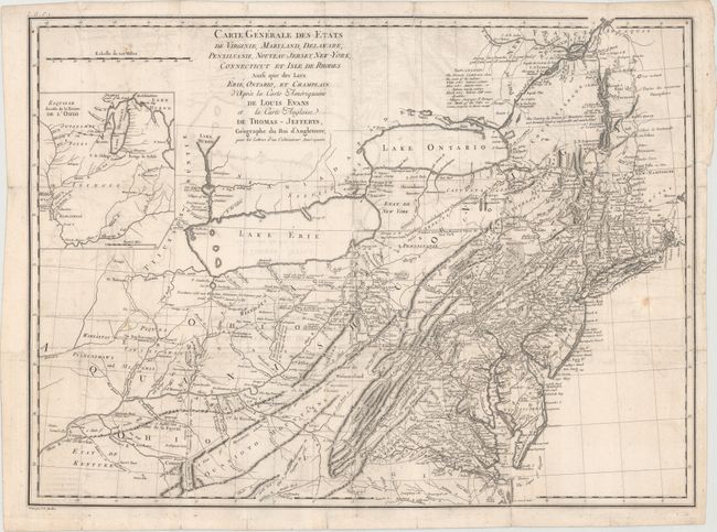
Auction 150, Lot 152
Subject: Eastern United States
Crevecoeur, Michel Guillaume De
Carte Generale des Etats de Virginie, Maryland, Delaware, Pensilvanie, Nouveau-Jersey, New-York, Connecticut, et Isle de Rhodes Ainsi que des Lacs Erie, Ontario, et Champlain..., 1787
Size: 25.8 x 18.9 inches (65.5 x 48 cm)
Estimate: $800 - $1,000
Sold for: $600
Closed on 9/17/2014
Auction 150, Lot 153
Subject: Eastern United States
Melish, John
United States of America, 1822
Size: 21.5 x 17 inches (54.6 x 43.2 cm)
Estimate: $550 - $700
Sold for: $400
Closed on 9/17/2014
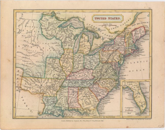
Auction 150, Lot 154
Subject: Eastern United States
Hall, Sidney
United States, 1829
Size: 9.3 x 7.3 inches (23.6 x 18.5 cm)
Estimate: $140 - $170
Sold for: $110
Closed on 9/17/2014
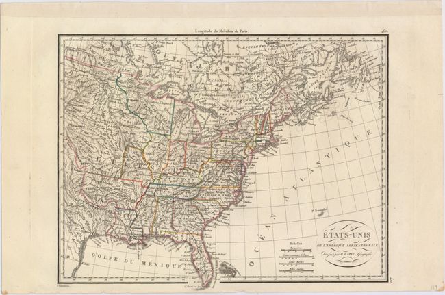
Auction 150, Lot 155
Subject: Eastern United States
Lapie, Alexander Emile & Pierre
Etats-Unis de l'Amerique Septentrionale, 1830
Size: 11.8 x 9.2 inches (30 x 23.4 cm)
Estimate: $150 - $180
Sold for: $75
Closed on 9/17/2014
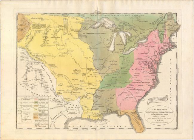
Auction 150, Lot 156
Subject: Eastern United States
Tasso, G.
Stati-Uniti dell' America Settentrionale dalle Piu Recenti Mappe…, 1832
Size: 18.6 x 13.6 inches (47.2 x 34.5 cm)
Estimate: $350 - $425
Sold for: $180
Closed on 9/17/2014
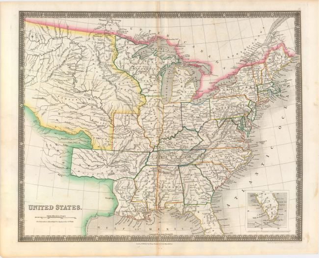
Auction 150, Lot 157
Subject: Eastern United States
Teesdale, Henry
United States, 1837
Size: 16 x 13 inches (40.6 x 33 cm)
Estimate: $240 - $300
Sold for: $120
Closed on 9/17/2014
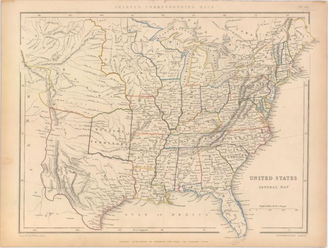
Auction 150, Lot 158
Subject: Eastern United States
Chapman & Hall
United States General Map, 1848
Size: 16.9 x 13.1 inches (42.9 x 33.3 cm)
Estimate: $140 - $170
Sold for: $110
Closed on 9/17/2014
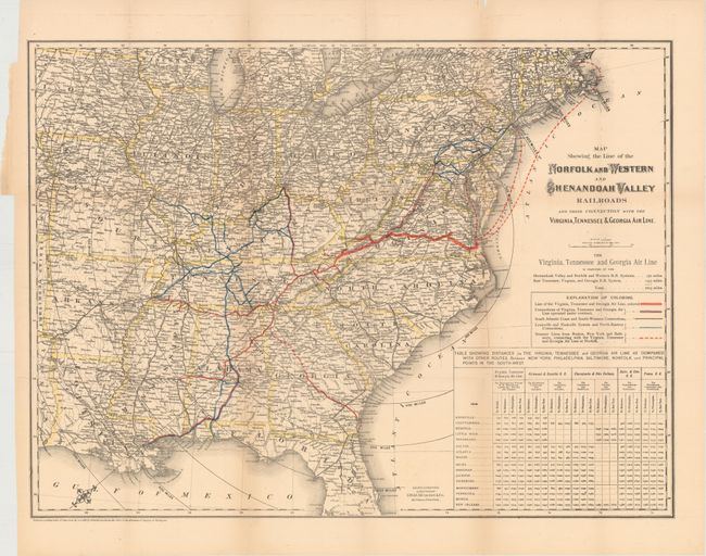
Auction 150, Lot 159
Subject: Eastern United States
Colton, G.W. & C.B.
Map Showing the Line of the Norfolk and Western and Shenandoah Valley Railroads and Their Connection with the Virginia, Tennessee & Georgia Air Line [with report] First Annual Report of the President and Directors of the Norfolk & Western Railroad Company, 1881
Size: 25.6 x 19.1 inches (65 x 48.5 cm)
Estimate: $140 - $170
Sold for: $75
Closed on 9/17/2014
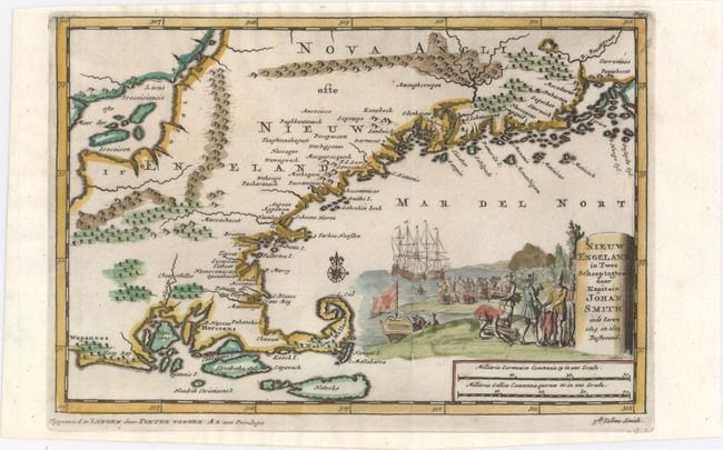
Auction 150, Lot 160
Subject: Colonial New England - United States
Aa, Pieter van der
Nieuw Engeland in Twee Scheeptogten door Kapitein Johan Smith inde Iaren 1614 en 1615 Bestevend, 1710
Size: 9.1 x 6.1 inches (23.1 x 15.5 cm)
Estimate: $500 - $650
Sold for: $600
Closed on 9/17/2014
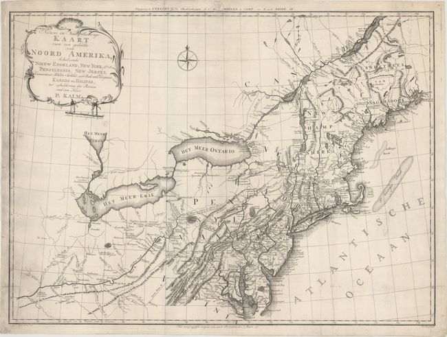
Auction 150, Lot 161
Subject: Colonial New England & Mid-Atlantic United States
Kalm, Peter
Nieuwe en Nauwkeurige Kaart van een gedeelte van Noord Amerika, behelzende Nieuw Engeland, New York, Pensylvania, New Jersey, Connecticut, Rhode Island, een Stuk van Virginia, Kanada en Halifax, 1772
Size: 29.9 x 22 inches (75.9 x 55.9 cm)
Estimate: $1,200 - $1,500
Unsold
Closed on 9/17/2014
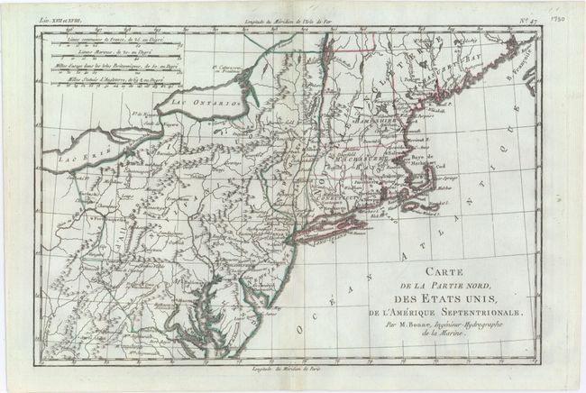
Auction 150, Lot 162
Subject: Colonial New England & Mid-Atlantic United States
Bonne/Raynal
Carte de la Partie Nord, des Etats Unis, de l'Amerique Septentrionale, 1780
Size: 12.8 x 8.5 inches (32.5 x 21.6 cm)
Estimate: $120 - $150
Sold for: $90
Closed on 9/17/2014
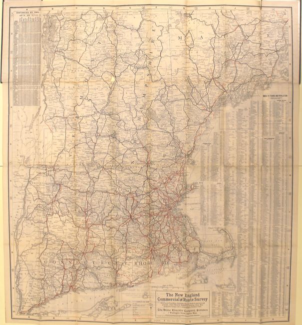
Auction 150, Lot 163
Subject: New England - United States
The New England Commercial and Route Survey Showing All Postoffices, Railroads, Electric Roads in Operation and Proposed, Good Roads..., 1907
Size: 31.6 x 35 inches (80.3 x 88.9 cm)
Estimate: $100 - $130
Sold for: $65
Closed on 9/17/2014
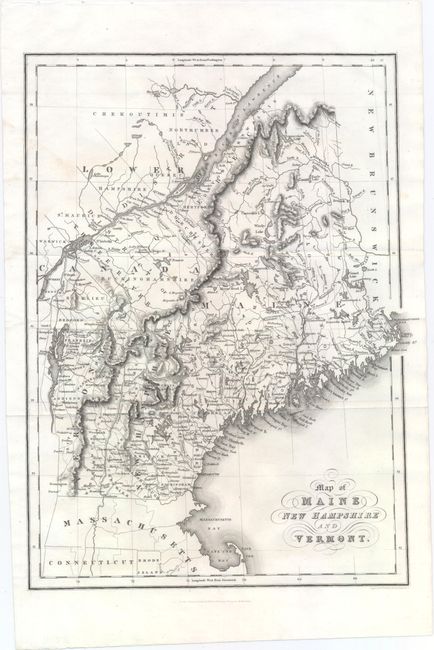
Auction 150, Lot 164
Subject: Maine, New Hampshire, and Vermont
Hinton, Simpkin & Marshall
Map of Maine New Hampshire and Vermont, 1832
Size: 10.5 x 14.3 inches (26.7 x 36.3 cm)
Estimate: $120 - $150
Sold for: $130
Closed on 9/17/2014
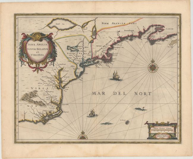
Auction 150, Lot 165
Subject: Colonial New England & Mid-Atlantic United States
Jansson, Jan
Nova Anglia Novum Belgium et Virginia, 1638
Size: 19.8 x 15.3 inches (50.3 x 38.9 cm)
Estimate: $1,600 - $1,900
Jansson's Influential Map of the East Coast
Sold for: $1,400
Closed on 9/17/2014
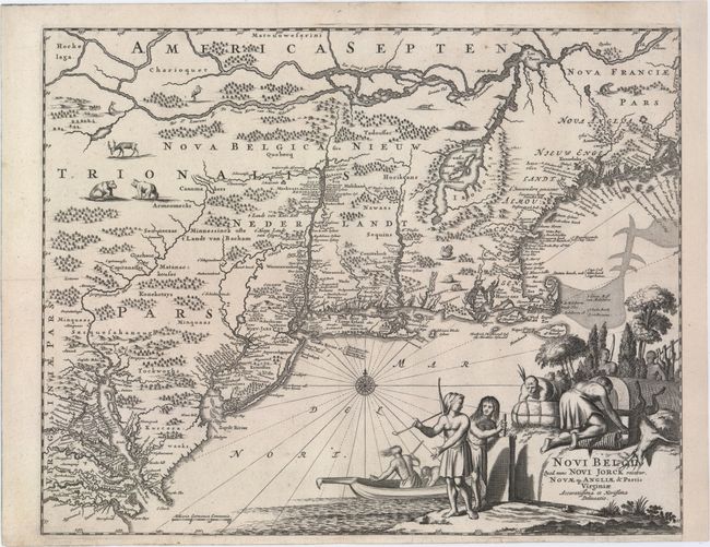
Auction 150, Lot 166
Subject: Colonial New England & Mid-Atlantic United States
Montanus, Arnoldus
Novi Belgii, quod nunc Novi Jorck Vocatur, Novae qz. Angliae & Partis Virginiae Accuratissima et Novissima Delineatio, 1671
Size: 14.5 x 11.5 inches (36.8 x 29.2 cm)
Estimate: $1,400 - $1,700
Unsold
Closed on 9/17/2014
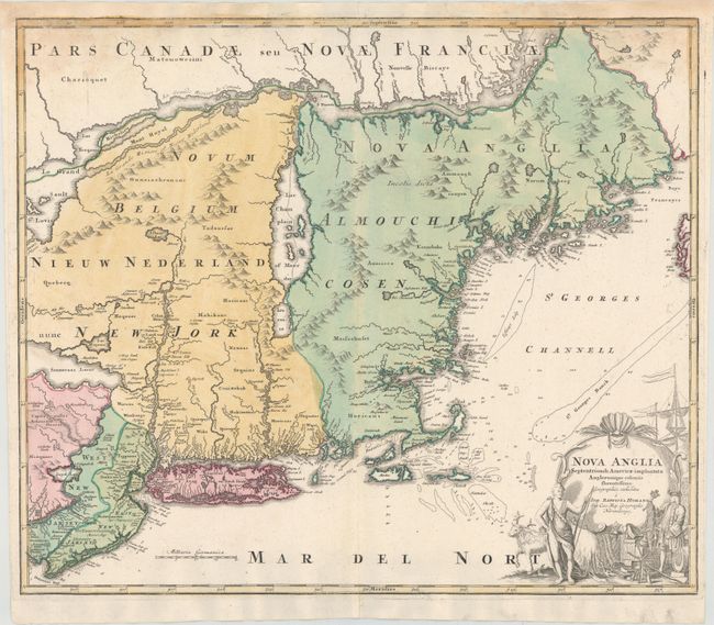
Auction 150, Lot 167
Subject: Colonial New England & Mid-Atlantic United States
Homann, Johann Baptist
Nova Anglia Septentrionali Americae Implantata Anglorumque Coloniis Florentissima..., 1730
Size: 22.8 x 19.3 inches (57.9 x 49 cm)
Estimate: $900 - $1,100
Unsold
Closed on 9/17/2014
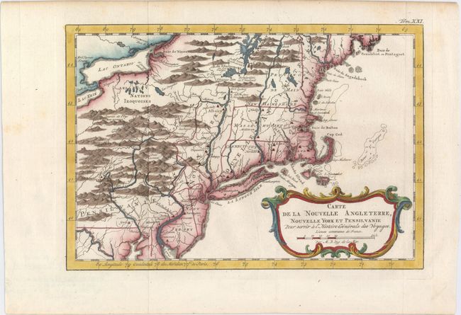
Auction 150, Lot 168
Subject: Colonial New England & Mid-Atlantic United States
Bellin, Jacques Nicolas
Carte de la Nouvelle Angleterre, Nouvelle York et Pensilvanie pour Servir a l'Histoire Generale des Voyages, 1757
Size: 11.5 x 7.9 inches (29.2 x 20.1 cm)
Estimate: $240 - $300
Sold for: $130
Closed on 9/17/2014
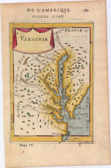
Auction 150, Lot 169
Subject: Colonial Mid-Atlantic United States
Mallet, Alain Manesson
Virginie, 1683
Size: 4.1 x 5.9 inches (10.4 x 15 cm)
Estimate: $275 - $350
Sold for: $200
Closed on 9/17/2014
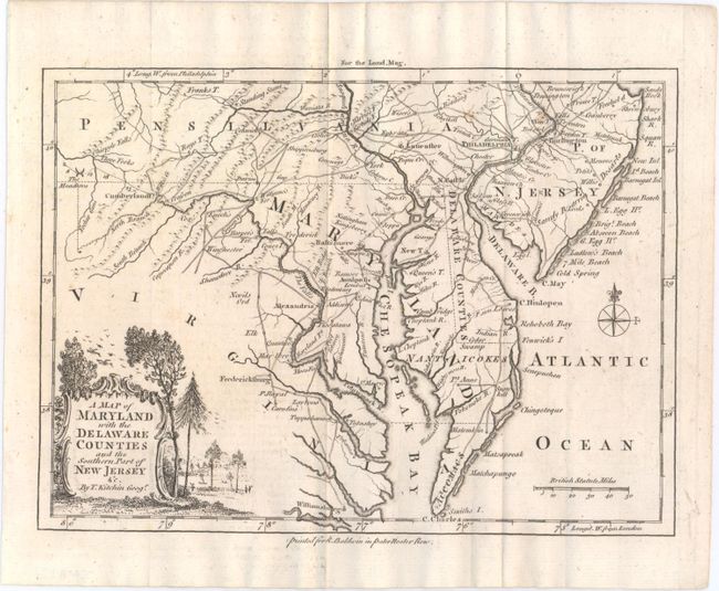
Auction 150, Lot 170
Subject: Colonial Mid-Atlantic United States
Kitchin, Thomas
A Map of Maryland with the Delaware Counties and the Southern Part of New Jersey &c., 1757
Size: 8.9 x 6.6 inches (22.6 x 16.8 cm)
Estimate: $400 - $475
Sold for: $375
Closed on 9/17/2014
Auction 150, Lot 171
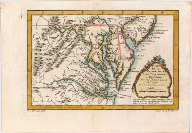
Subject: Colonial Mid-Atlantic United States
Bellin, Jacques Nicolas
Carte de la Virginie, de la Baye Chesapeack, et Pays Voisins pour Servir a l'Histoire Generale des Voyages..., 1757
Size: 11.4 x 7.5 inches (29 x 19.1 cm)
Estimate: $275 - $350
Sold for: $275
Closed on 9/17/2014
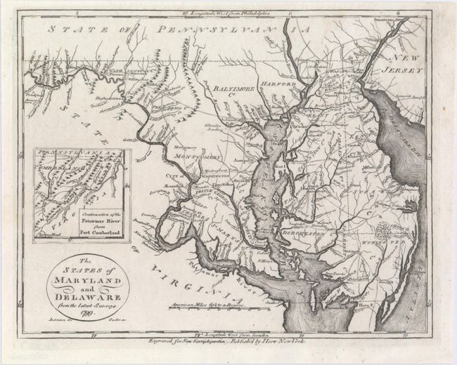
Auction 150, Lot 172
Subject: Mid-Atlantic United States
Low, E.
The States of Maryland and Delaware from the Latest Surveys, 1799
Size: 9.2 x 7.3 inches (23.4 x 18.5 cm)
Estimate: $190 - $230
Sold for: $180
Closed on 9/17/2014
190 lots
Page 1 of 4