Subject: Colonial New England - United States
Period: 1710 (circa)
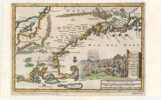
Publication: Naauwkeurige Versameling der Gedenk-Waardigste Zee en Landreysen…
Color: Hand Color
Size:
9.1 x 6.1 inches
23.1 x 15.5 cm
This interesting map covering Rhode Island to Penobscot Bay in Maine uses cartography and names from John Smith's report of the area in 1614-15. It features a large Lacus Irocoisiensis with several large islands. The map is filled with many place names, both Indian and early colonial settlements. The Cape Ann peninsula is oddly shaped and named Tragabigzanda, the name given by John Smith in honor of a Greek maiden who was kind to him while he was held captive by Turks. Nantucket is named Natocke and Martha's Vineyard bears the name of Elizabeths Eyl. The delicately colored pictorial title cartouche depicts Captain John Smith trading with the natives, while his crew greet a mermaid in the background. This map was published in van der Aa's compilation of early voyages of exploration.
References: McCorkle #707-2.
Condition: A
Excellent impression and color with one small worm hole in left blank margin.