Subject: Eastern United States
Period: 1837 (circa)
Publication: A New General Atlas of the World
Color: Hand Color
Size:
16 x 13 inches
40.6 x 33 cm
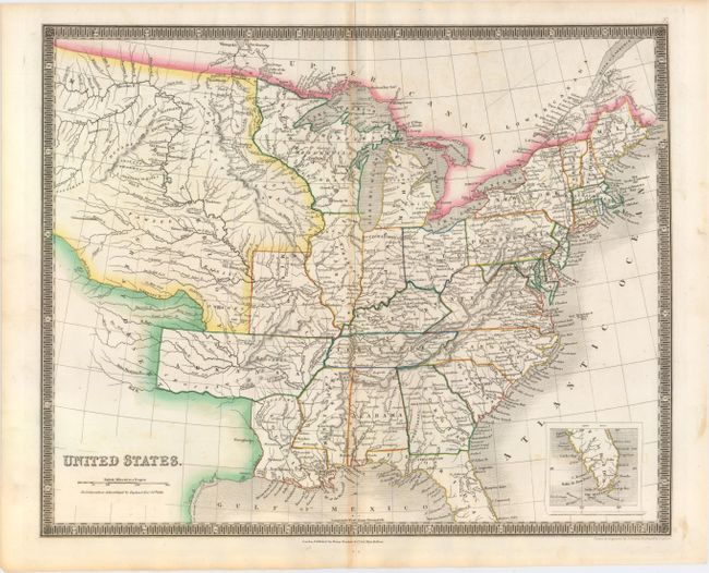
This map features a large Arkansas Territory that extends into today's Oklahoma. The map extends well into the west, here labeled both the Great Desert and Missouri Territory, as distinct from the state of Missouri that is also shown. The Northwest Territory covers all of Wisconsin and northern Minnesota. The map is filled with information and locates many Indian tribes, forts, early settlements and topography. Inset on the same scale shows the southern half of Florida. Well engraved with fine detail throughout and surrounded in a keyboard-style border.
Henry Teesdale was a prominent London publisher and founding fellow of the Royal Geographical Society. He produced large-scale maps and charts and a number of fine atlases in the early part of the nineteenth century. He employed the most skilled draftsmen and engravers and his maps are renowned for precise detail and fine coloring. His maps are increasingly scarce on the market.
References:
Condition: B+
Original color on watermarked paper (J. Whatman 1837) with light toning along the centerfold and two short separations confined to the blank margins closed on verso with archival tape.