Subject: United States & Canada
Period: 1787 (dated)
Publication:
Color: Hand Color
Size:
15.4 x 13.3 inches
39.1 x 33.8 cm
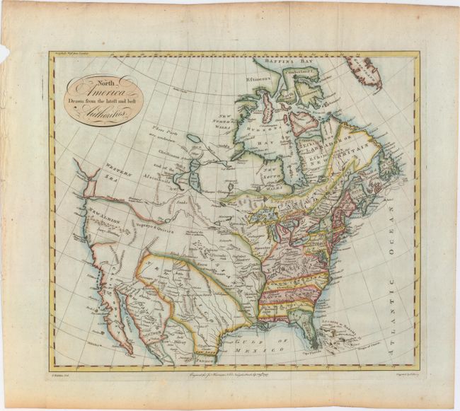
This great map shows good detail in the east with Virginia, the Carolinas and Georgia extending to the Mississippi River. The gulf coast is comprised of East and West Florida, with West Florida also extending to the Mississippi. There are numerous early frontier settlements, forts, Buffalo Meadows, and Indian nations located. In the Pacific Northwest, the Straits of Juan de Fuca open up to a huge, but undefined Western Sea. The River of the West conjecturally flows from Pikes Lake in the Intermountain West. New Albion and the Snowy Mountains are prominently shown, but the western region is mostly blank. The Missouri River is partly delineated with "the head of this River unknown." New Mexico is a large area that includes Texas with several Indian pueblos located. The Colorado River is unnamed and extends into today's Colorado. Central Canada has a bizarre set of lakes and river systems as is commonly seen in this period. The map was drawn by Kitchin and engraved by G. Terry. Imprint below neatline "Engraved for Jno. Harrison No. 115 Newgate Street, Sept. 29th 1787."
References: McGuirk #197.
Condition: A
A nice impression with attractive color and wide margins. There is a small, unobtrusive hole in the Pacific.