Catalog Archive
Auction 150, Lot 163

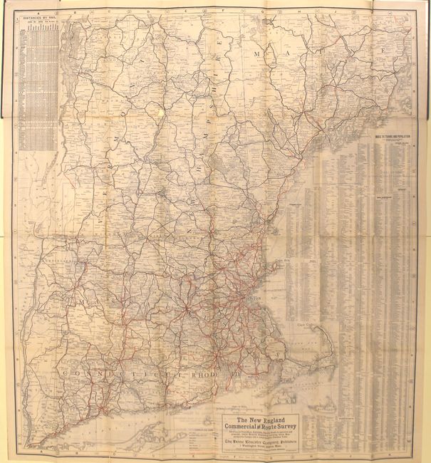
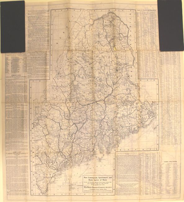
"The New England Commercial and Route Survey Showing All Postoffices, Railroads, Electric Roads in Operation and Proposed, Good Roads...",

Subject: New England - United States

Period: 1907 (dated)

Publication:

Color: Printed Color

Size:
31.6 x 35 inches
80.3 x 88.9 cm
Download High Resolution Image
(or just click on image to launch the Zoom viewer)

This detailed map covers the region from New York City north to Bangor, Maine. Identifies electric railways in orange overprinting and good roads with a black line. Includes a table of distances and a city index also listing population. The verso contains a map of Maine from Portsmouth to Caribou with the outdoorsman in mind featuring roads, railroads, lighthouses, camps and trails. Panels of text describe hunting and fishing laws. Self folds into tall, stiff black boards (4.5 x 9.5"). Published by F.S. Blanchard & Co.

References:

Condition: B

Light toning with a few long fold separations that would benefit from simple archival repairs. The boards show light wear.

Estimate: $100 - $130

Sold for: $65

Closed on 9/17/2014

Archived