Subject: Colonial Eastern United States & Canada
Period: 1755 (published)
Publication: Universal Magazine
Color: Hand Color
Size:
14.8 x 10.8 inches
37.6 x 27.4 cm
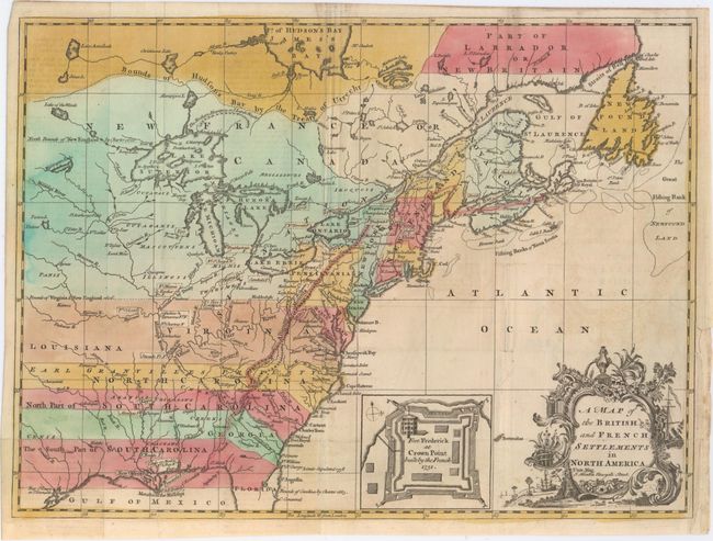
This is one of several similar maps illustrating the growing French/British conflict in North America. It was issued just before the French and Indian War was officially declared and depicts the British and French settlements and forts (delimited with dotted lines and uncolored) in the disputed territory west of the Allegany Mountains. The British colonies south of the Bounds of Virginia and New England 1606 extend to the western-most edge of the map, which is about the 100th Meridian. Earl Granville's Property is shown in North Carolina, and Georgia is shown as a separate strip with parts of South Carolina both north and south of it. Next to the decorative title cartouche is an inset map of "Fort Frederick at Crown Point built by the French 1731."
References: Jolly #UNIV-45; Sellers & Van Ee #36.
Condition: B+
Issued folding on watermarked paper with faint offsetting. A binding trim at lower right has been replaced with old paper, and a 0.75" binding tear has been closed on verso with archival tape.