Filtered by Category:Canada(Show All Categories)
Showing results for:Auction 150
Catalog Archive
33 lots
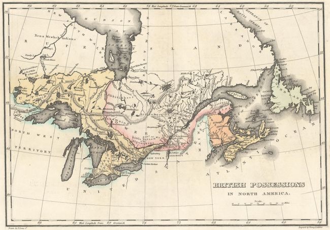
Auction 150, Lot 107
Subject: Canada
Carey & Lea
Geographical, Statistical, and Historical Map of Upper and Lower Canada, and the Other British Possessions in North America, 1822
Size: 14.1 x 9.9 inches (35.8 x 25.1 cm)
Estimate: $180 - $210
Sold for: $130
Closed on 9/17/2014
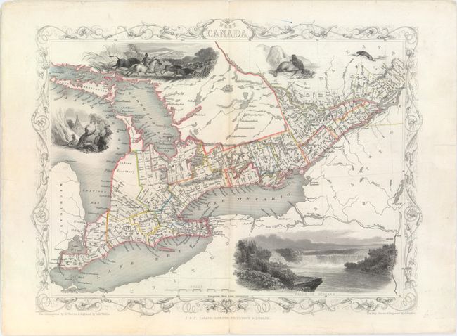
Auction 150, Lot 108
Subject: Canada
Tallis, John
[Lot of 2] West Canada [and] East Canada, and New Brunswick, 1851
Size: 13.4 x 10.1 inches (34 x 25.7 cm)
Estimate: $200 - $240
Unsold
Closed on 9/17/2014
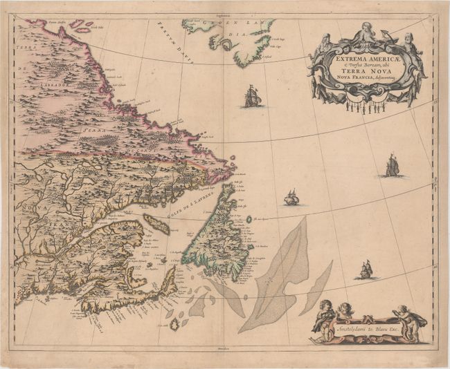
Auction 150, Lot 109
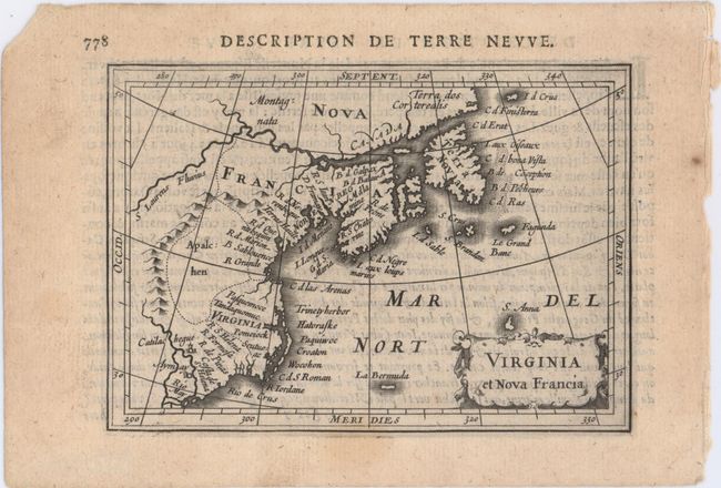
Subject: Eastern Canada
Blaeu, Johannes
Extrema Americae Versus Boream, ubi Terra Nova Nova Francia, Adjacentiaq, 1670
Size: 22.3 x 17.7 inches (56.6 x 45 cm)
Estimate: $2,000 - $2,300
Blaeu's Only Map of Canada, Showing the Canadian Maritimes
Sold for: $1,700
Closed on 9/17/2014
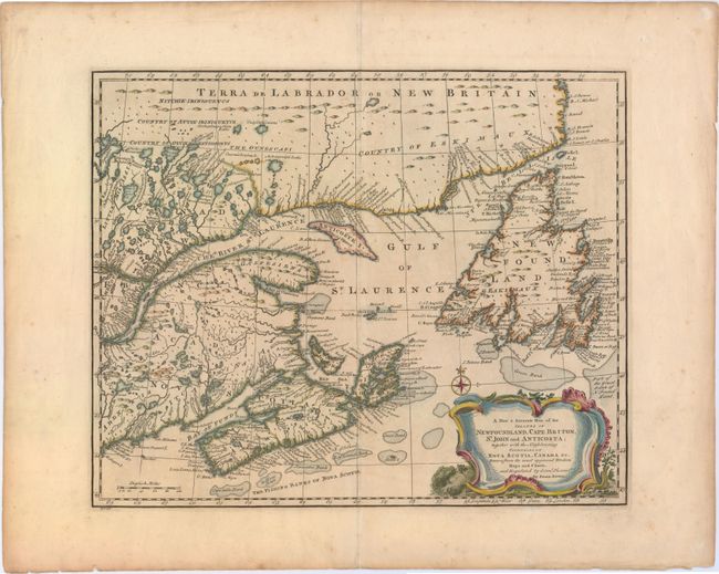
Auction 150, Lot 110
Subject: Eastern Canada
Bowen, Emanuel
A New & Accurate Map of the Islands of Newfoundland, Cape Briton, St. John and Anticosta; Together with the Neighbouring Countries of Nova Scotia, Canada &c. Drawn from the Most Approved Moderns Maps and Charts, and Regulated by Astronl. Observatns., 1752
Size: 16.8 x 13.7 inches (42.7 x 34.8 cm)
Estimate: $375 - $450
Sold for: $275
Closed on 9/17/2014
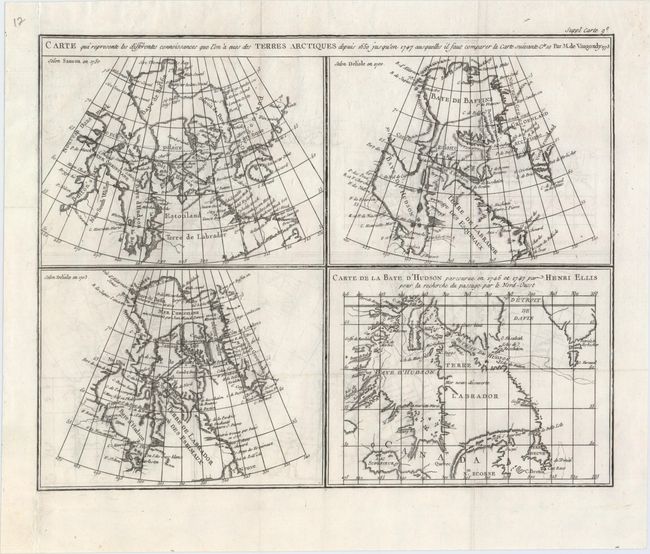
Auction 150, Lot 111
Subject: Eastern Canada
Robert de Vaugondy, Didier
Carte qui Represente les Differentes Connoissances que l'on a Eues des Terres Arctiques Depuis 1650 Jusqu'en 1747 Ausquelles il Faut Comparer la Carte Suivante, 1773
Size: 15.3 x 12.1 inches (38.9 x 30.7 cm)
Estimate: $80 - $110
Sold for: $45
Closed on 9/17/2014
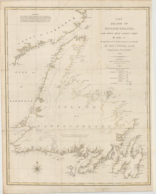
Auction 150, Lot 112
Subject: Eastern Canada
Faden, William
The Island of Newfoundland, Laid Down from Surveys Taken by Order of the Right Honorable the Lords Commissioners of Admiralty, by Lieut. Michael Lane..., 1790
Size: 22.8 x 28.1 inches (57.9 x 71.4 cm)
Estimate: $600 - $750
Unsold
Closed on 9/17/2014
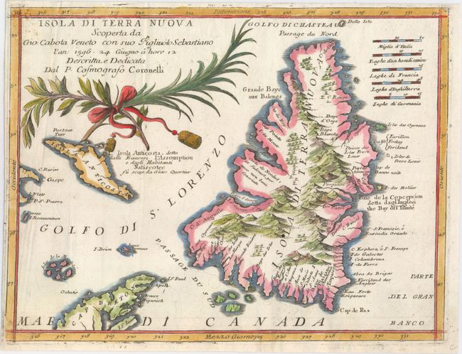
Auction 150, Lot 113
Subject: Newfoundland, Canada
Coronelli, Vincenzo Maria
Isola di Terra Nuova Scoperta da Gio: Cabota Veneto con suo Figliuolo Sebastiano..., 1696
Size: 12 x 9.1 inches (30.5 x 23.1 cm)
Estimate: $450 - $550
Unsold
Closed on 9/17/2014
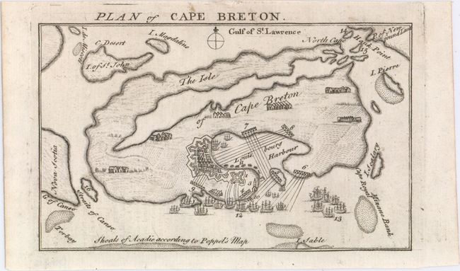
Auction 150, Lot 114
Subject: Cape Breton Island, Canada
[Lot of 2] Plan of Cape Breton [and] A Map of Royal or Cape Breton I. from the Best Authorities, 1745-47
Size: See Description
Estimate: $140 - $180
Sold for: $120
Closed on 9/17/2014
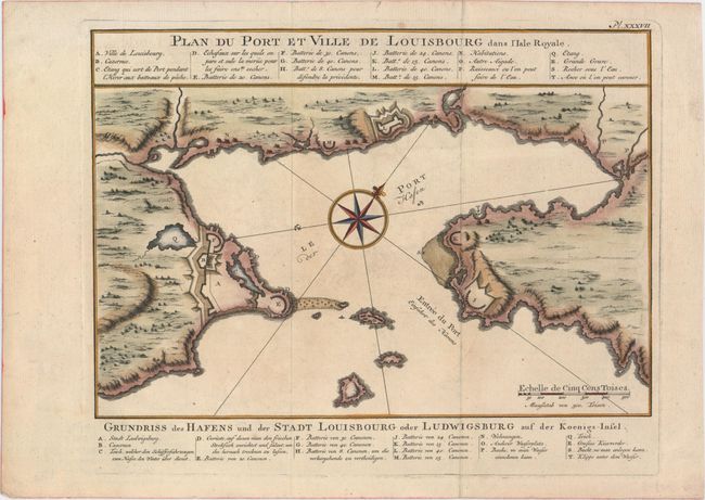
Auction 150, Lot 115
Subject: Cape Breton Island, Canada
Bellin, Jacques Nicolas
Plan du Port et Ville de Louisbourg dans l'Isle Royale, 1752
Size: 11.1 x 7.7 inches (28.2 x 19.6 cm)
Estimate: $160 - $200
Sold for: $120
Closed on 9/17/2014
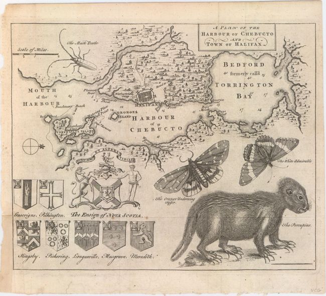
Auction 150, Lot 116
Subject: Halifax, Canada
A Plan of the Harbour of Chebucto and Town of Halifax, 1750
Size: 10.8 x 8.8 inches (27.4 x 22.4 cm)
Estimate: $700 - $850
The Porcupine Map
Sold for: $500
Closed on 9/17/2014
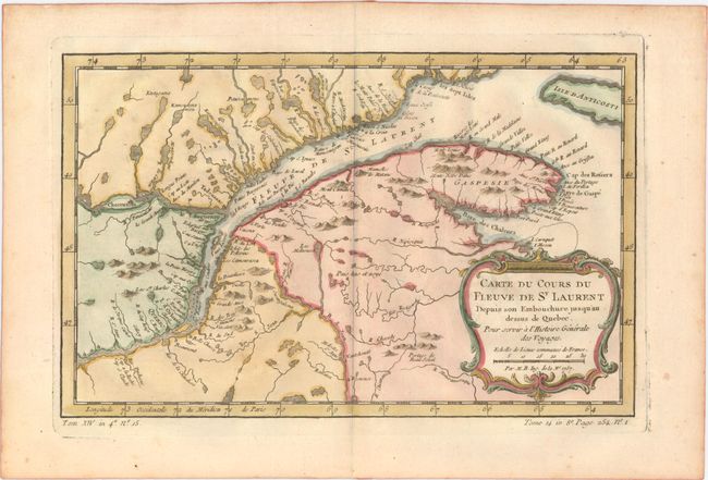
Auction 150, Lot 117
Subject: St. Lawrence River, Canada
Bellin, Jacques Nicolas
Carte du Cours du Fleuve de St. Laurent Depuis son Embouchure Jusqu'au Dessus de Quebec. Pour Servir a l'Histoire Generale des Voyages, 1757
Size: 11.9 x 7.6 inches (30.2 x 19.3 cm)
Estimate: $140 - $170
Sold for: $70
Closed on 9/17/2014
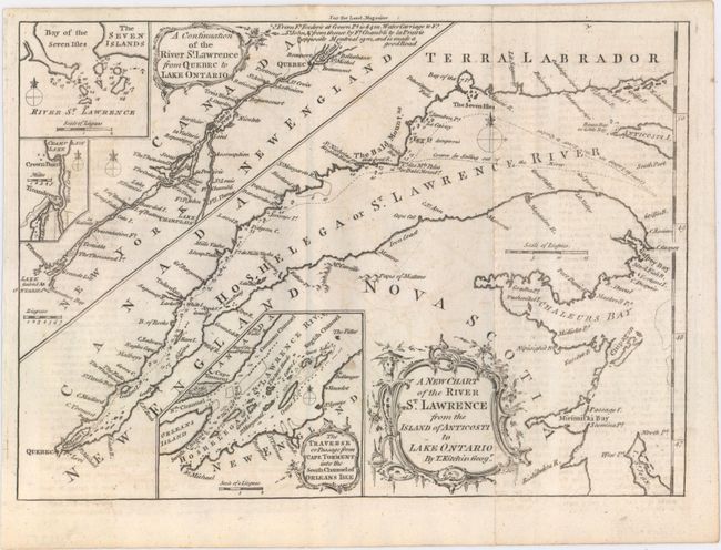
Auction 150, Lot 118
Subject: St. Lawrence River, Canada
[Lot of 2] A New Chart of the River St. Lawrence from the Island of Anticosti to Lake Ontario [and] A Plan of the River St. Lawrence, from the Falls of Montmorenci to Sillery; with the Operations of the Siege of Quebec, 1759
Size: 10.2 x 7.2 inches (25.9 x 18.3 cm)
Estimate: $230 - $275
Sold for: $170
Closed on 9/17/2014
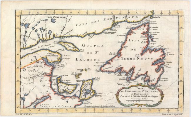
Auction 150, Lot 119
Subject: St. Lawrence Bay, Canada
Bellin, Jacques Nicolas
Carte du Golphe de St. Laurent et Pays Voisins pour Servir a l'Histoire Generale des Voyages, 1780
Size: 14.3 x 8.8 inches (36.3 x 22.4 cm)
Estimate: $140 - $170
Unsold
Closed on 9/17/2014
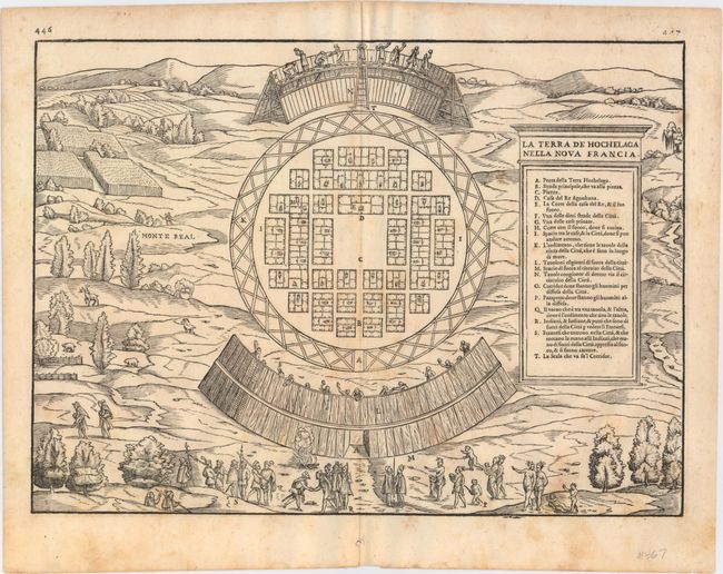
Auction 150, Lot 120
Subject: Montreal, Canada
Gastaldi/Ramusio
La Terra de Hochelaga nella Nova Francia, 1565
Size: 14.5 x 10.6 inches (36.8 x 26.9 cm)
Estimate: $2,200 - $2,500
The First Published Plan of a Settlement in North America
Sold for: $1,600
Closed on 9/17/2014
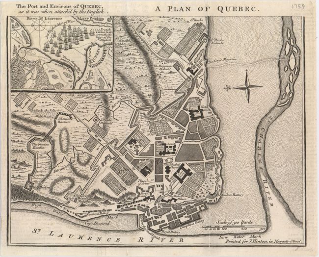
Auction 150, Lot 121
Subject: Quebec City, Canada
Hinton, John
A Plan of Quebec, 1759
Size: 9.2 x 7.1 inches (23.4 x 18 cm)
Estimate: $140 - $180
Sold for: $85
Closed on 9/17/2014
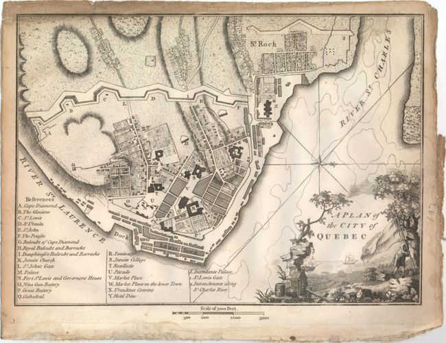
Auction 150, Lot 122
Subject: Quebec City, Canada
Weld, Isaac
A Plan of the City of Quebec, 1798
Size: 9.5 x 6.8 inches (24.1 x 17.3 cm)
Estimate: $120 - $150
Sold for: $75
Closed on 9/17/2014
Auction 150, Lot 123
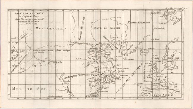
Subject: Colonial United States, Canada & Arctic
Robert de Vaugondy, Didier
Partie de la Carte du Capitaine Cluny Auteur d'un Ouvrage Anglois Intitule American Traveller Publie a Londres en 1769, 1769
Size: 16.2 x 8.5 inches (41.1 x 21.6 cm)
Estimate: $140 - $180
Sold for: $80
Closed on 9/17/2014
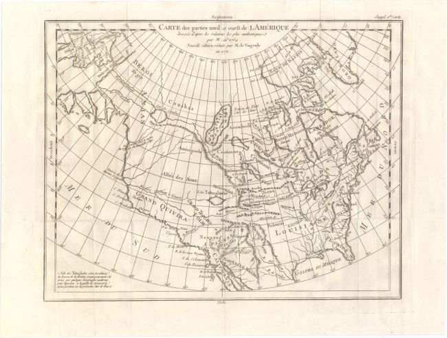
Auction 150, Lot 124
Subject: Colonial United States & Canada
Robert de Vaugondy, Didier
Carte des Parties Nord et Ouest de l'Amerique Dressee d'Apres les Relations les Plus Authentiques par M... en 1764, 1772
Size: 14.9 x 11.7 inches (37.8 x 29.7 cm)
Estimate: $200 - $240
Sold for: $150
Closed on 9/17/2014
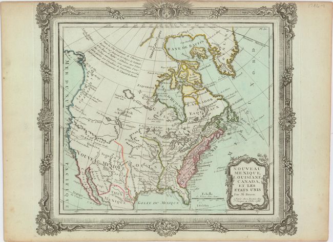
Auction 150, Lot 125
Subject: United States & Canada
Brion de la Tour/Desnos
Nouveau Mexique, Louisiane, Canada, et les Etats Unis, 1786
Size: 12.5 x 11 inches (31.8 x 27.9 cm)
Estimate: $180 - $220
Sold for: $160
Closed on 9/17/2014
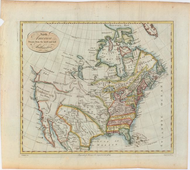
Auction 150, Lot 126
Subject: United States & Canada
Kitchin, Thomas
North America Drawn from the Latest and Best Authorities, 1787
Size: 15.4 x 13.3 inches (39.1 x 33.8 cm)
Estimate: $400 - $475
Sold for: $1,500
Closed on 9/17/2014
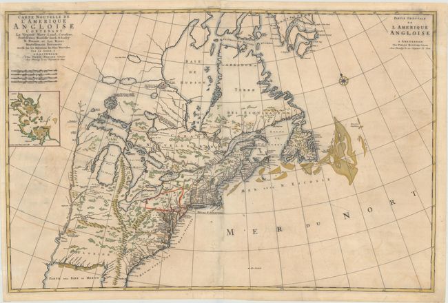
Auction 150, Lot 127
Subject: Colonial Eastern United States & Canada
Mortier, Pierre
Carte Nouvelle de l'Amerique Angloise Contenant la Virginie, Mary-Land, Caroline, Pensylvania, Nouvelle Iorck, N: Iarsey N: France, et les Terres Nouvellement Decouerte..., 1700
Size: 36 x 23.5 inches (91.4 x 59.7 cm)
Estimate: $2,500 - $3,250
A Map Showing Fascinating Geographic Misconceptions
Unsold
Closed on 9/17/2014
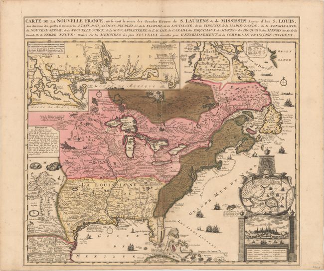
Auction 150, Lot 128
Subject: Colonial Eastern United States & Canada
Fer, Nicolas de
Carte de la Nouvelle France, ou se voit le cours des Grandes Rivieres de S. Laurens & de Mississipi, Aujour d'hui S. Louis…, 1719
Size: 21.7 x 19.6 inches (55.1 x 49.8 cm)
Estimate: $1,600 - $1,900
Striking Map of French Colonial Possessions
Sold for: $1,900
Closed on 9/17/2014
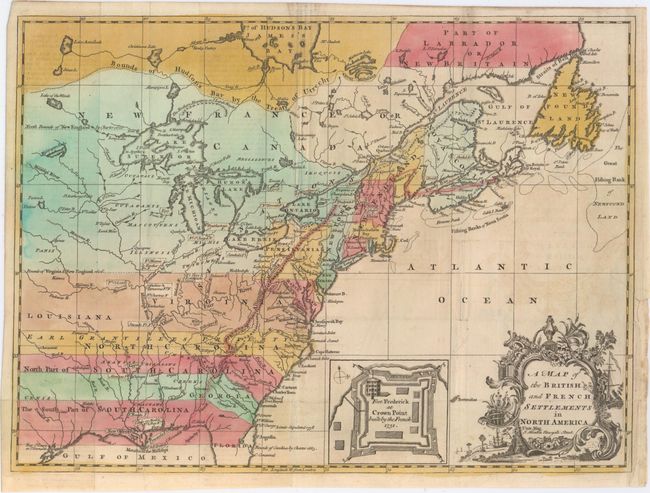
Auction 150, Lot 129
Subject: Colonial Eastern United States & Canada
Hinton, John
A Map of the British and French Settlements in North America, 1755
Size: 14.8 x 10.8 inches (37.6 x 27.4 cm)
Estimate: $550 - $650
Sold for: $2,300
Closed on 9/17/2014
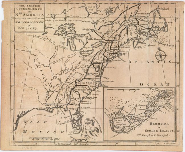
Auction 150, Lot 130
Subject: Colonial Eastern United States & Canada
Gibson, John
The British Governments in Nth. America Laid Down Agreeable to the Proclamation of Oct. 7. 1763, 1763
Size: 9.3 x 7.9 inches (23.6 x 20.1 cm)
Estimate: $275 - $375
Sold for: $400
Closed on 9/17/2014
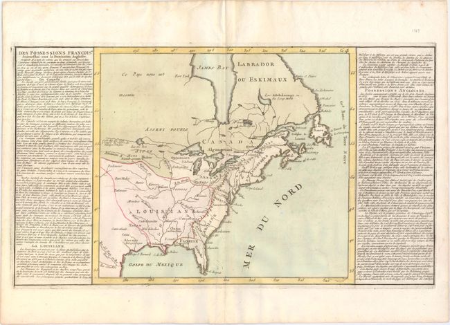
Auction 150, Lot 131
Subject: Eastern United States & Canada
Clouet, Jean Baptiste Louis
Des Possessions Francoises Aujourd'hui sous la Domination Angloises..., 1787
Size: 13.8 x 12.5 inches (35.1 x 31.8 cm)
Estimate: $200 - $240
Sold for: $120
Closed on 9/17/2014
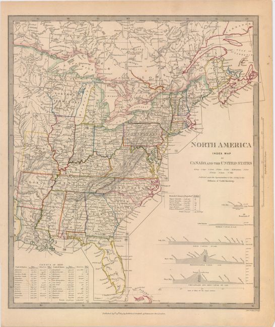
Auction 150, Lot 132
Subject: Eastern United States & Canada
SDUK Society for the Diffusion of Useful Knowledge
[Lot of 15 - North America], 1832-34
Size: 12 x 15 inches (30.5 x 38.1 cm)
Estimate: $1,500 - $2,000
Matching Set of North America SDUK Maps
Sold for: $800
Closed on 9/17/2014
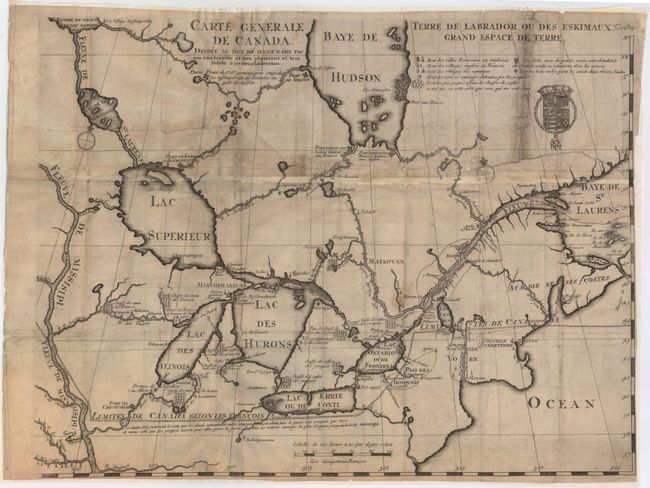
Auction 150, Lot 133
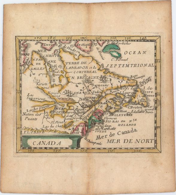
Subject: Colonial Northeastern United States & Canada, Great Lakes
Lahontan, Louis Armand, Baron de
Carte Generale de Canada. Dediee au Roy de Danemark par Son Tres Humble et Tres Obeissant et Tres Fidele Serviteur Lahontan, 1705
Size: 21.5 x 16.6 inches (54.6 x 42.2 cm)
Estimate: $2,000 - $2,400
Lahontan's Map of Canada and the Great Lakes
Sold for: $1,200
Closed on 9/17/2014
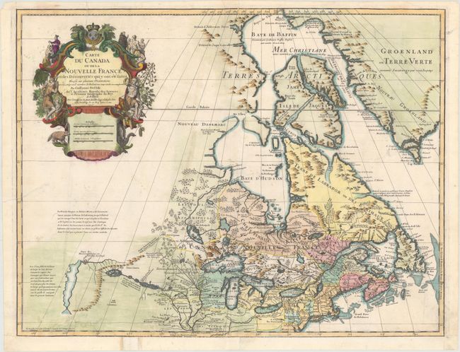
Auction 150, Lot 134
Subject: Colonial Northeastern United States & Canada, Great Lakes
Delisle/Buache
Carte du Canada ou de la Nouvelle France et des Decouvertes qui y ont ete Faites…, 1745
Size: 25.5 x 19.5 inches (64.8 x 49.5 cm)
Estimate: $1,200 - $1,500
One of the Most Influential Maps of Canada, the Great Lakes and Upper Midwest
Unsold
Closed on 9/17/2014
Auction 150, Lot 135
Subject: Northeastern United States & Canada
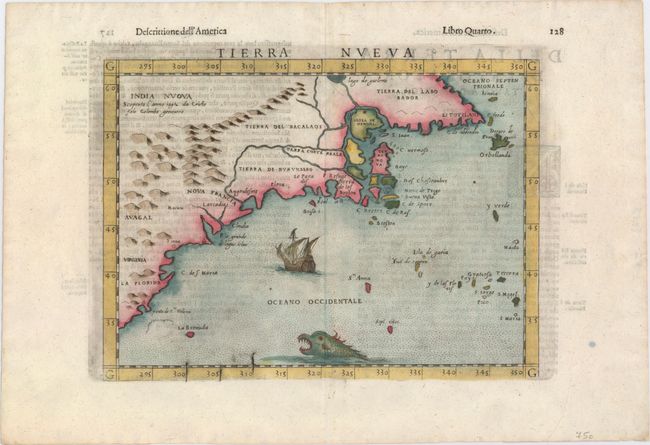
Ruscelli, Girolamo
Tierra Nueva, 1599
Size: 9.6 x 7.1 inches (24.4 x 18 cm)
Estimate: $1,100 - $1,300
Sold for: $800
Closed on 9/17/2014
Auction 150, Lot 136
Subject: Colonial Northeastern United States & Canada
Hondius/Bertius
Virginia et Nova Francia, 1618
Size: 5.4 x 3.8 inches (13.7 x 9.7 cm)
Estimate: $475 - $600
Sold for: $325
Closed on 9/17/2014
Auction 150, Lot 137
Subject: Colonial Northeastern United States & Canada
Duval, Pierre
Canada, 1682
Size: 4.8 x 3.9 inches (12.2 x 9.9 cm)
Estimate: $400 - $500
Sold for: $300
Closed on 9/17/2014
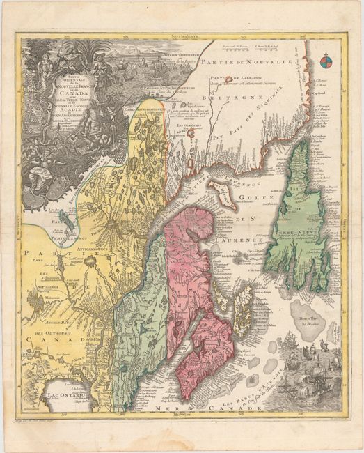
Auction 150, Lot 138
Subject: Colonial New England & Canada
Seutter/Lotter
Partie Orientale de la Nouvelle France ou du Canada avec l'Isle de Terre-Neuve et de Nouvelle Escosse, Acadie et Nouv. Angleterre avec Fleuve de St. Laurence, 1740
Size: 19.6 x 22.7 inches (49.8 x 57.7 cm)
Estimate: $1,000 - $1,300
Sold for: $575
Closed on 9/17/2014
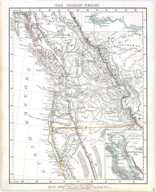
Auction 150, Lot 139
Subject: Western United States & Canada
Flemming, Carl
Das Oregon-Gebiet, 1848
Size: 12.6 x 16.4 inches (32 x 41.7 cm)
Estimate: $230 - $300
Sold for: $170
Closed on 9/17/2014
33 lots