Catalog Archive
Auction 150, Lot 144

"Map of the United States Canada and a Part of Mexico to Illustrate Olney's School Geography", Robinson, D.F. & Co.

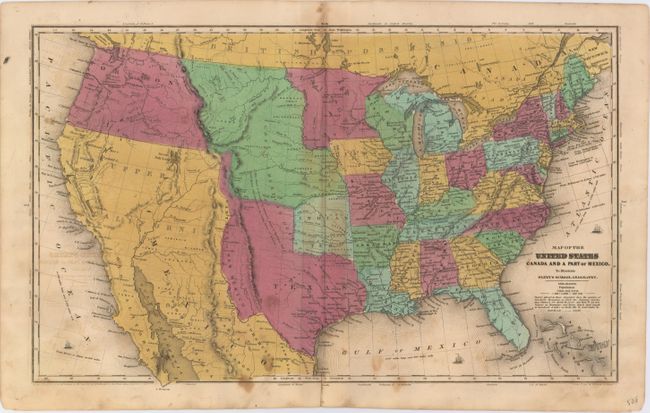
Subject: United States

Period: 1846 (circa)

Publication: Olney's School Geography

Color: Hand Color

Size:
17.3 x 10.4 inches
43.9 x 26.4 cm
Download High Resolution Image
(or just click on image to launch the Zoom viewer)

Despite its 1844 copyright date, this map shows Texas as part of the United States. This is evidenced by the removal of Texas from the title in an earlier publication with the same copyright date shown here. Depicted in its stovepipe configuration, many cities are located in Texas including Austin, Houston, San Antonio de Bexar and Columbus. To the west is a small region named Santa Fe or New Mexico. To Texas' north is a square-shaped Indian Territory and a large Nebraska Territory bound by the Rockies to the west and the Missouri River to the east. Minnesota Territory occupies the region from the Missouri River east to the Mississippi. Mexico controls the Southwest, and the huge Oregon Territory reaches to the Continental Divide. Drawn and engraved by Sherman & Smith, N.Y.

References:

Condition: B

Light offsetting with several small stains in the image and a short centerfold separation at bottom that just passes the neatline and has been closed on verso with archival tape.

Estimate: $200 - $250

Sold for: $240

Closed on 9/17/2014

Archived