Subject: Eastern United States
Period: 1822 (circa)
Publication:
Color: Hand Color
Size:
21.5 x 17 inches
54.6 x 43.2 cm
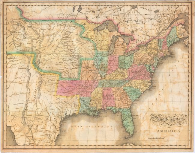
A great map by the important American cartographer John Melish. The map extends west to longitude 109°, with the northern border of the United States extending into present-day Canada. It provides a detailed view of the Missouri River and the headwaters of the Columbia River, based on information from Lewis and Clark's expedition. To the south, it is one of the earliest maps to use Stephen H. Long's material and the name Long's Peak first appears on this map. The new state of Missouri is shown with its straight western border. Michigan Territory includes the eastern part of present-day Wisconsin, which is still a part of North West Terry. The large Arkansas Territory takes in most of present-day Oklahoma. Texas and the Southwest are an interesting hodgepodge of regions, including the Great American Desert, New Mexico, New Santander. The map was engraved by Benjamin Tanner.
References: cf. Wheat (TMW) #338.
Condition: B
On watermarked paper with moderate offsetting. A centerfold separation that enters 1.5" into map at top and an edge tear at left that enters 1" into the image and have both been closed on verso with archival tape.