Filtered by Category:United States(Show All Categories)
Showing results for:Auction 136
Catalog Archive
246 lots
Page 1 of 5
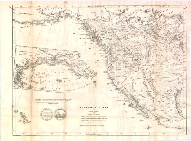
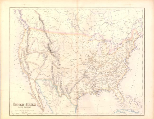
Auction 136, Lot 110
Subject: Western North America
Burr, David H.
The North-West Coast of North America and adjacent Territories…, 1840
Size: 21.38 x 16 inches (54.3 x 40.6 cm)
Estimate: $250 - $325
Sold for: $170
Closed on 6/1/2011
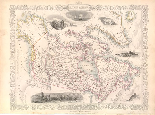
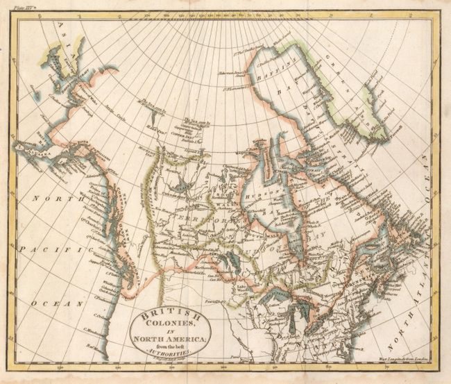
Auction 136, Lot 120
Subject: Canada and Alaska
Tallis, John
British America, 1851
Size: 12.8 x 10.2 inches (32.5 x 25.9 cm)
Estimate: $160 - $200
Sold for: $120
Closed on 6/1/2011
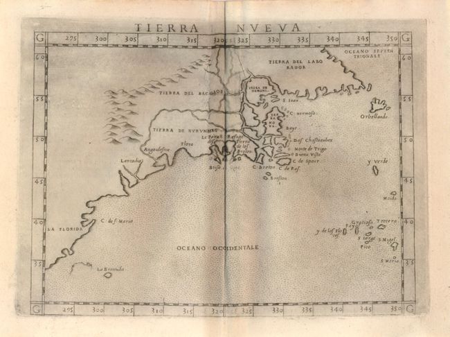
Auction 136, Lot 124
Subject: United States and Canada
Ruscelli, Girolamo
Tierra Nueva, 1574
Size: 9.5 x 7 inches (24.1 x 17.8 cm)
Estimate: $1,000 - $1,300
Unsold
Closed on 6/1/2011
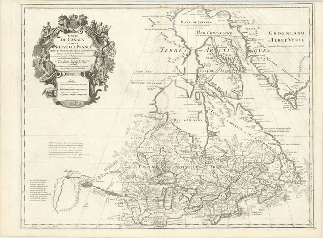
Auction 136, Lot 125
Subject: Colonial United States and Canada
Delisle, Guillaume
Carte du Canada ou de la Nouvelle France et des Decouvertes qui y ont ete faites…, 1718
Size: 25 x 19 inches (63.5 x 48.3 cm)
Estimate: $1,800 - $2,100
One of the most influential maps of Canada, the Great Lakes and Upper Midwest
Sold for: $1,500
Closed on 6/1/2011
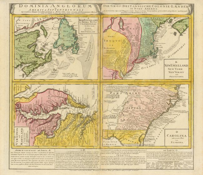
Auction 136, Lot 126
Subject: Colonial United States & Canada
Homann Heirs
Dominia Anglorum in America Septentrionali, 1740
Size: 21.8 x 19.6 inches (55.4 x 49.8 cm)
Estimate: $600 - $800
Sold for: $450
Closed on 6/1/2011
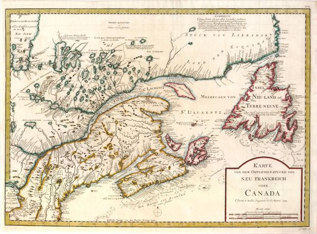
Auction 136, Lot 127
Subject: Colonial United States & Canada
Bellin, Jacques Nicolas
Karte von dem Ostlichen-Stucke von Neu Frankreich oder Canada, 1744
Size: 21.8 x 15.8 inches (55.4 x 40.1 cm)
Estimate: $400 - $500
Unsold
Closed on 6/1/2011
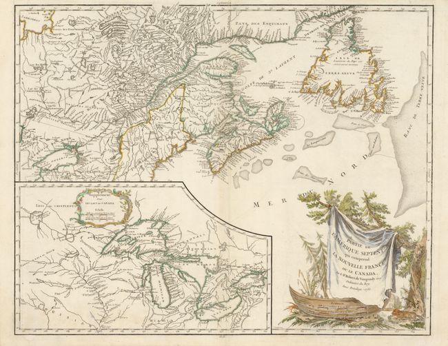
Auction 136, Lot 128
Subject: Colonial United States and Canada
Robert de Vaugondy, Gilles
Partie de l'Amerique Septent? qui comprend la Nouvelle France ou le Canada, 1755
Size: 23.8 x 19 inches (60.5 x 48.3 cm)
Estimate: $600 - $700
Sold for: $450
Closed on 6/1/2011
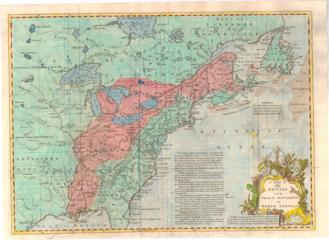
Auction 136, Lot 129
Subject: Colonial United States and Canada
Lodge, John
A Map of the British and French Settlements in North America, 1755
Size: 15.5 x 11 inches (39.4 x 27.9 cm)
Estimate: $350 - $450
Sold for: $250
Closed on 6/1/2011
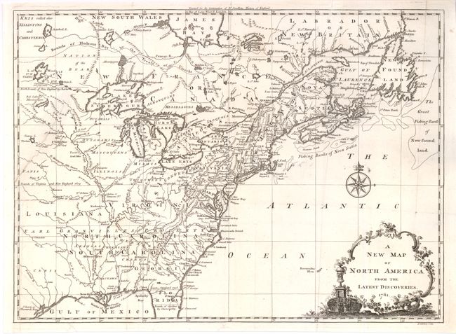
Auction 136, Lot 130
Subject: Colonial United States and Canada
Spilsbury, J.
A New Map of North America from the Latest Discoveries, 1761
Size: 14.75 x 10.9 inches (37.5 x 27.7 cm)
Estimate: $300 - $375
Unsold
Closed on 6/1/2011
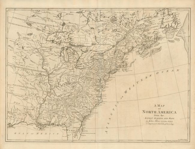
Auction 136, Lot 131
Subject: Colonial United States and Canada
Blair, Rev. John
A Map of North America from the Latest Surveys and Maps, 1768
Size: 22.5 x 16.4 inches (57.2 x 41.7 cm)
Estimate: $850 - $1,000
Unsold
Closed on 6/1/2011
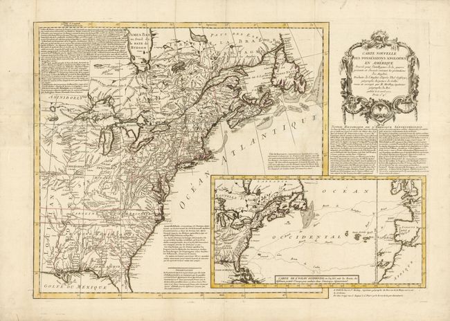
Auction 136, Lot 132
Subject: Colonial United States and Canada
Moithey, Maurille Antoine
Carte Nouvelle des Possessions Angloises en Amerique Dressee pour l'Intelligence de la Guerre Presente et Divisee Suivant les Pretentions des Anglois…, 1777
Size: 27.2 x 19.2 inches (69.1 x 48.8 cm)
Estimate: $2,400 - $3,000
Sold for: $1,500
Closed on 6/1/2011
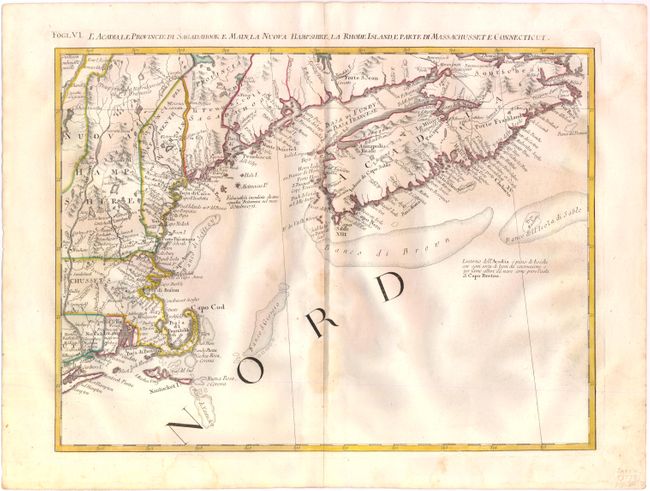
Auction 136, Lot 133
Subject: Colonial United States and Canada
Zatta, Antonio
L'Acadia, le Provincie di Sagadahook e Main, la Nuova Hampshire, la Rhode Island, e Parte di Massachusset e Connecticut, 1778
Size: 16.5 x 12.6 inches (41.9 x 32 cm)
Estimate: $300 - $400
Sold for: $220
Closed on 6/1/2011
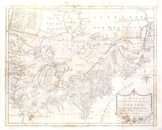
Auction 136, Lot 134
Subject: Canada & United States
Stockdale, John
A Map of the Northern and Middle States; Comprehending the Western Territory and the British Dominions in North America from the Best Authorities, 1793
Size: 15.8 x 12.8 inches (40.1 x 32.5 cm)
Estimate: $500 - $650
Sold for: $375
Closed on 6/1/2011
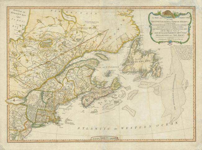
Auction 136, Lot 135
Subject: Canada & United States
Laurie & Whittle
A New and Correct Map of the British Colonies in North America Comprehending Eastern Canada with the Province of Quebec, New Brunswick, Nova Scotia, and the Government of Newfoundland: with the Adjacent States of New England, Vermont, New York…, 1794
Size: 26.4 x 18.6 inches (67.1 x 47.2 cm)
Estimate: $600 - $750
Sold for: $450
Closed on 6/1/2011
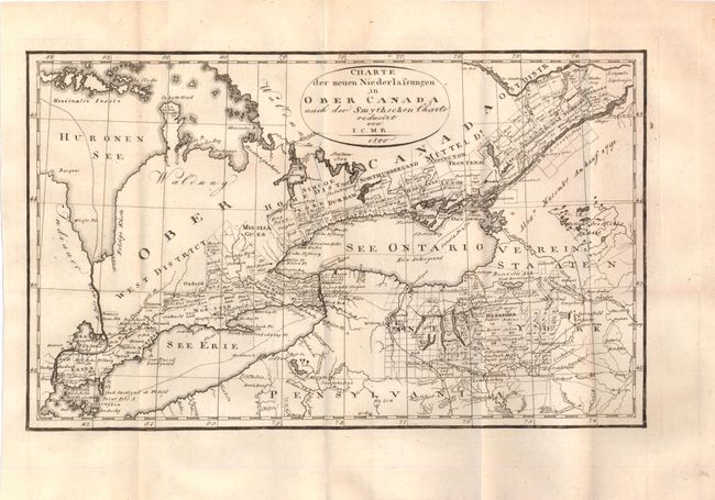
Auction 136, Lot 136
Subject: Canada & United States, Great Lakes
I.C.M.R.
Charte der neuen Niederlassungen in Ober Canada nach der Smythschen Charte, 1800
Size: 12.5 x 7.5 inches (31.8 x 19.1 cm)
Estimate: $200 - $250
Sold for: $150
Closed on 6/1/2011
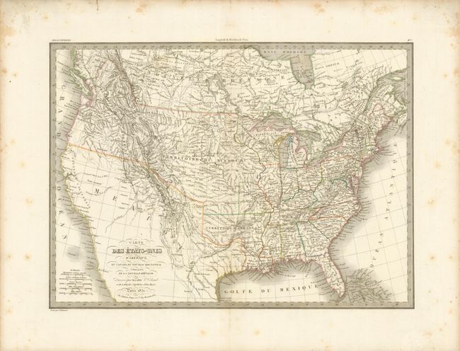
Auction 136, Lot 137
Subject: Canada & United States
Lapie, Alexander Emile & Pierre
Carte des Etats-Unis d'Amerique…, 1832
Size: 21.2 x 15.4 inches (53.8 x 39.1 cm)
Estimate: $375 - $475
Unsold
Closed on 6/1/2011
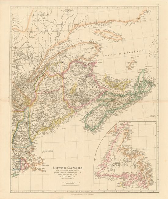
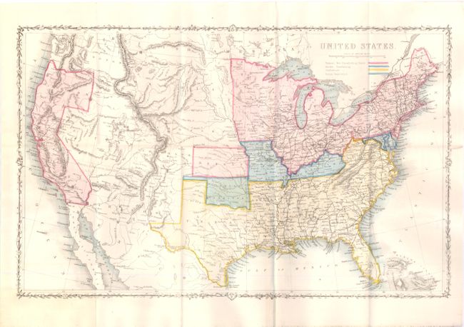
Auction 136, Lot 138
Subject: Canada & United States
Arrowsmith, John
Lower Canada, New Brunswick, Nova Scotia, Prince Edwards Id. Newfoundland, and a large portion of the United States, 1842
Size: 19 x 23.6 inches (48.3 x 59.9 cm)
Estimate: $200 - $250
Sold for: $210
Closed on 6/1/2011
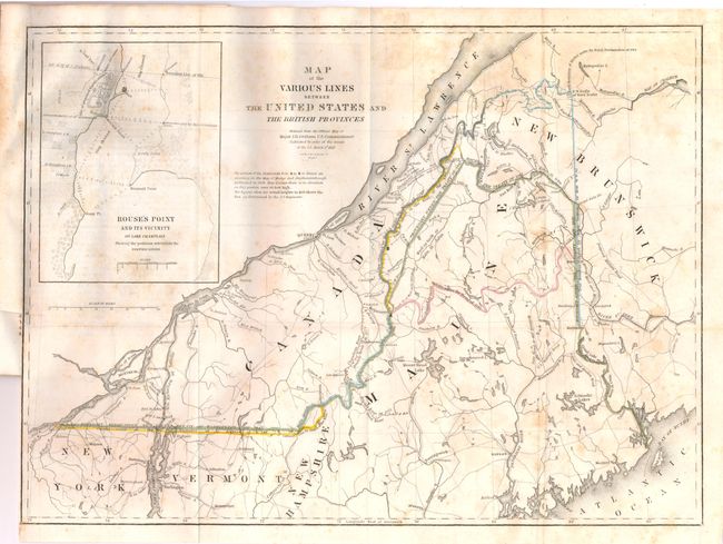
Auction 136, Lot 139
Subject: Canada & New England
Graham, James D.
Map of the Various Lines between the United States and the British Provinces, 1846
Size: 15.5 x 11.8 inches (39.4 x 30 cm)
Estimate: $400 - $600
Sold for: $300
Closed on 6/1/2011
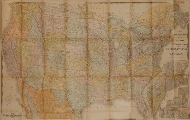
Auction 136, Lot 140
Subject: United States and Canada
Rand McNally & Co.
Official Railroad map of the United States and Canada, 1885
Size: 42.5 x 26.8 inches (108 x 68.1 cm)
Estimate: $140 - $180
Sold for: $170
Closed on 6/1/2011
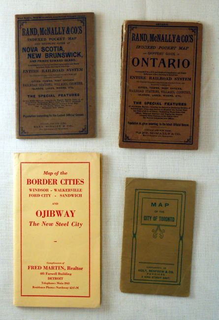
Auction 136, Lot 141
Subject: Canada & United States, Detroit
[Lot of 4 - Pocket Maps of Canada and Detroit], 1902-1920
Size: See Description
Estimate: $120 - $200
Sold for: $110
Closed on 6/1/2011
Auction 136, Lot 142
Subject: Canada & United States
[Lot of 10 - American Cities], 1839-1856
Size: See Description
Estimate: $150 - $180
Sold for: $100
Closed on 6/1/2011
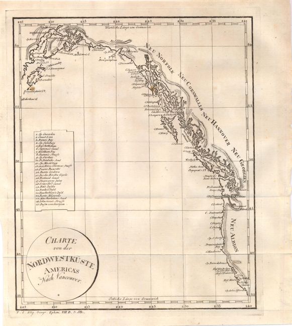
Auction 136, Lot 143
Subject: Western Canada & United States
Anon.
Charte von der Nordwestkuste Americas nach Vancouver, 1804
Size: 8.1 x 10 inches (20.6 x 25.4 cm)
Estimate: $150 - $180
Sold for: $230
Closed on 6/1/2011
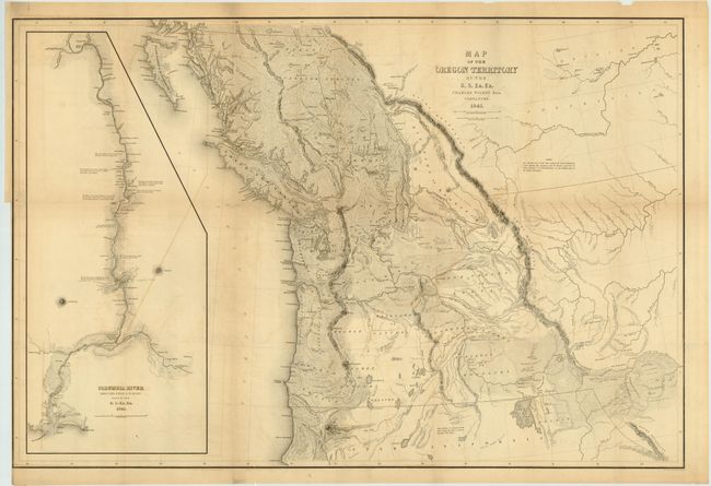
Auction 136, Lot 144
Subject: Western Canada & United States
Wilkes, Charles
Map of the Oregon Territory by the U.S. Ex. Ex., 1841
Size: 34.5 x 22.8 inches (87.6 x 57.9 cm)
Estimate: $1,500 - $2,000
Wilkes' Large-scale Exploring Expedition Map of the Northwest
Sold for: $1,000
Closed on 6/1/2011
Auction 136, Lot 145
Subject: Canada and Alaska
Russell, John C.
British Colonies in North America from the best authorities, 1810
Size: 9 x 7.6 inches (22.9 x 19.3 cm)
Estimate: $140 - $180
Sold for: $50
Closed on 6/1/2011
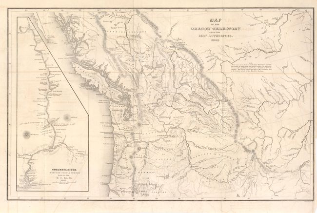
Auction 136, Lot 146
Subject: Northwestern Canada & United States
Wilkes, Charles
Map of the Oregon Territory from the Best Authorities, 1849
Size: 13.2 x 8.3 inches (33.5 x 21.1 cm)
Estimate: $140 - $220
Sold for: $70
Closed on 6/1/2011
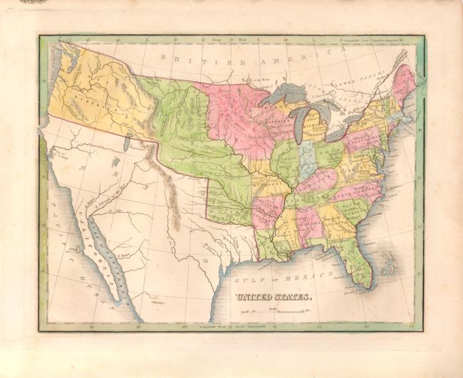
Auction 136, Lot 147
Subject: United States
Bradford, Thomas Gamaliel
United States, 1838
Size: 10 x 7.7 inches (25.4 x 19.6 cm)
Estimate: $90 - $120
Sold for: $100
Closed on 6/1/2011
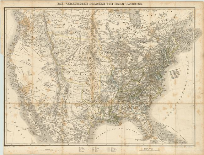
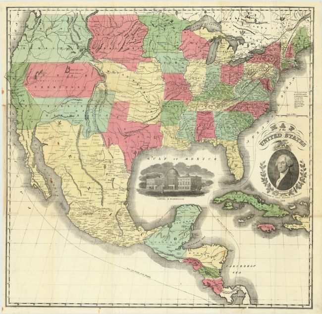
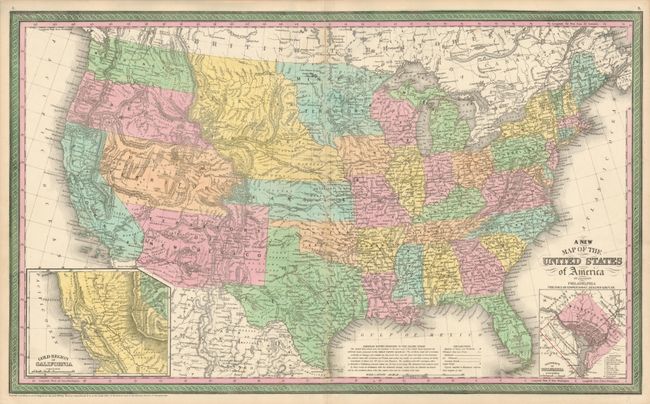
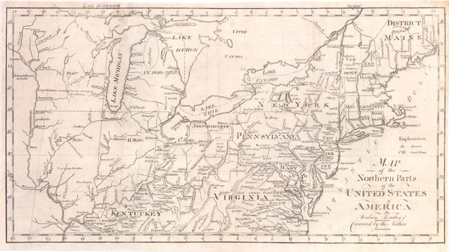
Auction 136, Lot 148
Subject: United States, Republic of Texas
Bromme, Traugott
Die Vereinigten Staaten von Nord-America, 1843
Size: 25.2 x 18.5 inches (64 x 47 cm)
Estimate: $1,000 - $1,600
Unsold
Closed on 6/1/2011
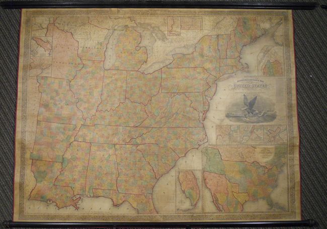
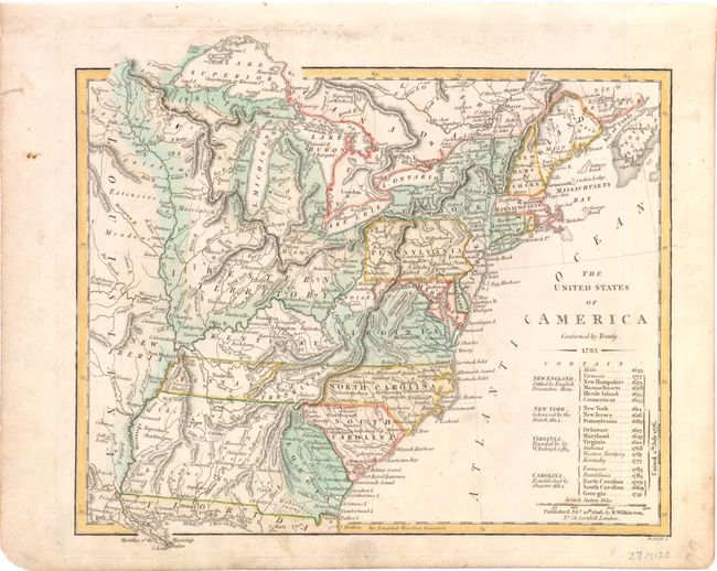
Auction 136, Lot 149
Subject: United States, Republic of Texas
Mitchell, Samuel Augustus
Mitchell's Reference & Distance Map of the United States, 1844
Size: 67 x 52.5 inches (170.2 x 133.4 cm)
Estimate: $8,000 - $10,000
Exceptional Wall Map Featuring the Independent Republic of Texas - 1844
Unsold
Closed on 6/1/2011
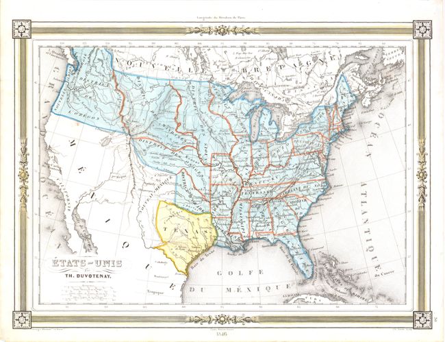
Auction 136, Lot 150
Subject: United States, Republic of Texas
Duvotenay, Thunot
Etats-Unis, 1846
Size: 12 x 8.8 inches (30.5 x 22.4 cm)
Estimate: $200 - $250
Sold for: $150
Closed on 6/1/2011
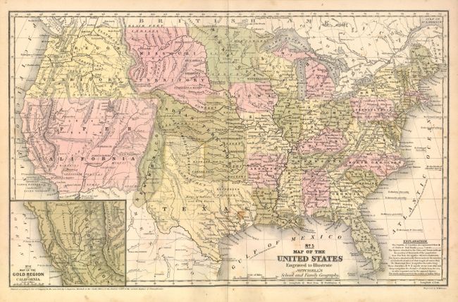
Auction 136, Lot 151
Subject: United States
Mitchell, Samuel Augustus
No. 5 Map of the United States Engraved to Illustrate Mitchell's School and Family Geography, 1849
Size: 16.7 x 10.5 inches (42.4 x 26.7 cm)
Estimate: $200 - $250
Sold for: $150
Closed on 6/1/2011
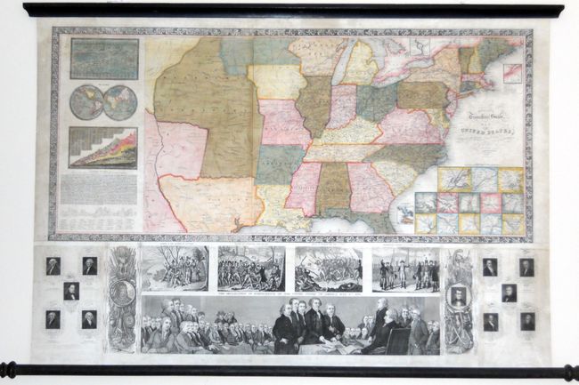
Auction 136, Lot 152
Subject: United States
Ensign, Thayer & Co.
Ensign's Travellers' Guide, and Map of the United States, Containing the Roads, Distances, Steam Boat and Canal Routes &c., 1848
Size: 39 x 26 inches (99.1 x 66 cm)
Estimate: $2,500 - $3,000
Flawless example of Ensign & Thayer's rare wall map
Sold for: $1,800
Closed on 6/1/2011
Auction 136, Lot 153
Subject: United States
Case, Tiffany & Company
Map of the United States, 1851
Size: 23.5 x 24 inches (59.7 x 61 cm)
Estimate: $700 - $900
Sold for: $650
Closed on 6/1/2011
Auction 136, Lot 154
Subject: United States
Swanston, George H.
United States North America, 1852-54
Size: 20.5 x 16 inches (52.1 x 40.6 cm)
Estimate: $200 - $250
Sold for: $120
Closed on 6/1/2011
Auction 136, Lot 155
Subject: United States
Thomas, Cowperthwait & Co.
A New Map of the United States of America by J.H. Young, 1854
Size: 26.3 x 15.8 inches (66.8 x 40.1 cm)
Estimate: $300 - $375
Sold for: $170
Closed on 6/1/2011
Auction 136, Lot 156
Subject: United States
Shaffner, Taliaferro Preston
United States, 1862
Size: 16.8 x 10.5 inches (42.7 x 26.7 cm)
Estimate: $200 - $250
Sold for: $160
Closed on 6/1/2011
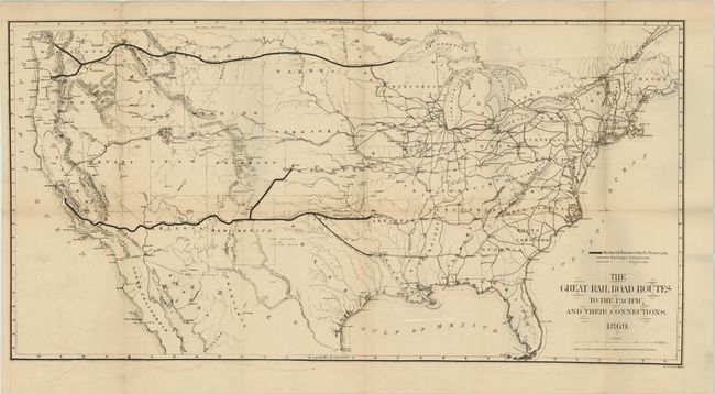
Auction 136, Lot 157
Subject: United States
Gorlinski, Joseph
The Great Railroad Routes to the Pacific, and Their Connections, 1869
Size: 27.5 x 14 inches (69.9 x 35.6 cm)
Estimate: $250 - $325
Sold for: $375
Closed on 6/1/2011
Auction 136, Lot 158
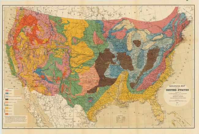
Subject: United States
Hitchcock, Charles Henry
Geological Map of the United States compiled by C.H. Hitchcock and W. P. Blake…, 1873
Size: 33.5 x 21.5 inches (85.1 x 54.6 cm)
Estimate: $250 - $350
Sold for: $500
Closed on 6/1/2011
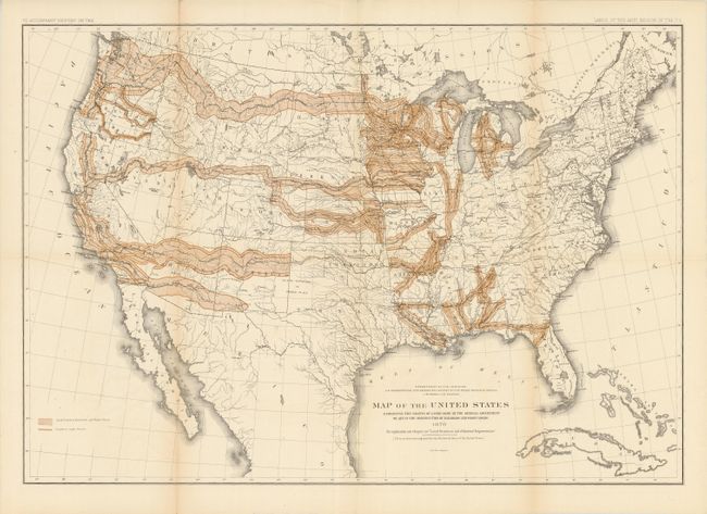
Auction 136, Lot 159
Subject: United States
Powell, John Wesley
Report on the Lands of the Arid Region of the United States, with a More Detailed Account of the Lands of Utah, 1879
Size: 9.5 x 12 inches (24.1 x 30.5 cm)
Estimate: $500 - $650
Sold for: $375
Closed on 6/1/2011
Auction 136, Lot 160
Subject: United States
U.S. Geological Survey (USGS)
[Lot of 2] Map of the United States Exhibiting the Present Status of Knowledge Relating to the Areal Distribution of Geologic Groups [and] Map of the United States Exhibiting the Progress Made in the Geographic Survey, 1884
Size: 28.2 x 17.3 inches (71.6 x 43.9 cm)
Estimate: $325 - $400
Sold for: $240
Closed on 6/1/2011
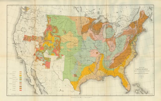
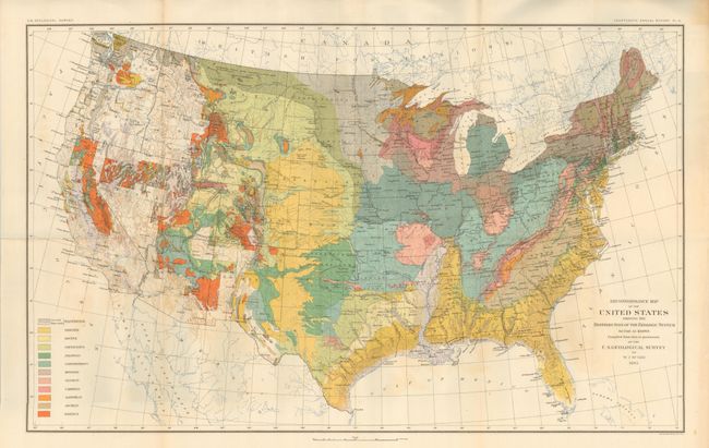
Auction 136, Lot 161
Subject: United States
Hitchcock, Charles Henry
Geological Map of the United States and Part of Canada Compiled by C.H. Hitchcock for the American Institute of Mining Engineers to Illustrate the Schemes of Coloration and Nomenclature Recommended by the International Geological Congress, 1886
Size: 27.8 x 17.3 inches (70.6 x 43.9 cm)
Estimate: $500 - $650
Sold for: $1,100
Closed on 6/1/2011
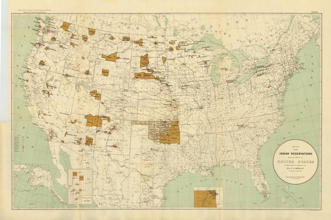
Auction 136, Lot 162
Subject: United States
U.S. Government
[Lot of 2] Map Showing Indian Reservations within the Limits of the United States ... [and] Map of Linguistic Stocks of American Indians chiefly within the Present Limits of the United States, 1890-1894
Size: See Description
Estimate: $250 - $350
Sold for: $250
Closed on 6/1/2011
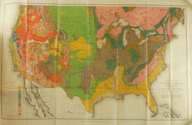
Auction 136, Lot 163
Subject: United States
U.S. Geological Survey (USGS)
Reconnaissance Map of the United States Showing the Distribution of the Geologic System So Far As Known, 1893
Size: 28.2 x 17.4 inches (71.6 x 44.2 cm)
Estimate: $275 - $350
Sold for: $200
Closed on 6/1/2011
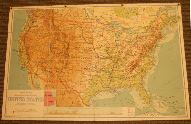
Auction 136, Lot 164
Subject: United States
Philip, George
Philips' Comparative Series of Large School Maps. United States, 1905
Size: 70 x 44.3 inches (177.8 x 112.5 cm)
Estimate: $240 - $300
Unsold
Closed on 6/1/2011
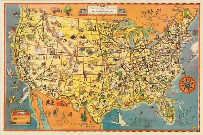
Auction 136, Lot 165
Subject: United States
A good-natured map of the United States setting forth the services of The Greyhound Lines and a few principle connecting bus lines, 1937
Size: 29.3 x 19.5 inches (74.4 x 49.5 cm)
Estimate: $140 - $200
Cartograph-style Map - Greyhound Bus Lines
Sold for: $220
Closed on 6/1/2011
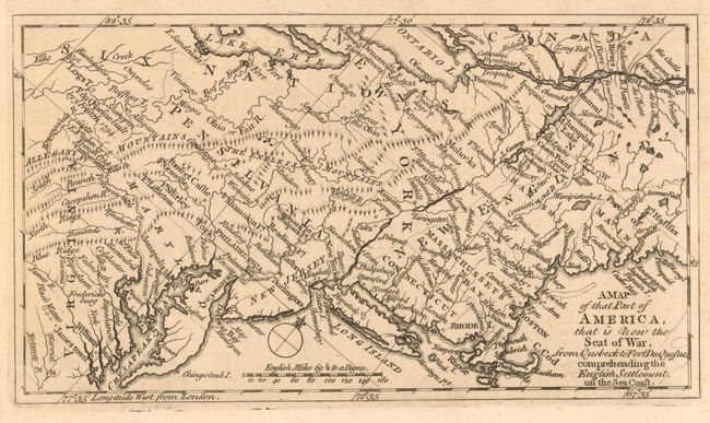
Auction 136, Lot 166
Subject: Colonial United States and Canada
Anon.
A Map of that Part of America, that is now the Seat of War, from Quebeck to Fort Duquesne, comprehending the English Settlement on the Sea Coast, 1758
Size: 7.5 x 4.3 inches (19.1 x 10.9 cm)
Estimate: $400 - $500
Sold for: $250
Closed on 6/1/2011
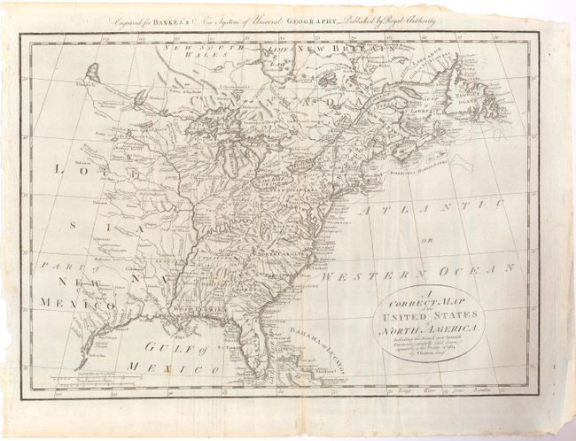
Auction 136, Lot 167
Subject: Eastern United States
Bowen, Thomas
A Correct Map of the United States of North America, Including the British and Spanish Territories, carefully laid down agreeable to the Treaty of 1784, 1787
Size: 17.5 x 12.5 inches (44.5 x 31.8 cm)
Estimate: $325 - $400
Sold for: $220
Closed on 6/1/2011
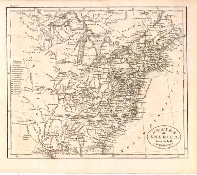
Auction 136, Lot 168
Subject: Eastern United States
Russell, John C.
States of America, from the best Authorities, 1795
Size: 9 x 7.5 inches (22.9 x 19.1 cm)
Estimate: $140 - $180
Sold for: $90
Closed on 6/1/2011
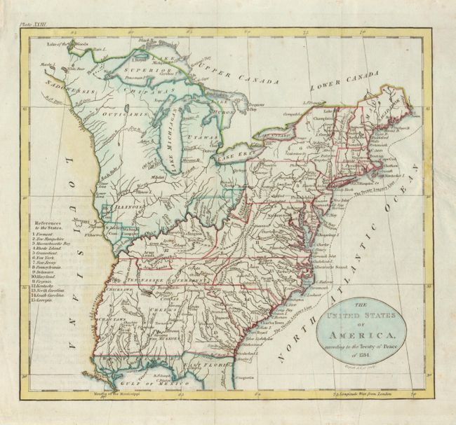
Auction 136, Lot 169
Subject: Eastern United States
Russell, John C.
The United States of America, according to the Treaty of Peace of 1784, 1795
Size: 8 x 7.3 inches (20.3 x 18.5 cm)
Estimate: $150 - $180
Sold for: $110
Closed on 6/1/2011
Auction 136, Lot 170
Subject: Eastern United States
Bradley, Abraham Jr.
[Lot of 2] Map of the Northern parts of the United States of America... [in set with] Map of the Southern parts of the United States of America…, 1802
Size: See Description
Estimate: $550 - $700
Sold for: $400
Closed on 6/1/2011
Auction 136, Lot 171
Subject: Eastern United States
Wilkinson, Robert
The United States of America Confirmed by Treaty 1783, 1806
Size: 11 x 9.3 inches (27.9 x 23.6 cm)
Estimate: $550 - $700
Early map of the United States featuring Franklinia and the Indiana Land Company
Sold for: $850
Closed on 6/1/2011
246 lots
Page 1 of 5