Subject: Canada and Alaska
Period: 1810 (circa)
Publication:
Color: Hand Color
Size:
9 x 7.6 inches
22.9 x 19.3 cm
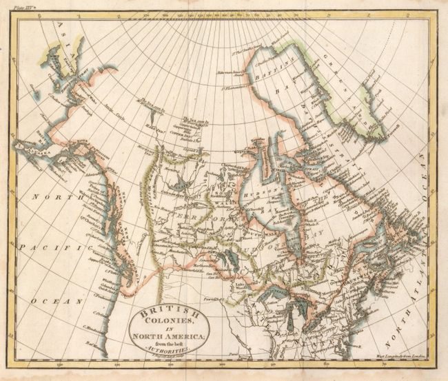
This very finely engraved map shows all of Canada and Alaska. The western reaches are blank but along the coast are labeled New Cornwall, New Hanover and New Georgia. In the far north of Yukon is the notation "The Sea seen by Mr. McKenzie in 1789" and further east another says "The Sea seen by Mr. Hearn in 1771." locates the Copper Indians and the Coppermine River. The entire northern coast is blank. The map hints at a Northwest Passage with a complex network of rivers, the key connection is delineated by dotted line. In Alaska the Aleutian chain is Alyaska and the chart locates Cook's River, Prince Williams Sound, Mt. Elias, Bristol Bay, and Norton Sound. Kodiak Island is I. Kichtac.
References:
Condition: A
A little light toning or water staining along lower margin, else fine.