Subject: United States
Period: 1884 (dated)
Publication: Fifth Annual Report of the United States Geological Survey…
Color: Printed Color
Size:
28.2 x 17.3 inches
71.6 x 43.9 cm
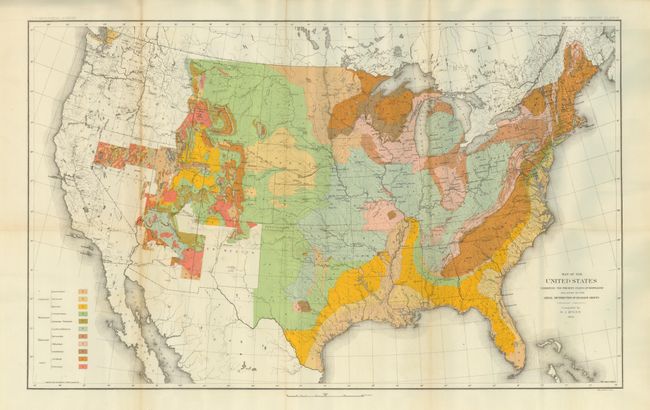
1) This is the first published geological map of the United States by the USGS. It is generally referred to as the McGee map after the compiler. The legend at lower left names and color codes twelve different geological formations. There is also very fine detail of hydrology. Vast areas of the western U.S. remain blank, reflecting the infancy and inadequacy of western geological explorations at the time, and coincidentally emphasizes the need for more congressional funding. The mapping of the King, Hayden, Powell and Wheeler surveys are evident in the West, but little else. This was the most up-to-date map at the time, but was soon superseded by Hitchock's 1886 map that augmented the western states' geological detail.
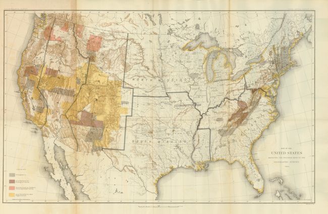
2) This map shows the progress of the United States geographic surveys. The primary focus is on the western states including Colorado, Utah, Nevada and California. The legend shows four different surveys: Triangulation, Area Surveyed by Geological Survey, Area Surveyed by Northern Transcontinental Survey, and Area Surveyed by other Organizations.
References:
Condition: A
Folding as issued with very faint fold toning, overall very good