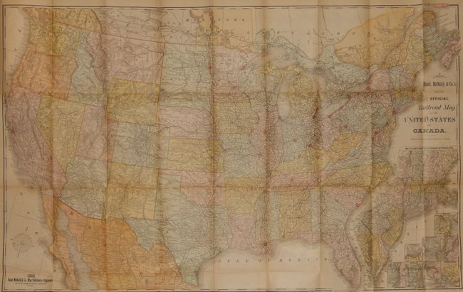
Subject: United States and Canada
Period: 1885 (dated)
Publication:
Color: Printed Color
Size:
42.5 x 26.8 inches
108 x 68.1 cm
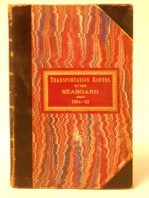
This very large, colorful folding map features terrific railroad detail along with wagon roads, watershed, cities and villages, and much more. While covering mainly the United States is shows the Canadian Pacific Railway through the southern part of Canada. It includes an inset, "Map of Atlantic Coast States Engraved on a Large Scale," plus individual city plans of Boston, Cincinnati, New York, Philadelphia, St. Louis, Chicago, Buffalo & Niagara Falls, and Washington. The map is attached at the rear of the original report: "Mr. Aldrich, from the Committee on Transportation Routes to the Seaboard…" The 43 pp. report is dated March 3, 1885 and contains extensive information on shipments in the Untied States to include all forms of commerce. Hardbound in original presentation marbled paper boards with quarter leather. Red leather label on cover with fancy tooling and gilt title. Rare to find this map with the Senate report. The Modelski reference is a similar map with nearly identical title, issued six years later.
References:
Condition: A
The map is fine except for a nearly invisible, small puncture in Indian Territory that is closed on the blank verso and clean tear in lower margin well away from map, closed on verso. The report and covers are also very good with only a small amount of wear at spine edge.