Catalog Archive
Auction 136, Lot 143

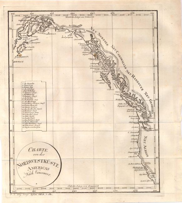
"Charte von der Nordwestkuste Americas nach Vancouver", Anon.

Subject: Western Canada & United States

Period: 1804 (circa)

Publication:

Color: Black & White

Size:
8.1 x 10 inches
20.6 x 25.4 cm
Download High Resolution Image
(or just click on image to launch the Zoom viewer)

Nice map of the Pacific coast stretching from present-day San Francisco north to Anchorage, Alaska. There is extensive detail of the coastline naming Vancouver Island, Prince William Sound and Kodiak Island. There is also a numbered key to the left of the image naming 24 different points of interest. Published by Weimar Geographisches Institut.

References:

Condition: B+

Fine impression. There is faint toning and a few minor spots, else very good. Issued folded.

Estimate: $150 - $180

Sold for: $230

Closed on 6/1/2011

Archived