Subject: United States
Period: 1879 (dated)
Publication:
Color: Printed Color
Size:
9.5 x 12 inches
24.1 x 30.5 cm
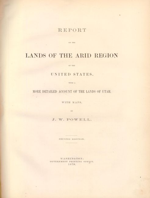
This is the Second House of Representatives Edition wherein the authors "were thus given the opportunity to revise their text and eliminate a few formal errors…The substance of the report is unchanged." In the report Powell draws on his extensive knowledge of the West to present the case that contemporary land laws were destructive to the land. With the election of reform-minded President Hayes, Powell seized the opportunity to present his ideas to change existing land laws and settlement policies to protect the lands of the West. Powell's report was initially met with extreme skepticism, but his ideas were vindicated by the Dust Bowl years of the 1930s and many of his revolutionary principles were then enacted. This is a complete example of an important and historical work that includes the three folding maps in a pocket inside back cover. Quarto, original brown cloth, 195 pp. with 2 full-page maps and 3 large color folding maps.
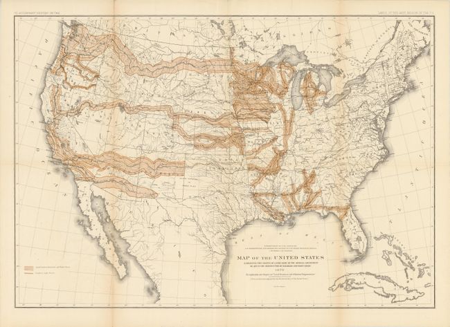
Map of the United States Exhibiting the Grants of Lands Made by the General Government to aid in the Construction of Railroads and Wagon Roads, by U.S. Department of Interior, (28.3 x 19.6"). The largest land give-away ever, Public Domain Land was granted by Congress to 19th century railroad companies to pay for construction of the railroad lines. Most - but by no means all - grants were west of the Mississippi River and ultimately totaled more than 174 million acres. This map, published while John Wesley Powell was in charge of the department, shows the grant areas within the United States. Vast swaths are colored, including virtually the entire state of Iowa. A finely rendered map with lithography by Julius Bien. A historical and desirable railroad map that may have been the source for a map used in an 1884 campaign poster by Democrats claiming a giveaway of public lands to special interests.
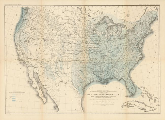
Rain Chart of the United States Showing by Isohyetal Lines the Distribution of the Mean Annual Precipitation in Rain and Melted Snow, by U.S. Department of Interior, (28.3 x 24.3"). Ref: Wheat (TMW) #1290. This fine thematic map is a copy of the chart constructed for the Smithsonian Institution in 1868 by Charles A. Schottt. Wheat says "that such maps could now be constructed demonstrates the quantity of observational data American scientists had amassed, as well as the effective aid maps could render in the presentation of such data." The legend shows via pattern and color different annual rain falls. Lithographed by the firm of Julius Bien.
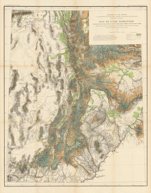
Map of Utah Territory Representing the Extent of the Irrigable, Timber and Pasture Lands, by U.S. Department of Interior, (28.6 x 36"). A colorful, graphic map that shows the populated regions of the territory; leaving off the arid portion west of the Great Salt Lake and the region south of the Colorado River. The map represents the extent of farm, lumber and pasture lands within the territory. It also details railroads, wagon roads, trails, telegraph lines, towns, forts, and county seats, plus topographic features and hydrography. Elevation information is given through finely done hachure. The map was compiled from several earlier important surveys including those of Wheeler, King, and Hayden. Ref: Moffat #151; Wheat #1290.
References:
Condition: A
Binding is tight but has light shelf wear and the spine is sunned. Contents are clean and tight. The three maps are all very good with just a few fold intersection splits and a faint hint of toning at some folds. Small ex-libris stamps on versos.