Subject: Canada & United States
Period: 1832 (dated)
Publication:
Color: Hand Color
Size:
21.2 x 15.4 inches
53.8 x 39.1 cm
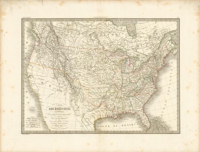
This is a map covering both the United States and Canada; the western parts of which are largely still the domain of several Indian nations. The United States' claims in the Pacific Northwest are shown with the District de la Columbia extending well into present-day British Columbia. The cartography in the west is primarily taken from the explorations of Lewis and Clark. The Missouri territory occupies all of the Midwest. Two large lakes in today's Utah drain via rivers to the Pacific, as defined by dotted lines. The Colorado River ends in the desert east of San Diego. This interesting map was published by Colonel Pierre Lapie (1777-1850) and his son Alexandre Emile, who was the Royal Geographer to the King in Paris. The map was engraved by Lallemand. Lapie's embossed atlas stamp is to the right of the title in an unengraved area of the map.
References:
Condition: B+
Minor toning and foxing in the margin. Small tear in the upper margin which would be easily repaired.