Catalog Archive
Auction 136, Lot 132

"Carte Nouvelle des Possessions Angloises en Amerique Dressee pour l'Intelligence de la Guerre Presente et Divisee Suivant les Pretentions des Anglois…", Moithey, Maurille Antoine

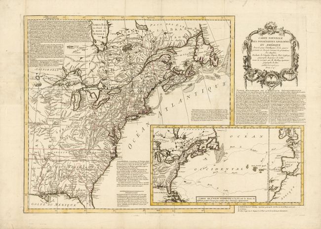
Subject: Colonial United States and Canada

Period: 1777 (dated)

Publication:

Color: Hand Color

Size:
27.2 x 19.2 inches
69.1 x 48.8 cm
Download High Resolution Image
(or just click on image to launch the Zoom viewer)

This scarce Revolutionary War map of the British Colonies was intended to provide the French public with geographical and historical information on the war in which they were involved. The map is filled with historical, topographical and military notes on the area. A large inset map titled Carte de l'Ocean Occidental shows the various Atlantic Trading Routes from France and Spain to the new world from Brest, Nantes, Rochefort, Lisbon and Cadiz. The map also features details regarding Indian territories and Colonial settlements, as well as a decorative cartouche. The map credits Thomas Jefferys, geographer to the Prince of Wales.

References: Sellers and Van Ee #155; McCorkle #777.10

Condition: B+

Issued folding, but now pressed, with expert paper restoration at fold intersections with 1" of neatline at left in skilled facsimile.

Estimate: $2,400 - $3,000

Sold for: $1,500

Closed on 6/1/2011

Archived