Subject: United States
Period: 1854 (circa)
Publication: Mitchell's New Universal Atlas
Color: Hand Color
Size:
26.3 x 15.8 inches
66.8 x 40.1 cm
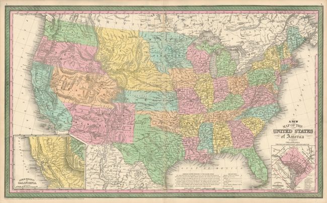
This outstanding map of the United States illustrates early western territorial development. The newly created Kansas Territory was carved out of the northern part of what had been set aside for Indian Territory. Washington and Oregon both extend eastward to the Rocky Mountains and the Continental Divide. Utah and New Mexico are both shown in their largest configurations, with New Mexico occupying the entire Southwest. Minnesota Territory stretches to the Missouri River, which it shares as a boundary with a huge Nebraska Territory. The map is filled with forts, Indian tribes, emigrant roads, early railways, mines and battlefields. Several exploration routes are shown including those of Fremont, Marcy, and Kearney. Fremont Basin in Utah Territory is bounded by great dividing ridges separating the waters of the Pacific Ocean and the waters of the Great Basin. In the lower corners of the map are insets of the Gold Region of California and the District of Columbia. Dated 1850 but published circa 1854.
References: cf Wheat [TMW] #685.
Condition: A
Minor toning in the fold, else fine.