Filtered by Category:United States(Show All Categories)
Showing results for:Auction 125
Catalog Archive
215 lots
Page 1 of 5
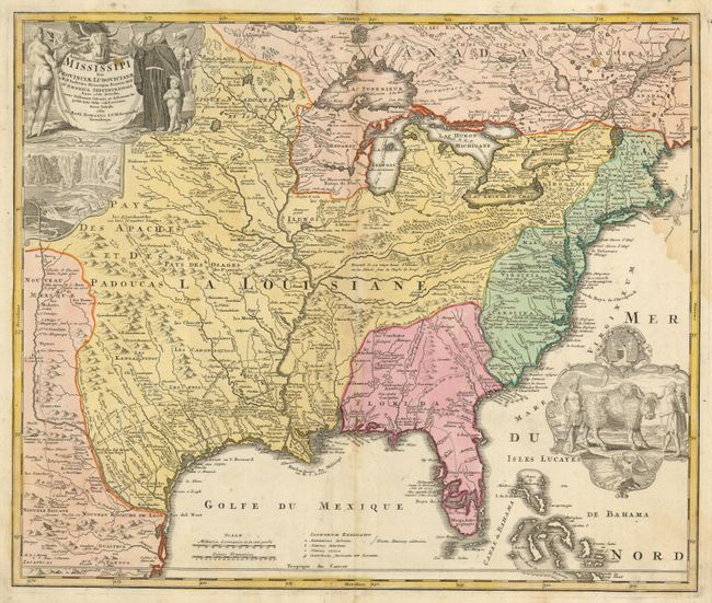
Auction 125, Lot 114
Subject: Colonial North America
Homann, Johann Baptist
Amplissimae Regionis Mississipi Seu Provinciae Ludovicianae…, 1730
Size: 22.8 x 19.3 inches (57.9 x 49 cm)
Estimate: $1,700 - $2,000
Sold for: $1,300
Closed on 9/24/2008
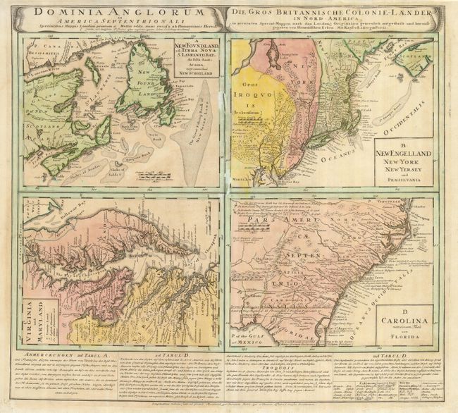
Auction 125, Lot 116
Subject: Colonial United States and Canada
Homann Heirs
Dominia Anglorum in America Septentrionali, 1740
Size: 21.8 x 19.8 inches (55.4 x 50.3 cm)
Estimate: $550 - $650
Unsold
Closed on 9/24/2008
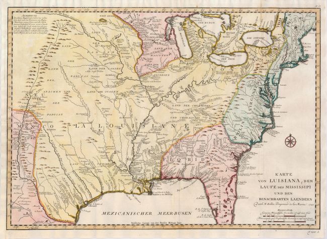
Auction 125, Lot 117
Subject: Colonial Louisiana
Bellin, Jacques Nicolas
Karte von Luisiana, dem Laufe des Mississipi und den Benachbarten Laendern…, 1744
Size: 22 x 15.5 inches (55.9 x 39.4 cm)
Estimate: $1,000 - $1,200
Sold for: $750
Closed on 9/24/2008
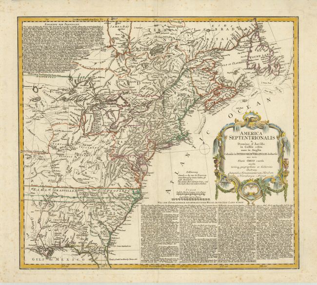
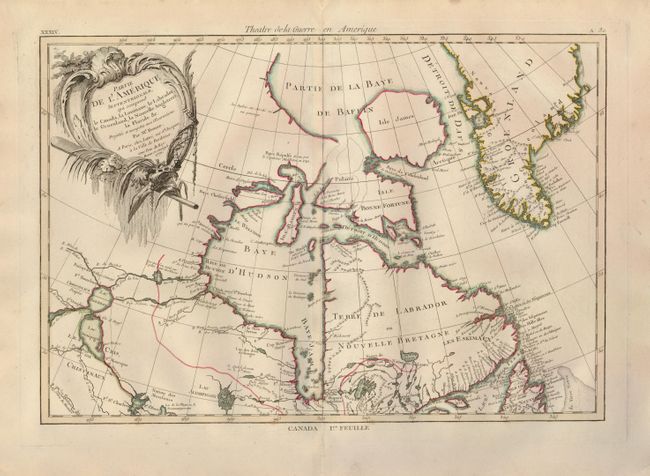
Auction 125, Lot 119
Subject: Colonial North America
Homann Heirs
America Septentrionalis a Domino d'Anville in Galliis edita nunc in Anglia Coloniis in Interiorem Virginiam deductis nec non Fluvii Ohio cursu…, 1756
Size: 20 x 18 inches (50.8 x 45.7 cm)
Estimate: $500 - $600
Sold for: $475
Closed on 9/24/2008
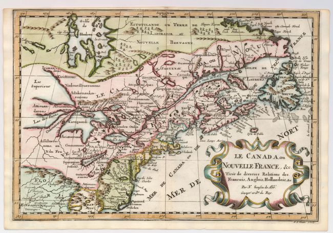
Auction 125, Lot 128
Subject: Colonial United States and Canada - Great Lakes
Sanson, Nicolas
Le Canada, ou Nouvelle France, &c. Tiree de diverses Relations des Francois, Anglois, Hollandois, &c., 1700
Size: 12 x 8.2 inches (30.5 x 20.8 cm)
Estimate: $850 - $950
Sold for: $900
Closed on 9/24/2008
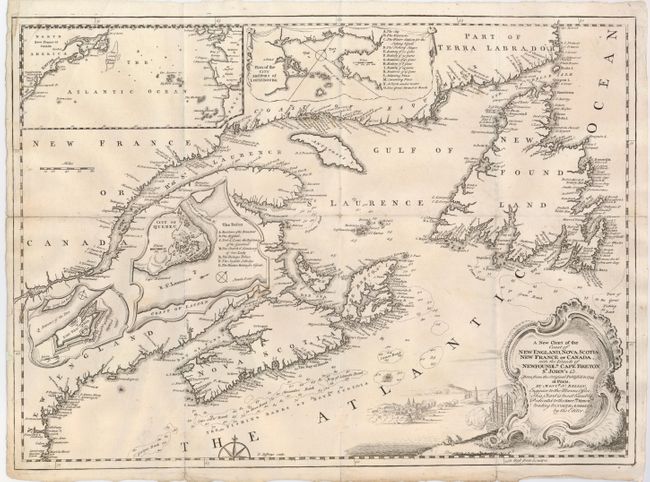
Auction 125, Lot 129
Subject: Colonial United States and Canada
Jefferys, Thomas
A New Chart of the Coast of New England, Nova Scotia, New France or Canada, with the Islands of Newfoundld. Cape Breton St. John's &c…, 1746
Size: 18.5 x 13.5 inches (47 x 34.3 cm)
Estimate: $250 - $300
Sold for: $275
Closed on 9/24/2008
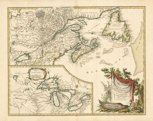
Auction 125, Lot 130
Subject: Colonial United States and Canada - Great Lakes
Robert de Vaugondy, Didier
Partie de l'Amerique Septent? qui comprend la Nouvelle France ou le Canada, 1755
Size: 23.7 x 19 inches (60.2 x 48.3 cm)
Estimate: $850 - $1,000
Sold for: $800
Closed on 9/24/2008
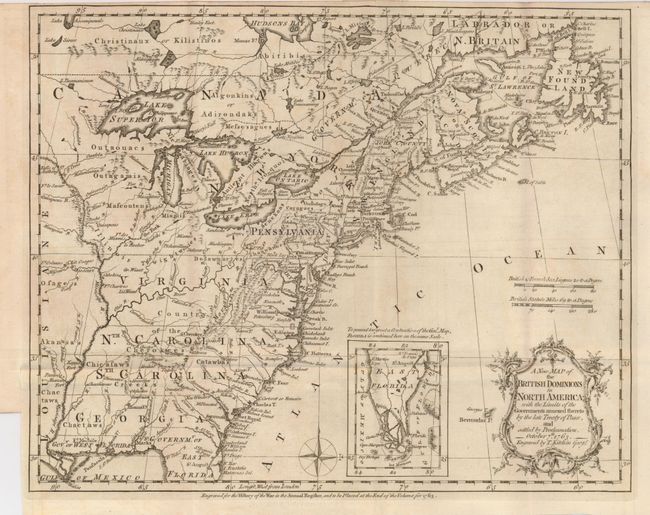
Auction 125, Lot 131
Subject: Colonial United States and Canada
Kitchin, Thomas
A New Map of the British Dominions in North America; with the Limits of the Governments Annexed thereto by the Late Treaty of Peace, and Settled by Proclamation, October 7th, 1763, 1763
Size: 11.8 x 9.4 inches (30 x 23.9 cm)
Estimate: $400 - $500
Sold for: $375
Closed on 9/24/2008
Auction 125, Lot 132
Subject: Colonial United States and Canada
Bonne/Lattre
[2 sheets] Partie de l'Amerique Septentrionale, qui comprend le Canada, la Louisiane, le Labrador, le Groenland, la Nouvelle Angleterre, la Florida &c., 1776
Size: 17.2 x 11.6 inches (43.7 x 29.5 cm)
Estimate: $600 - $750
Sold for: $425
Closed on 9/24/2008
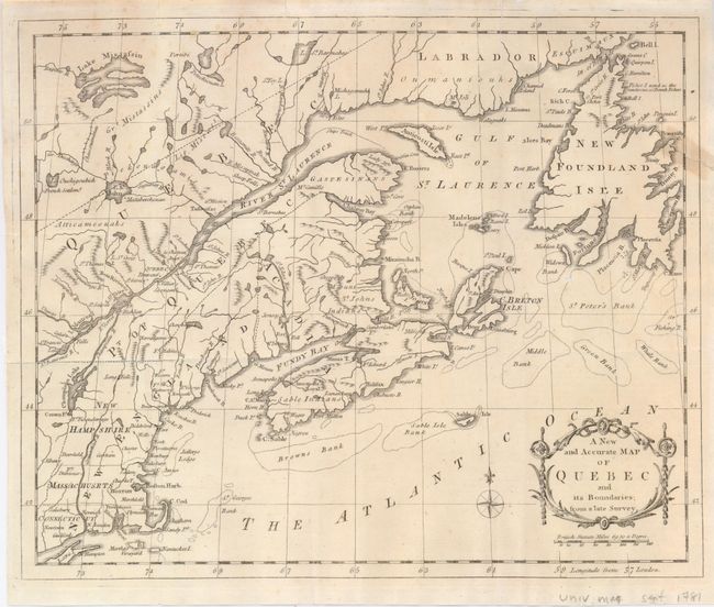
Auction 125, Lot 133
Subject: Canada & United States
Anon.
A New and Accurate Map of Quebec and its Boundaries; from a Late Survey, 1781
Size: 12.5 x 10.5 inches (31.8 x 26.7 cm)
Estimate: $150 - $200
Sold for: $75
Closed on 9/24/2008
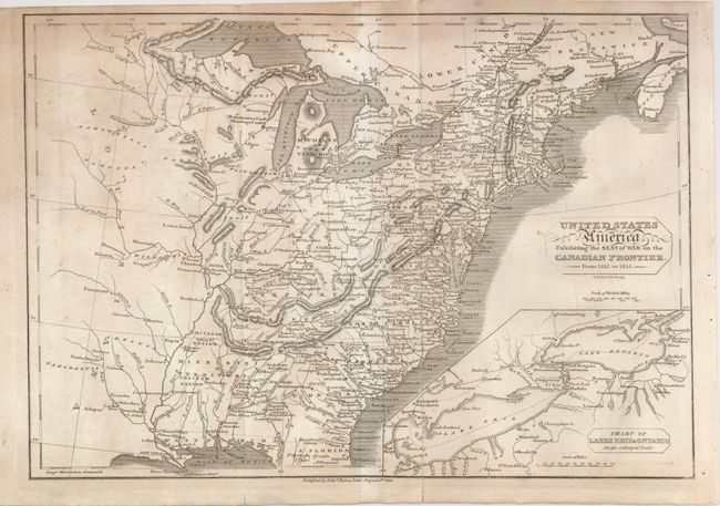
Auction 125, Lot 134
Subject: Canada & United States
Baines, Edward
United States of America, Exhibiting the Seat of War on the Canadian Frontier from 1812 to 1815, 1816
Size: 13.5 x 9.5 inches (34.3 x 24.1 cm)
Estimate: $110 - $150
Sold for: $210
Closed on 9/24/2008
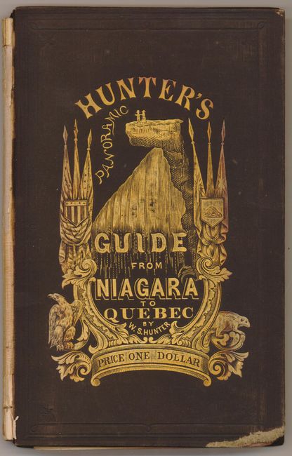
Auction 125, Lot 135
Subject: Canada & United States
Waud, Alfred R.
Hunter's Panoramic Guide from Niagara to Quebec, 1857
Size: 6 x 132 inches (15.2 x 335.3 cm)
Estimate: $200 - $250
Sold for: $220
Closed on 9/24/2008
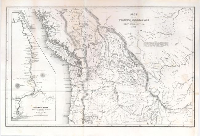
Auction 125, Lot 136
Subject: Northwestern United States and Canada
Wilkes, Charles
Map of the Oregon Territory from the Best Authorities, 1849
Size: 13 x 8 inches (33 x 20.3 cm)
Estimate: $200 - $250
Sold for: $150
Closed on 9/24/2008
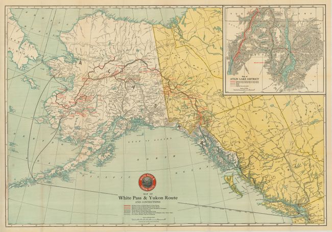
Auction 125, Lot 137
Subject: Alaska & Western Canada
Various
[Lot of 4 - Alaska, Western Canada], 1915-17
Size: See Description
Estimate: $100 - $150
Sold for: $160
Closed on 9/24/2008
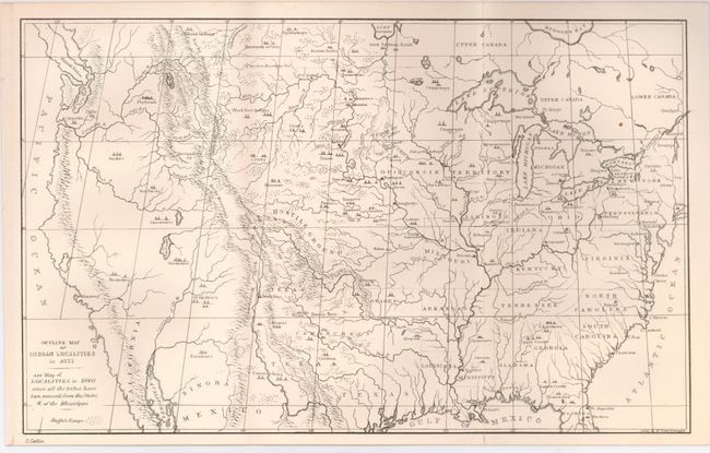
Auction 125, Lot 138
Subject: United States
U.S. Government
[Lot of 4 - Indian Reservations], 1833-1899
Size: See Description
Estimate: $150 - $250
Sold for: $375
Closed on 9/24/2008
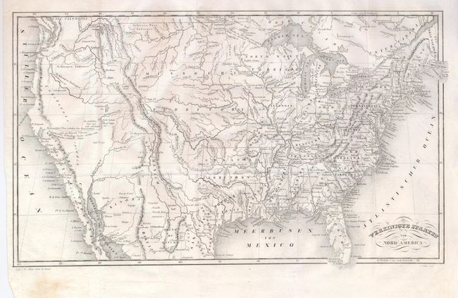
Auction 125, Lot 139
Subject: United States
Vereinigte Staaten von Nord America, 1835
Size: 13.3 x 9.5 inches (33.8 x 24.1 cm)
Estimate: $250 - $350
Unsold
Closed on 9/24/2008
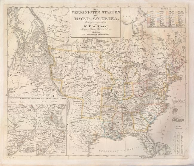
Auction 125, Lot 140
Subject: United States
Streit, Friedrich Wilhelm
Die Vereinigten Staaten von Nord-Amerika, 1841
Size: 18.5 x 15.5 inches (47 x 39.4 cm)
Estimate: $230 - $300
Unsold
Closed on 9/24/2008
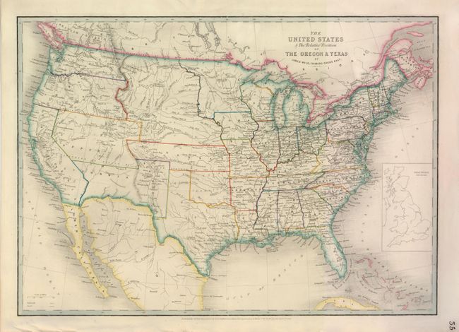
Auction 125, Lot 141
Subject: United States
Wyld, James
The United States & the Relative Position of the Oregon & Texas, 1854
Size: 21 x 15 inches (53.3 x 38.1 cm)
Estimate: $325 - $400
Sold for: $240
Closed on 9/24/2008
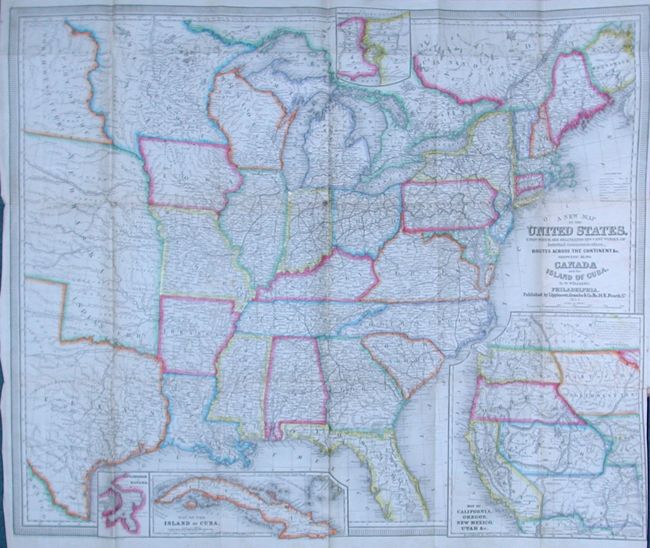
Auction 125, Lot 142
Subject: United States
Williams, Wellington
A New Map of the United States, Upon Which Are Delineated its Vast Works of Internal Communication, Routes Across the Continent &c. Showing Also Canada and the Island of Cuba, 1854
Size: 28.8 x 24.5 inches (73.2 x 62.2 cm)
Estimate: $450 - $550
Sold for: $300
Closed on 9/24/2008
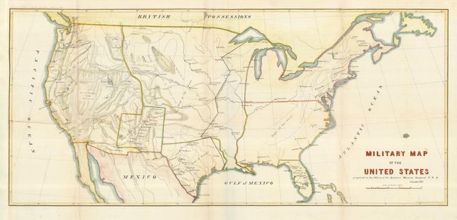
Auction 125, Lot 143
Subject: United States
U.S. War Department
Military Map of the United States…, 1857
Size: 29.3 x 13.5 inches (74.4 x 34.3 cm)
Estimate: $150 - $200
Sold for: $130
Closed on 9/24/2008
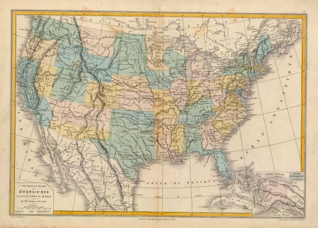
Auction 125, Lot 144
Subject: United States
Drioux & Leroy
Carte Physique et Politique des Etats-Unis Canada et Partie du Mexique, 1867
Size: 16.7 x 11.5 inches (42.4 x 29.2 cm)
Estimate: $100 - $140
Unsold
Closed on 9/24/2008
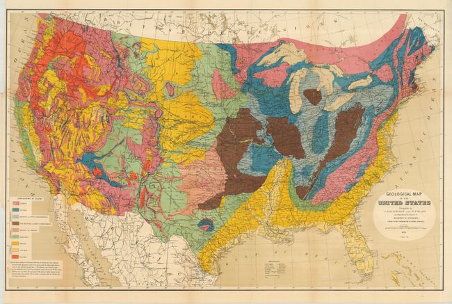
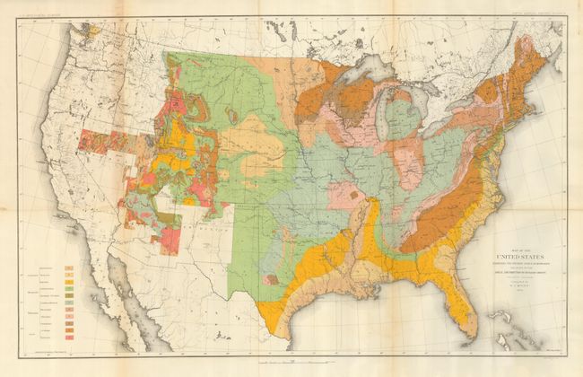
Auction 125, Lot 145
Subject: United States
Hitchcock, Charles Henry
Geological Map of the United States compiled by C.H. Hitchcock and W. P. Blake…, 1873
Size: 33.5 x 21.5 inches (85.1 x 54.6 cm)
Estimate: $250 - $350
Sold for: $220
Closed on 9/24/2008
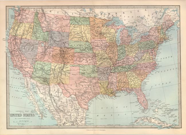
Auction 125, Lot 146
Subject: United States
Bartholomew, John
General Map of the United States, 1877
Size: 16 x 11 inches (40.6 x 27.9 cm)
Estimate: $400 - $600
Sold for: $300
Closed on 9/24/2008
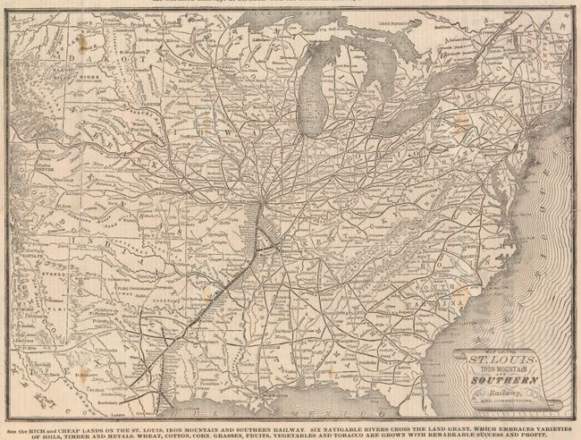
Auction 125, Lot 147
Subject: Central United States - Railroad
Railroad Companies, (Various)
Map of the St. Louis, Iron Mountain and Southern Railway, and Connections, 1878
Size: 14 x 12 inches (35.6 x 30.5 cm)
Estimate: $150 - $200
Sold for: $100
Closed on 9/24/2008
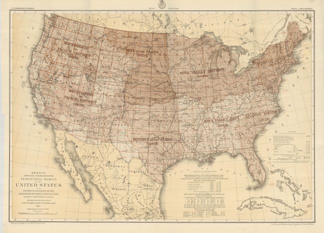
Auction 125, Lot 148
Subject: United States
Wheeler, George (Lt)
Sketch Indicating a Distribution of the Territorial Domain of the United States into Districts Favorable to the Operations of Parties Prosecuting General Government Surveys…, 1879
Size: 28 x 20 inches (71.1 x 50.8 cm)
Estimate: $150 - $200
Sold for: $100
Closed on 9/24/2008
Auction 125, Lot 149
Subject: United States
U.S. Geological Survey (USGS)
Map of the United States Exhibiting the Present Status of Knowledge Relating to the Areal Distribution of Geologic Groups, 1884
Size: 28 x 17.3 inches (71.1 x 43.9 cm)
Estimate: $140 - $180
Sold for: $220
Closed on 9/24/2008
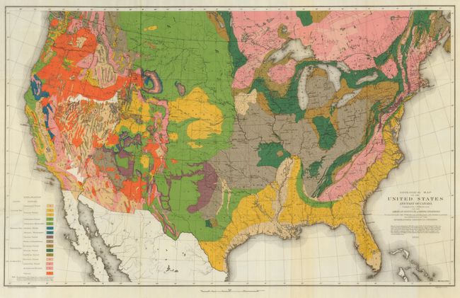
Auction 125, Lot 150
Subject: United States
Hitchcock, Charles Henry
Geological Map of the United States and Part of Canada Compiled by C.H. Hitchcock for the American Institute of Mining Engineers to Illustrate the Schemes of Coloration and Nomenclature Recommended by the International Geological Congress, 1886
Size: 27.8 x 17.3 inches (70.6 x 43.9 cm)
Estimate: $150 - $200
Sold for: $275
Closed on 9/24/2008
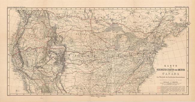
Auction 125, Lot 151
Subject: United States
Petermann, Augustus Herman
[Lot of 2] Karte der Vereinigten Staaten von Amerika und von Canada [and] Landwirtschafts-Karte der Vereinigten Staaten von Canada, 1886
Size: See Description
Estimate: $140 - $160
Unsold
Closed on 9/24/2008
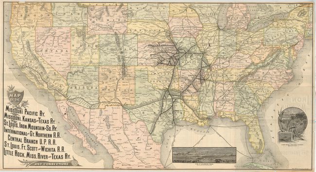
Auction 125, Lot 152
Subject: United States
Rand McNally & Co.
Map of the Missouri Pacific Ry, Missouri, Kansas and Texas Ry. St Louis, Iron Mountain and So. Ry. International and Gt. Northern R.R. Central Branch U.P.R.R. St. Louis, Ft. Scott and Wichita R.R. Little Rock, Miss. River and Texas Ry. And Connections., 1887
Size: 30.8 x 16.8 inches (78.2 x 42.7 cm)
Estimate: $140 - $180
Sold for: $325
Closed on 9/24/2008
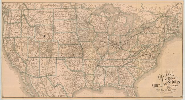
Auction 125, Lot 154
Subject: United States
Poole Bros.
Map of the Cleveland, Cincinnati, Chicago and St. Louis Railway. Big Four Route and Connections, 1890
Size: 30.5 x 16 inches (77.5 x 40.6 cm)
Estimate: $100 - $120
Sold for: $120
Closed on 9/24/2008
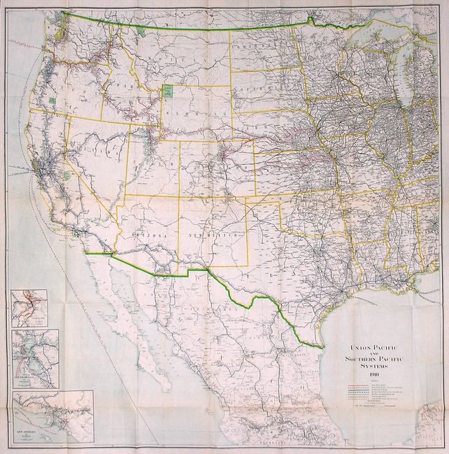
Auction 125, Lot 155
Subject: Central and Western United States
Railroad Companies, (Various)
Union Pacific and Southern Pacific Systems, 1910
Size: 43.6 x 43.5 inches (110.7 x 110.5 cm)
Estimate: $200 - $250
Unsold
Closed on 9/24/2008
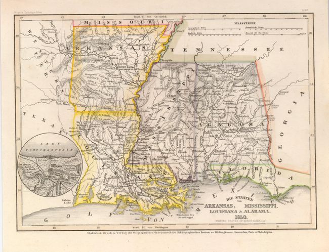
Auction 125, Lot 156
Subject: United States
Geographisches Institut
[Lot of 3] Die Staaten von Arkansas, Mississippi, Louisiana & Alabama [with] Die Staaten von Missouri Illinois, Indiana, Ohio, Kentucky & Tennessee [and] Die Staaten von Maine, New Hampshire, Massachusetts, Vermont, Connecticut & Rhode I., 1850
Size: 8 x 10.3 inches (20.3 x 26.2 cm)
Estimate: $150 - $200
Sold for: $110
Closed on 9/24/2008
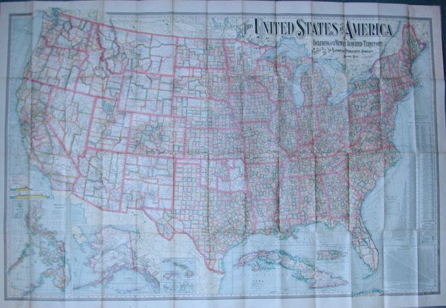
Auction 125, Lot 157
Subject: United States
[Lot of 2] United States of America Including Its Newly Acquired Territory [and] Official Map of the United States, 1902-1916
Size: See Description
Estimate: $180 - $200
Sold for: $130
Closed on 9/24/2008
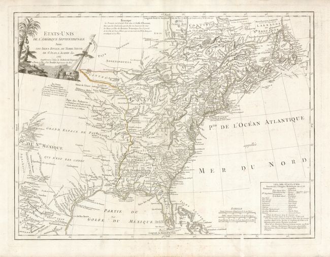
Auction 125, Lot 158
Subject: Eastern United States
Robert de Vaugondy/Boudet
Etats-Unis de l'Amerique Septentrionale avec les Isles Royale, de Terre Neuve, de St. Jean, l'Acadie &c., 1785
Size: 25 x 19 inches (63.5 x 48.3 cm)
Estimate: $900 - $1,200
Unsold
Closed on 9/24/2008
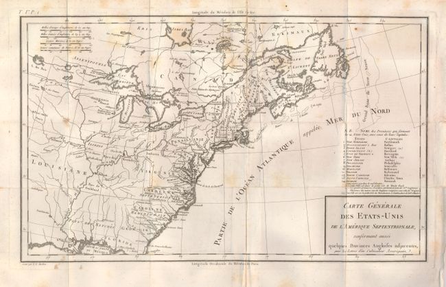
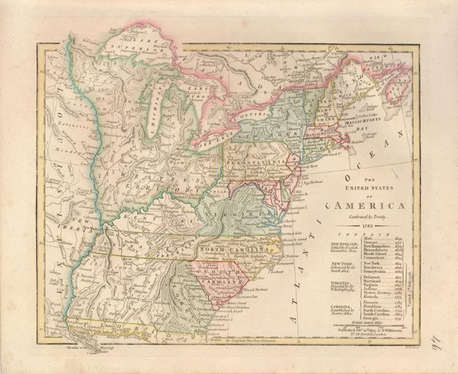
Auction 125, Lot 159
Subject: Eastern United States
Tardieu, Pierre Francois
Carte Generale des Etats-Unis de l'Amerique Septentrionale, Renfermant Aussi quelques Provinces Angloises adjacentes…, 1787
Size: 16.3 x 9.8 inches (41.4 x 24.9 cm)
Estimate: $400 - $500
Sold for: $200
Closed on 9/24/2008
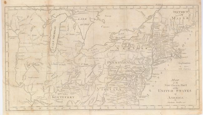
Auction 125, Lot 160
Subject: Eastern United States
Bradley, Abraham Jr.
Map of the Northern Part of the United States of America, 1797
Size: 15.8 x 8.5 inches (40.1 x 21.6 cm)
Estimate: $220 - $275
Sold for: $160
Closed on 9/24/2008
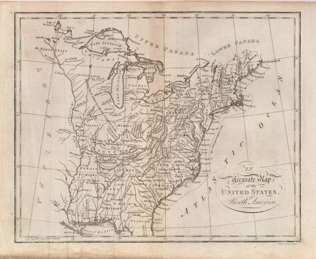
Auction 125, Lot 161
Subject: Eastern United States
[Lot of 2] An Accurate Map of the United States of North America [and] Etats Unis par Arrowsmith, 1800
Size: See Description
Estimate: $180 - $220
Sold for: $120
Closed on 9/24/2008
Auction 125, Lot 162
Subject: Eastern United States
Wilkinson, Robert
The United States of America Confirmed by Treaty 1783, 1812
Size: 11 x 9.3 inches (27.9 x 23.6 cm)
Estimate: $600 - $700
Sold for: $450
Closed on 9/24/2008
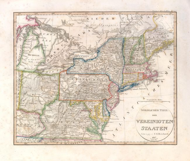
Auction 125, Lot 163
Subject: Eastern United States
Reichard, Christian Gottlieb Theoph
Nordlicher Theil der Vereinigten Staaten, 1824
Size: 13.3 x 11 inches (33.8 x 27.9 cm)
Estimate: $220 - $300
Sold for: $120
Closed on 9/24/2008
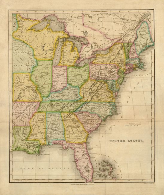
Auction 125, Lot 164
Subject: Eastern United States
Macredie, Alexander
United States, 1826
Size: 17 x 20.3 inches (43.2 x 51.6 cm)
Estimate: $230 - $300
Sold for: $170
Closed on 9/24/2008
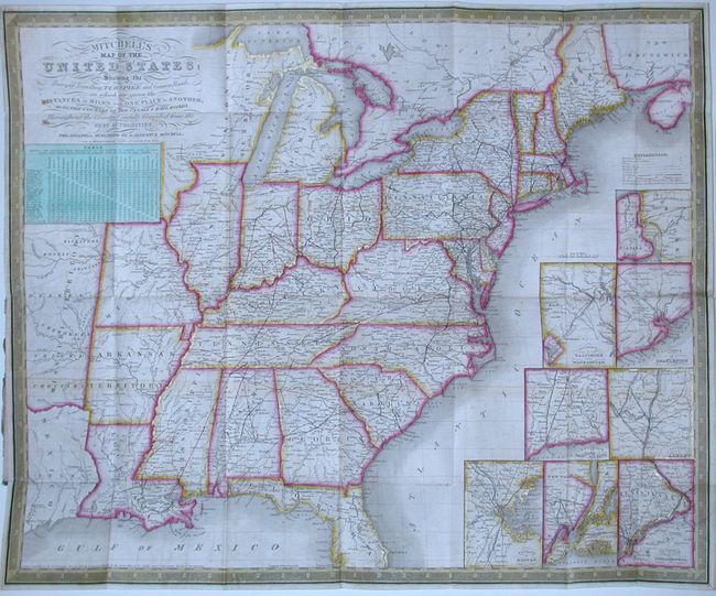
Auction 125, Lot 165
Subject: Eastern United States
Mitchell, Samuel Augustus
Mitchell's Map of the United States; Showing the Principal Traveling, Turnpike and Common Roads…Throughout the Country, Carefully Compiled from the Best Authorities, 1835
Size: 22 x 18.5 inches (55.9 x 47 cm)
Estimate: $750 - $850
Sold for: $650
Closed on 9/24/2008
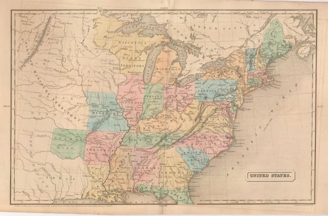
Auction 125, Lot 166
Subject: Eastern United States
Potter & Wilson
United States, 1838
Size: 16.3 x 10.4 inches (41.4 x 26.4 cm)
Estimate: $100 - $140
Sold for: $65
Closed on 9/24/2008
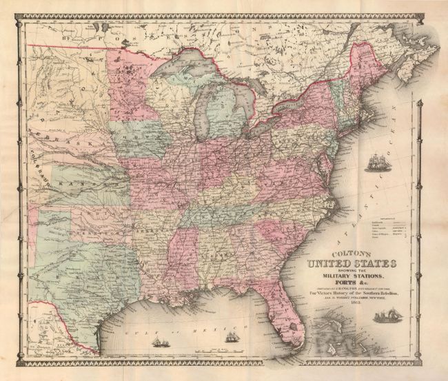
Auction 125, Lot 167
Subject: Eastern United States
Colton, Joseph Hutchins
Colton's United States Showing the Military Stations, Forts &c., 1862
Size: 16.5 x 14.5 inches (41.9 x 36.8 cm)
Estimate: $250 - $350
Sold for: $180
Closed on 9/24/2008
Auction 125, Lot 168
Subject: Eastern United States, Civil War
Ettinger, C.W.
United States of North America (Eastern & Central), 1863
Size: 25 x 17 inches (63.5 x 43.2 cm)
Estimate: $140 - $180
Unsold
Closed on 9/24/2008
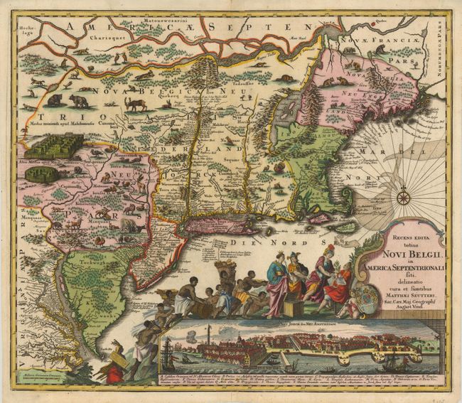
Auction 125, Lot 169
Subject: Colonial New England
Seutter, Matthias
Recens Edita totius Novi Belgii, in America Septentrionali siti, delineatio cura et Sumtibus, 1735
Size: 22.6 x 19.6 inches (57.4 x 49.8 cm)
Estimate: $4,000 - $4,500
Sold for: $4,250
Closed on 9/24/2008
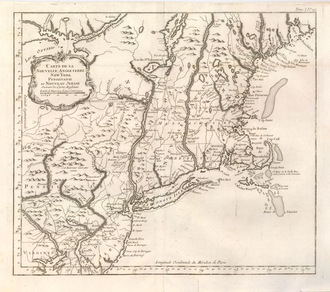
Auction 125, Lot 170
Subject: Colonial New England and Mid-Atlantic
Bellin, Jacques Nicolas
Carte de la Nouvelle Angleterre New York Pensilvanie et Nouveau Jersay…, 1764
Size: 14.5 x 12.6 inches (36.8 x 32 cm)
Estimate: $600 - $800
Sold for: $400
Closed on 9/24/2008
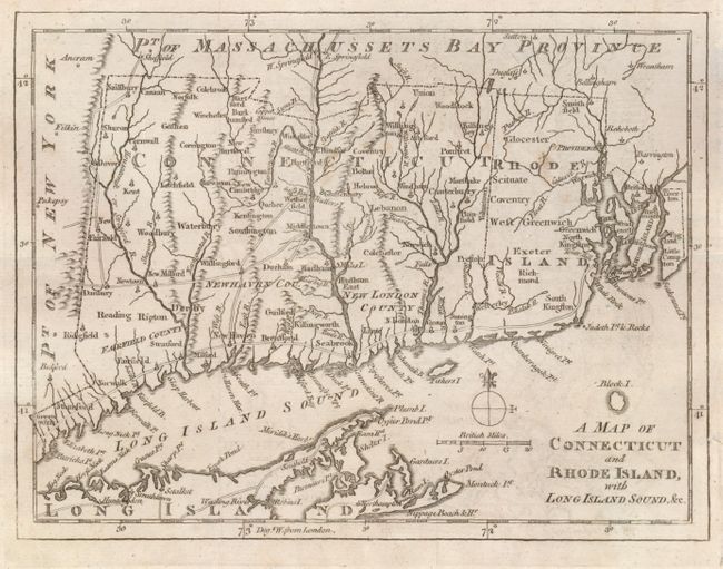
Auction 125, Lot 171
Subject: Colonial New England
Anon.
A Map of Connecticut and Rhode Island with Long Island Sound, &c., 1776
Size: 9 x 6.8 inches (22.9 x 17.3 cm)
Estimate: $200 - $250
Unsold
Closed on 9/24/2008
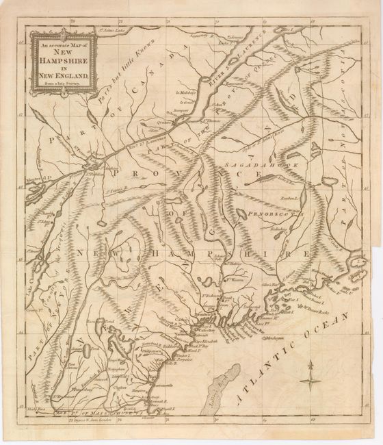
Auction 125, Lot 172
Subject: New England
Anon.
An accurate Map of New Hampshire in New England, from a late Survey, 1781
Size: 11.2 x 12.7 inches (28.4 x 32.3 cm)
Estimate: $250 - $325
Sold for: $110
Closed on 9/24/2008
Auction 125, Lot 173
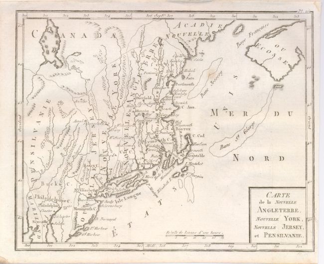
Subject: New England
Bertholon, C.
Carte de la Nouvelle Angleterre, Nouvelle York, Nouvelle Jersey, et Pensilvanie, 1799
Size: 8.5 x 6.8 inches (21.6 x 17.3 cm)
Estimate: $180 - $140
Sold for: $130
Closed on 9/24/2008
Auction 125, Lot 174
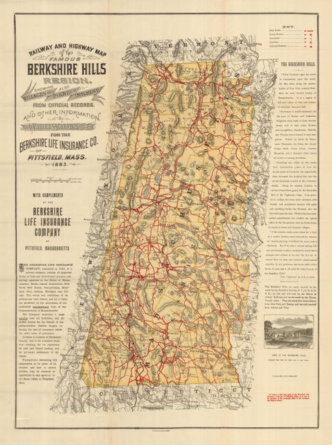
Subject: Massachusetts
Watson, C.E, Walter
Railway and Highway Map of the Famous Berkshire Hills Region, Showing also Villages and Points of Interest…, 1896
Size: 22 x 29.5 inches (55.9 x 74.9 cm)
Estimate: $350 - $400
Sold for: $250
Closed on 9/24/2008
215 lots
Page 1 of 5