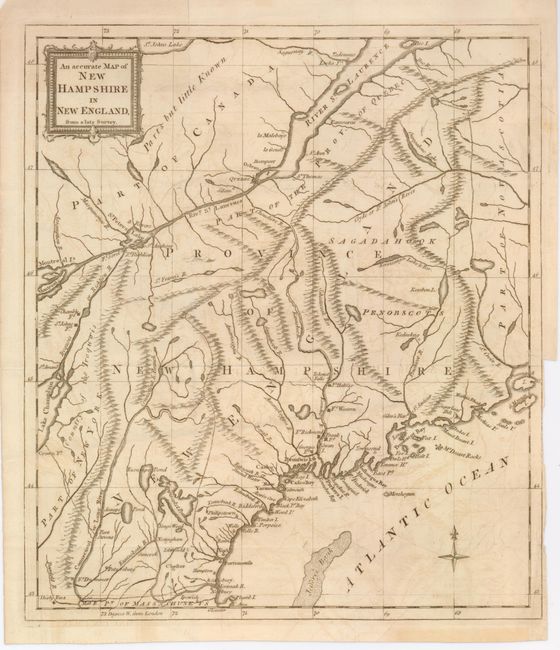
Subject: New England
Period: 1781 (published)
Publication: Universal Magazine
Color: Black & White
Size:
11.2 x 12.7 inches
28.4 x 32.3 cm
This Revolutionary War-era map covers the region of present-day Maine, New Hampshire and Vermont. Maps from British periodicals were designed to familiarize the magazine's readers with the location of the hostilities in the American War. New Hampshire was the first state to declare its independence in January 1776. No battles were fought on New Hampshire soil during the war, but the region was a major contributor to the war effort and thus of great interest to the British. Several strategic forts (including Fort Western) are located, mountains and watershed are illustrated in the interior, and there is good detail along the coastal areas. The region west of the Connecticut River is named both Part of New York and Country of the Iroquois. The title cartouche is contained in a picture frame-style cartouche.
References: Jolly UNIV-191; Seller and Van Ee #872.
Condition: B+
There is slight offsetting and a binding tear in the border and tight binding trim at lower right.