Subject: Colonial Louisiana
Period: 1744 (dated)
Publication: Allegmeine Historie der Reisen zu Wasser und zu Lande
Color: Hand Color
Size:
22 x 15.5 inches
55.9 x 39.4 cm
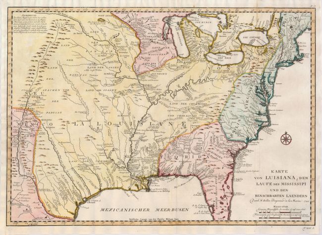
This is a scarce German issue of Bellin's map of Louisiana originally published in Charlevoix's Histoire. This finely engraved map covers the region from the Great Lakes to the Gulf of Mexico over to the Rocky Mountains and Santa Fe. The information in the west includes the road from Mexico City to Santa Fe and the routes of St. Denis and De Soto though Texas. The map shows strategic forts and areas claimed by the French just prior to the French and Indian War. Incredible detail of settlements, Indian tribes, rivers, and trails. The map is adorned by a nice compass rose. Published in 1756.
References: cf McCorkle #744-1; Brown (Ohio) pp. 69-70.
Condition: B+
Fine impression and nice color. Issued folding, now flattened with professional repair of a binding tear in the left border and replacement of the binding trim to better accommodate framing.