Subject: United States
Period: 1877 (published)
Publication: Zell's Encyclopedia
Color: Printed Color
Size:
16 x 11 inches
40.6 x 27.9 cm
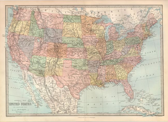
This map is unique for its depiction of the Territory of Huron in the northern portion of Dakota Territory. There was much interest in dividing Dakota Territory in the mid-1870's. In July, 1876 a democratic convention was held in Yankon to address the question, which resulted in a resolution declaring that "we favor the organization of a new territory out of the northern part of Dakota, and believe such an organization will largely tend to enhance the interests of the people in both sections." The U.S. Senate passed a bill in December of 1876 to create the Territory of Huron out of the Dakota Territory north of the 46th parallel, shown here with a dotted line. The bill was never signed into law, but here the cartographer acted on available information and included the nonexistent territory on this map. North and South Dakota were eventually created in 1879. We believe this to be a very scarce if not unique map, as we have found no other instances of maps showing the territory.
References:
Condition: A+
Fine example with beautiful color and impression with full margins.