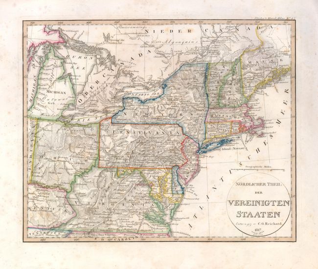
Subject: Eastern United States
Period: 1824 (dated)
Publication: Stieler's Hand Atlas
Color: Hand Color
Size:
13.3 x 11 inches
33.8 x 27.9 cm
This interesting German map covers the eastern states from eastern Kentucky and Indiana to the Atlantic. It was originally issued in 1817 and revised in 1824 to show the Michigan Territory. The northeastern boundary of Maine is undefined. One of the most interesting features of the map is the prominently marked Albemarle and Chesapeake Canal linking Petersburgh and Warrenton in Virginia. This canal was the second headwater canal in the Atlantic Intracoastal Waterway. First authorized in 1772, the canal project faced a number of political roadblocks over a period of 83 years before construction finally began in 1855. Its appearance on an 1824 map is an interesting anomaly.
References:
Condition: B
Lightly foxed.