Subject: Eastern United States
Period: 1800 (circa)
Publication:
Color:
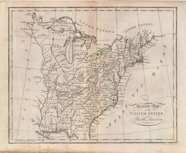
1) Engraved by Neele, the map shows pre-1800 political divisions including the Tennessee Government. A dotted line off the east coast identifies "The Twenty League Line." Filled with Indian tribes including the Outigamis, Nadowessis, Illinois, Miamis, Utawas, Chipawas, and more. Reserved army lands located along the Mississippi and Ohio Rivers include the Illinois Company, N. Jersey Company, Wabash Company, and lands reserved for the Virginia and N. Carolina troops. A pencil note on verso says "A System of Geography by a Literary Society Glasgow, 1802". Paper is watermarked 1801. Uncolored, 9" x 7.3". Some foxing, soft vertical creasing and water stain in lower margin not touching map. (B).
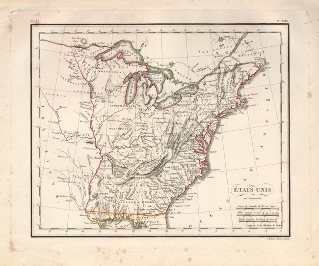
2) Engraved by Semen, the map does not identify Ohio and the land west of the Mississippi River is still Louisiana. Many Indian tribes and villages are named. A lead mine is located in today's northwestern Illinois. Florida is divided into the Spanish possessions of East and West Florida, Georgia extends to the Mississippi. Outline color, 10" x 8". Some foxing spots in margins, map is clean. (B+)
References:
Condition:
See individual descriptions above.