Subject: United States
Period: 1833-1899 (dated)
Publication:
Color: Printed Color
A historical set of folding maps showing the evolution of Indian Reservations over a period of 67 years.
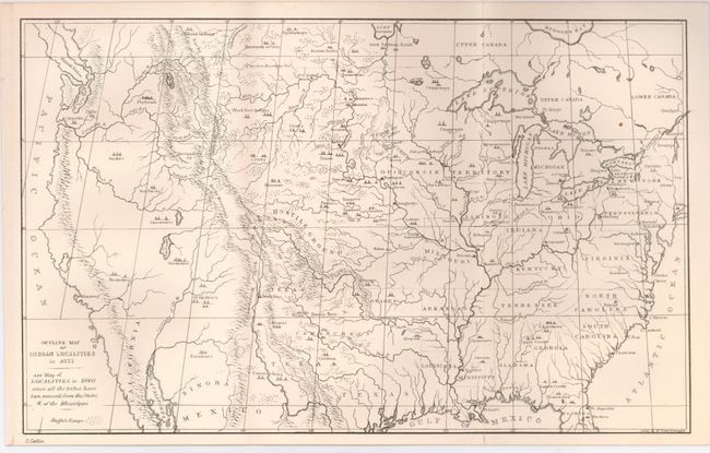
1) Outline Map of Indian Localities in 1833. (13 x 8"), b/w. This map is from a circa 1840 edition of Caitlin's Indian Gallery. Note below title: "See map of Localities in 1840 since all tribes have been removed from the states W. of the Mississippi." Folding, fine.
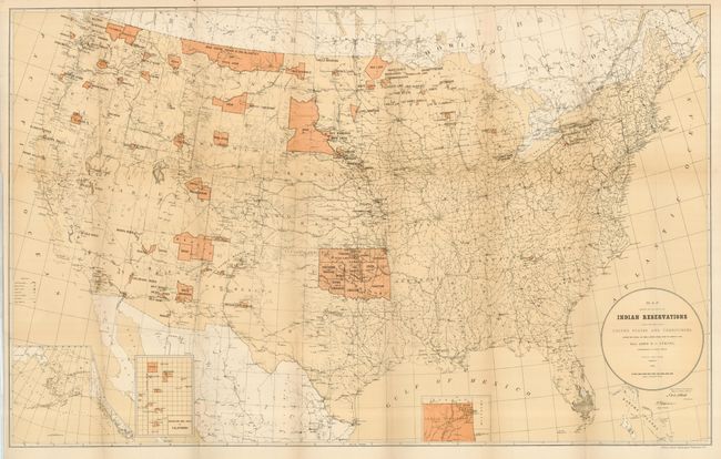
2) Map Showing the Locations of the Indian Reservations within the Limits of the United States and Territories. Compiled from Official and Other Authentic Sources, under the Direction of the Hon. John D.C. Atkins, Commissioner of Indian Affairs. 1885. Large and detailed, it locates towns, railroads, military stations and Indian agencies. Printed color. Drawn by Paul Brodie, draughtsman to the General Land Office. (33.5 x 21") Very good example with one small fold intersection split.
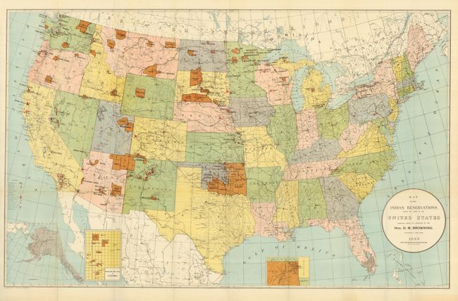
3) Map Showing Indian Reservation within the Limits of the United States Compiled under the Direction of the Hon. D.M. Browning. Commissioner of Indian Affairs., Norris Peters Co., Washington D.C., 1893. Colorful map shows reservations across the United States and locates towns, railroads, military stations, schools, and Indian agencies. This map also has insets of Indian Territory, Mission Ind. Res. of California and Alaska. (33 x 21"). Folding as issued, fine.
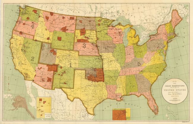
4) Map Showing Indian Reservation within the Limits of the United States Compiled under the Direction of the Hon. W.A. Jones. Commissioner of Indian Affairs., Norris Peters Co., Washington D.C., 1899. The same map as #3 with information updated to 1899. (33 x 21"). Folding as issued, fine.
References:
Condition:
See individual descriptions.