Catalog Archive
Auction 125, Lot 151

"[Lot of 2] Karte der Vereinigten Staaten von Amerika und von Canada [and] Landwirtschafts-Karte der Vereinigten Staaten von Canada", Petermann, Augustus Herman

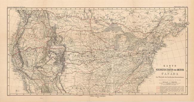
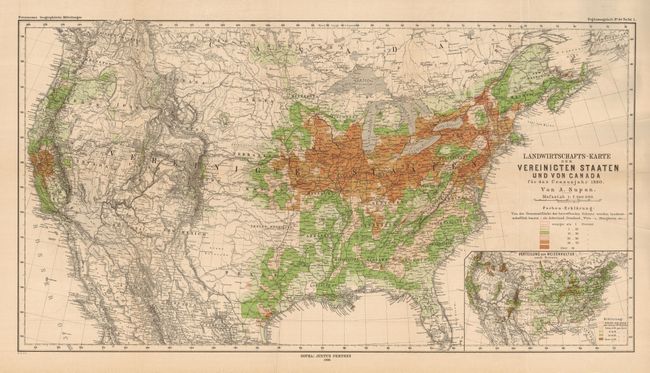
Subject: United States

Period: 1886 (dated)

Publication: Geographische Mitteilungen

Color: Printed Color

Size:
See Description
Download High Resolution Image
(or just click on image to launch the Zoom viewer)

Nice pair of maps that were published by Justus Perthes.

1) Railroad map with routes highlighted in red overprinting. Locates and names seven railroad systems. The map includes Canada up to about 50° and most of the U.S., less Florida and the southern extreme of the Gulf states. (27.5 x 13.5") Folding, fine. (A+)

2) This colorful thematic map shows population density indicated by color coding and grid. The underlying map of the U.S. shows terrific detail of watershed and mountains in hachure. (29.3 x 16") Folding as issued with soft crease at right. (A)

References:

Condition:

See individual descriptions.

Estimate: $140 - $160

Unsold

Closed on 9/24/2008

Archived