Subject: United States
Period: 1857 (dated)
Publication: Senate Ex. Doc. No. 11 & No. Ex. Doc. No. 2, 1 Session, 35 Cong
Color: Hand Color
Size:
29.3 x 13.5 inches
74.4 x 34.3 cm
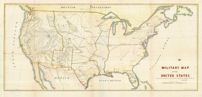
This interesting map shows how quickly the military establishment in the West grew following the war with Mexico. A black line shows the Extreme line of outposts in 1845, which is well east of the 100th meridian. The western region is now divided into military districts and numerous forts for protection of the frontier are shown therein. The topography and river systems of the West are shown along with several recent exploration routes. Wheat called this map very illuminating, and it would be a fine addition to any collection focusing on the mapping of the West or military development.
References: Wheat [TMW] #929.
Condition: B+
Issued folded, now flattened with the left margin extended and fold separations backed with light Japanese tissue. There is a War Department Library seal on verso.