Filtered by Category:United States(Show All Categories)
Showing results for:Auction 111
Catalog Archive
189 lots
Page 1 of 4
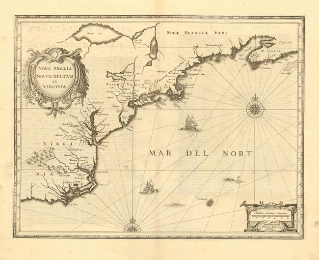
Auction 111, Lot 96
Subject: Colonial New England and Mid-Atlantic
Jansson, Jan
Nova Anglia Novum Belgium et Virginia, 1638
Size: 19.8 x 15.2 inches (50.3 x 38.6 cm)
Estimate: $2,200 - $2,750
Unsold
Closed on 6/8/2005
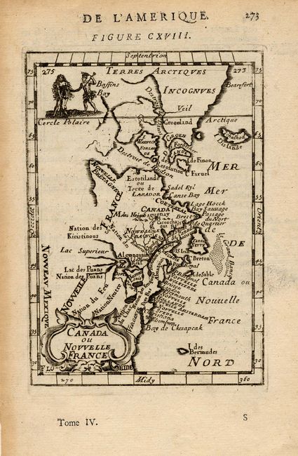
Auction 111, Lot 97
Subject: Colonial Canada & United States
Mallet, Alain Manesson
Canada ou Nouvelle France, 1683
Size: 4 x 5.5 inches (10.2 x 14 cm)
Estimate: $200 - $250
Sold for: $150
Closed on 6/8/2005
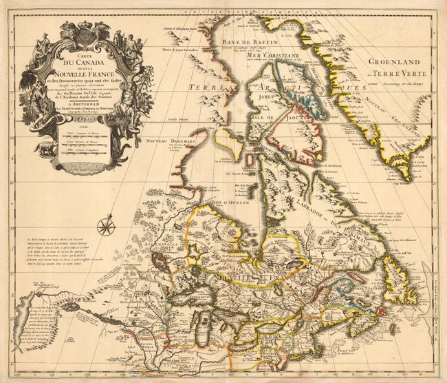
Auction 111, Lot 98
Subject: Colonial Canada & Great Lakes
Delisle/Covens & Mortier
Carte du Canada ou de la Nouvelle France et des Decouvertes qui y ont ete faites…, 1730
Size: 22.2 x 19.2 inches (56.4 x 48.8 cm)
Estimate: $1,100 - $1,200
Sold for: $1,100
Closed on 6/8/2005
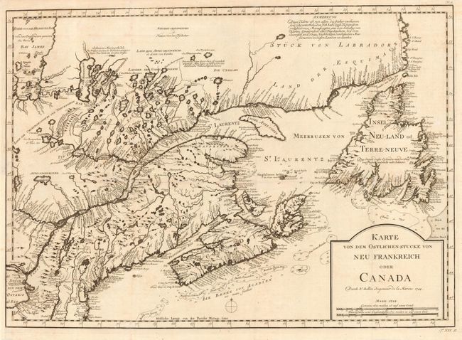
Auction 111, Lot 99
Subject: Colonial Canada & New England
Bellin, Jacques Nicolas
Karte von dem Ostlichen-Stucke von Neu Frankreich oder Canada, 1744
Size: 22 x 15.5 inches (55.9 x 39.4 cm)
Estimate: $550 - $650
Sold for: $325
Closed on 6/8/2005
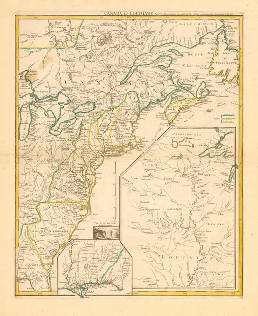
Auction 111, Lot 100
Subject: Colonial Canada & United States
Le Rouge, George Louis
Canada et Louisiane…, 1755
Size: 19.7 x 24 inches (50 x 61 cm)
Estimate: $1,800 - $2,100
Sold for: $1,200
Closed on 6/8/2005
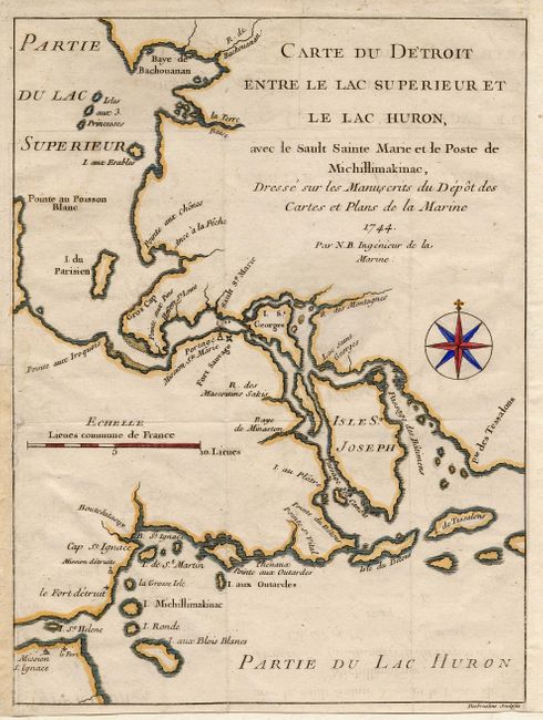
Auction 111, Lot 101
Subject: Colonial Great Lakes
Bellin, Jacques Nicolas
Carte du Detroit entre le Lac Superieur et le Lac Huron, avec le Sault Sainte Marie et le Poste de Michillimakinac…, 1744
Size: 6.2 x 8.2 inches (15.7 x 20.8 cm)
Estimate: $200 - $250
Sold for: $550
Closed on 6/8/2005
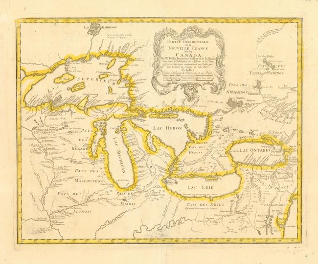
Auction 111, Lot 102
Subject: Colonial Great Lakes
Bellin/Homann Heirs
Partie Occidentale de la Nouvelle France ou du Canada, 1755
Size: 21 x 16.5 inches (53.3 x 41.9 cm)
Estimate: $1,600 - $1,800
Sold for: $1,600
Closed on 6/8/2005
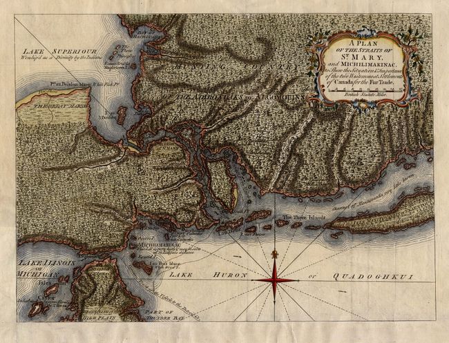
Auction 111, Lot 103
Subject: Colonial Great Lakes
Anon.
A Plan of the Straits of St. Mary, and Michilimakinac, to Shew the Situation & Importance of the two Westernmost Settlements of Canada for the Fur Trade, 1761
Size: 12.6 x 9.3 inches (32 x 23.6 cm)
Estimate: $350 - $400
Sold for: $350
Closed on 6/8/2005
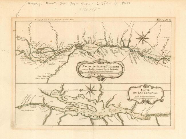
Auction 111, Lot 104
Subject: Colonial Canada and New York
Bellin, Jacques Nicolas
Partie du Fleuve St. Laurent depuis Quebec jusqu'au Lac St. Francois [on sheet with] Carte du Lac Champlain, 1764
Size: 12.2 x 8.2 inches (31 x 20.8 cm)
Estimate: $140 - $180
Sold for: $120
Closed on 6/8/2005
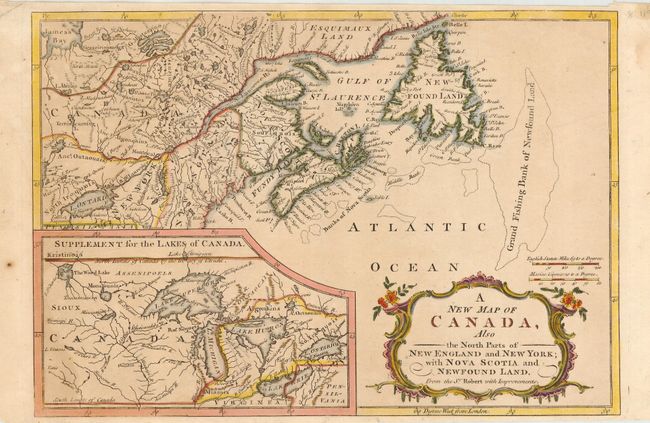
Auction 111, Lot 105
Subject: Colonial Canada, New England and Great Lakes
Anon.
A New Map of Canada, Also the North Parts of New England and New York; with Nova Scotia and Newfound Land, 1766
Size: 11.5 x 7.9 inches (29.2 x 20.1 cm)
Estimate: $180 - $240
Sold for: $200
Closed on 6/8/2005
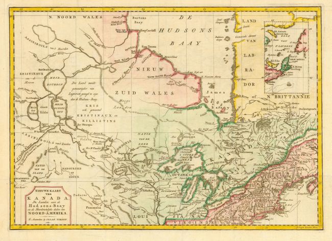
Auction 111, Lot 106
Subject: Colonial Canada and Great Lakes
Tirion, Isaac
Nieuwe Kaart van Kanada, de Landen aan de Hudsons-Baay en de Noordwestelyke deelen van Noord-Amerika, 1769
Size: 17 x 12 inches (43.2 x 30.5 cm)
Estimate: $350 - $400
Sold for: $250
Closed on 6/8/2005
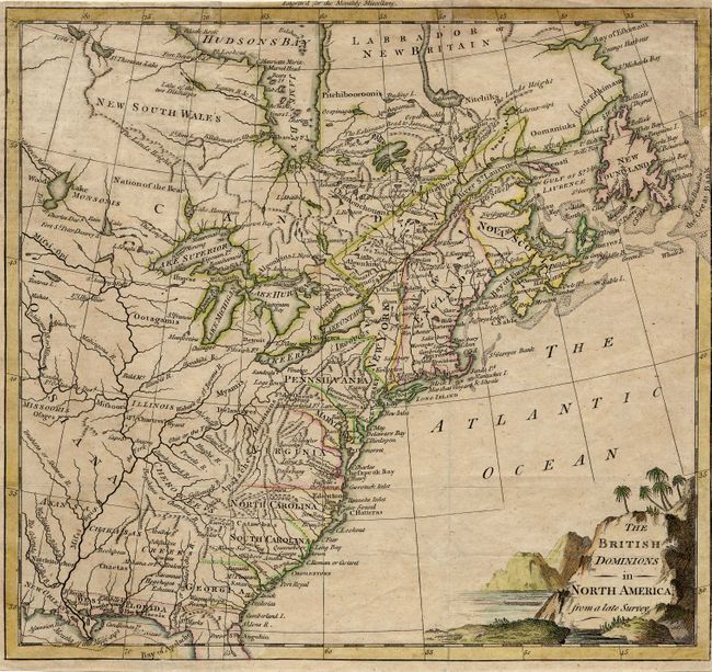
Auction 111, Lot 107
Subject: Colonial United States & Canada
Anon.
The British Dominions in North America from a late Survey, 1774
Size: 10 x 9.2 inches (25.4 x 23.4 cm)
Estimate: $350 - $400
Sold for: $450
Closed on 6/8/2005
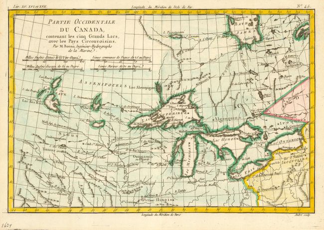
Auction 111, Lot 108
Subject: Colonial Canada & Great Lakes
Bonne, Rigobert
Partie Occidentale du Canada, Contenant les cinq Grands Lacs, avec les Pays Circonvoisins, 1775
Size: 12.5 x 8.4 inches (31.8 x 21.3 cm)
Estimate: $275 - $325
Sold for: $250
Closed on 6/8/2005
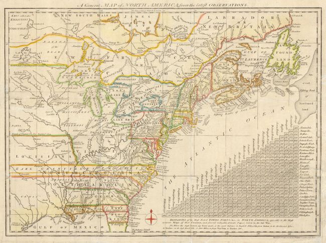
Auction 111, Lot 109
Subject: Colonial Canada & United States
Lodge, John
A General Map of North America from the latest Observations, 1776
Size: 15 x 10.8 inches (38.1 x 27.4 cm)
Estimate: $500 - $600
Sold for: $600
Closed on 6/8/2005
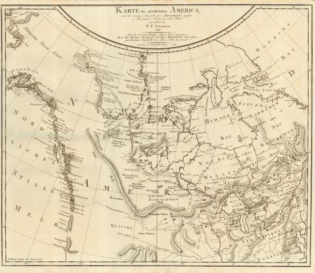
Auction 111, Lot 110
Subject: Colonial Canada & United States
Sotzmann, Daniel Friedrich
Karte des nordlichsten America…, 1791
Size: 18.8 x 15.5 inches (47.8 x 39.4 cm)
Estimate: $1,000 - $1,300
Sold for: $750
Closed on 6/8/2005
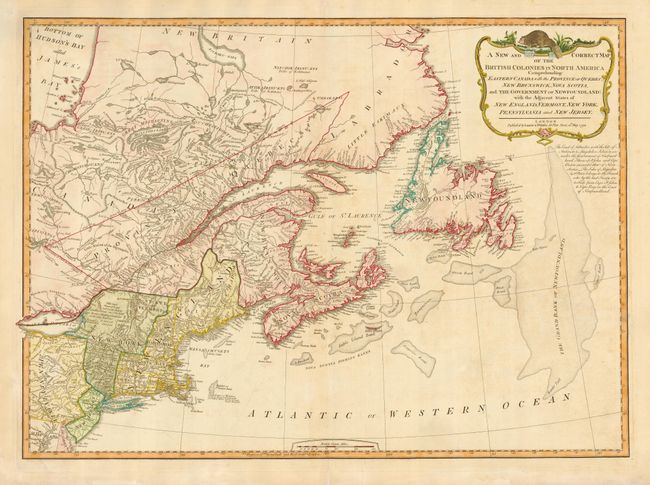
Auction 111, Lot 111
Subject: Colonial Canada & New England
Laurie & Whittle
A New and Correct Map of the British Colonies in North America Comprehending Eastern Canada with the Province of Quebec, New Brunswick, Nova Scotia, and the Government of Newfoundland: with the Adjacent States of New England, Vermont, New York…, 1794
Size: 26 x 18.7 inches (66 x 47.5 cm)
Estimate: $600 - $700
Sold for: $500
Closed on 6/8/2005
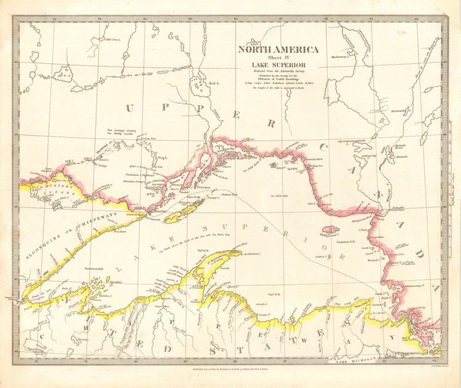
Auction 111, Lot 112
Subject: Canada and Great Lakes
SDUK Society for the Diffusion of Useful Knowledge
North America Sheet IV Lake Superior, 1832
Size: 15 x 12 inches (38.1 x 30.5 cm)
Estimate: $120 - $150
Sold for: $65
Closed on 6/8/2005
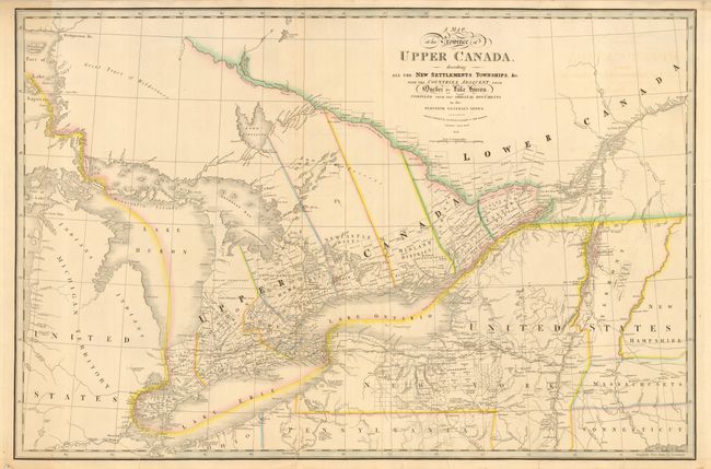
Auction 111, Lot 113
Subject: Canada and Great Lakes
Wyld, James
A Map of the Province of Upper Canada describing All the New Settlements, Townships, &c. with the Countries Adjacent, from Quebec to Lake Huron, 1838
Size: 33.7 x 22.3 inches (85.6 x 56.6 cm)
Estimate: $300 - $400
Sold for: $425
Closed on 6/8/2005
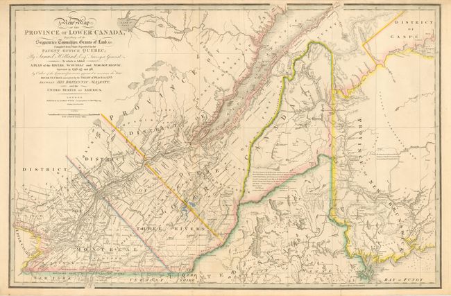
Auction 111, Lot 114
Subject: Canada and New England
Wyld, James
A New Map of the Province of Lower Canada, Describing all the Seigneuries, Townships, Grants of Land, &c. Compiled from Plans deposited in the Patent Office Quebec: by Samuel Holland, Esq. Surveyor General…, 1840
Size: 34 x 22.4 inches (86.4 x 56.9 cm)
Estimate: $350 - $450
Sold for: $275
Closed on 6/8/2005
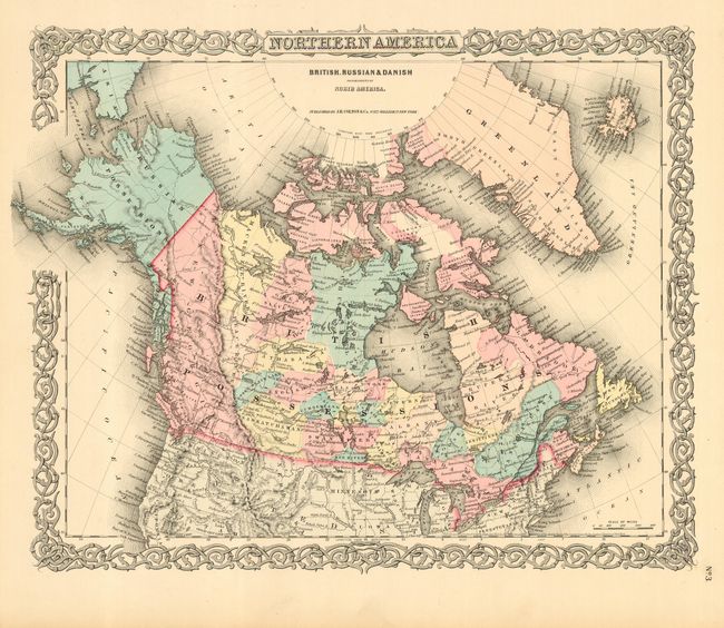
Auction 111, Lot 115
Subject: Canada & Alaska
Colton, Joseph Hutchins
Northern America British, Russian & Danish Possessions in North America, 1855
Size: 16 x 12.7 inches (40.6 x 32.3 cm)
Estimate: $140 - $180
Sold for: $80
Closed on 6/8/2005
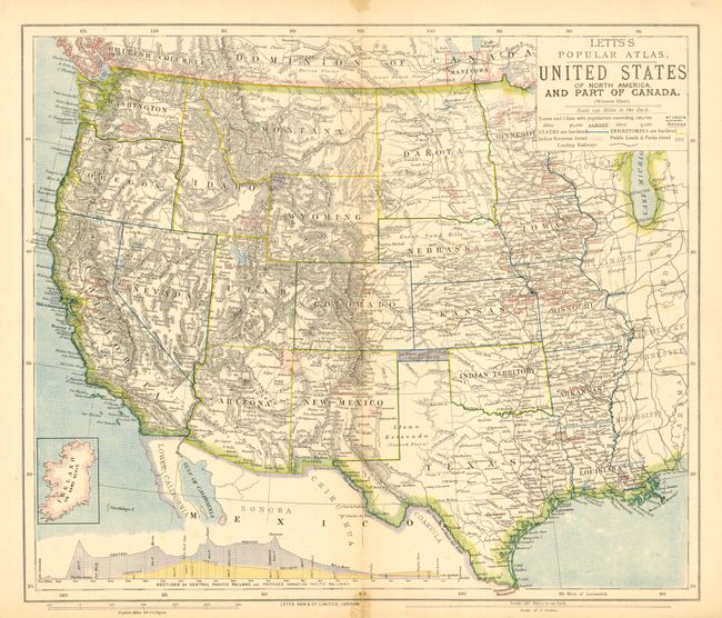
Auction 111, Lot 116
Subject: Western United States and Canada
Letts & Son
United States of North America and Part of Canada, 1883
Size: 15.5 x 13 inches (39.4 x 33 cm)
Estimate: $50 - $75
Sold for: $170
Closed on 6/8/2005
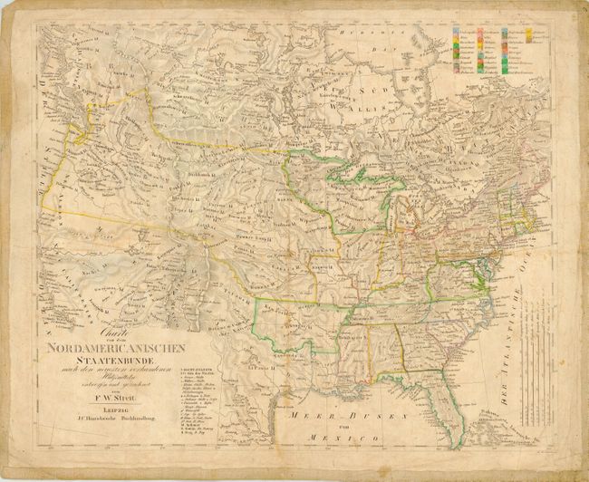
Auction 111, Lot 117
Subject: United States and Canada
Streit, Friedrich Wilhelm
Charte von dem Nordamericanischen Staatenbunde, nach den neucsten vorhandenen…, 1821
Size: 18.5 x 15.4 inches (47 x 39.1 cm)
Estimate: $250 - $350
Sold for: $400
Closed on 6/8/2005
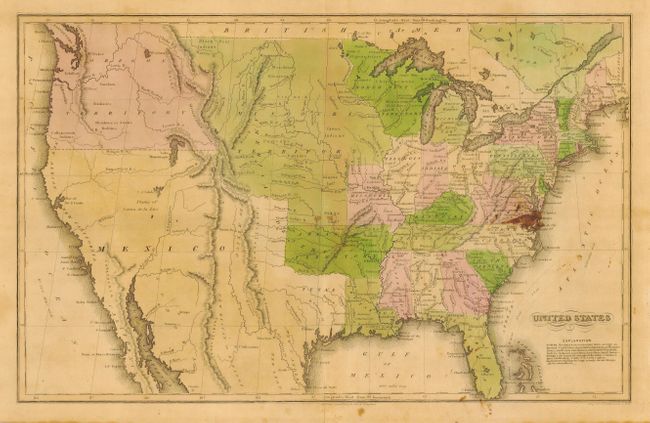
Auction 111, Lot 118
Subject: United States
Hammond, J.T.
United States, 1833
Size: 16.6 x 10.3 inches (42.2 x 26.2 cm)
Estimate: $80 - $100
Sold for: $110
Closed on 6/8/2005
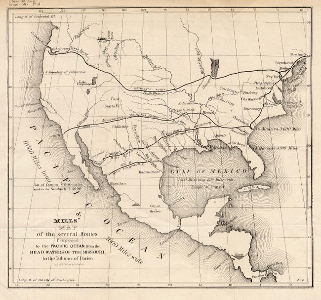
Auction 111, Lot 119
Subject: United States
U.S. Government
Mills' Map of the several Routes Proposed to the Pacific Ocean from the Head Waters of the Missouri, to the Isthmus of Darien, 1848
Size: 9 x 8.1 inches (22.9 x 20.6 cm)
Estimate: $150 - $250
Sold for: $350
Closed on 6/8/2005
Auction 111, Lot 120
Subject: United States
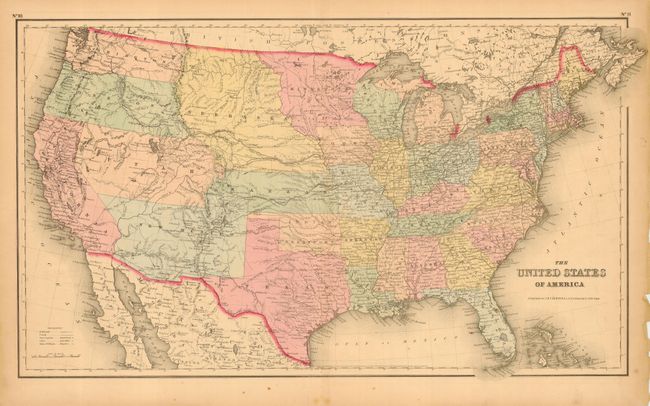
Colton, Joseph Hutchins
The United States of America, 1855
Size: 25 x 14.6 inches (63.5 x 37.1 cm)
Estimate: $275 - $325
Sold for: $400
Closed on 6/8/2005
Auction 111, Lot 121
Subject: United States
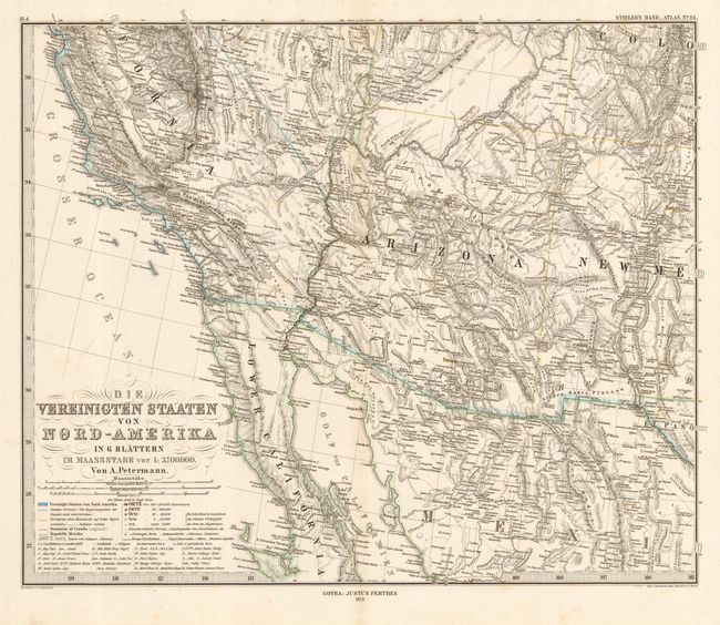
Petermann, Augustus Herman
Die Vereinigten Staaten von Nord-Amerika in 6 Blattern, 1873
Size: 16 x 13.2 inches (40.6 x 33.5 cm)
Estimate: $200 - $250
Sold for: $150
Closed on 6/8/2005
Auction 111, Lot 122
Subject: United States
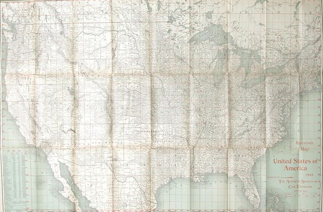
Rand McNally & Co.
Reference Map of the United States of America 1893 Presented by the American Society of Civil Engineers, 1893
Size: 30.5 x 20.5 inches (77.5 x 52.1 cm)
Estimate: $120 - $180
Sold for: $170
Closed on 6/8/2005
Auction 111, Lot 123
Subject: United States
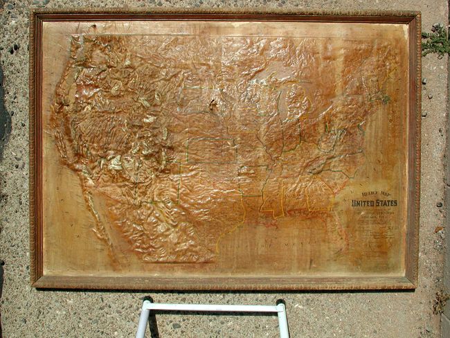
Central School Supply House
Relief Map of United States, 1899
Size: 40 x 27 inches (101.6 x 68.6 cm)
Estimate: $250 - $300
Unsold
Closed on 6/8/2005
Auction 111, Lot 124
Subject: United States, Cuba & Philippines
Fort Dearborn Pub. Co.
[Lot of 3] Map of United States [and] Geoff's Historical Map of the Spanish - American War in the West Indies, 1898 [and] Philippine Islands, 1899
Size: 19.7 x 13 inches (50 x 33 cm)
Estimate: $100 - $140
Sold for: $350
Closed on 6/8/2005
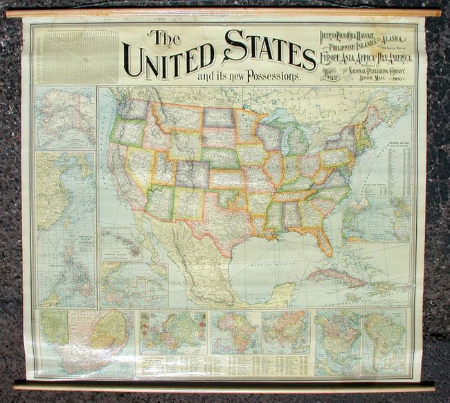
Auction 111, Lot 125
Subject: United States
National Publishing Co.
The United States and its new Possessions - Puerto Rico, Cuba, Hawaii, Philippine Islands and Alaska with General Maps of Europe, Asia, Africa and Pan-America, 1900
Size: 39 x 36 inches (99.1 x 91.4 cm)
Estimate: $350 - $450
Sold for: $550
Closed on 6/8/2005
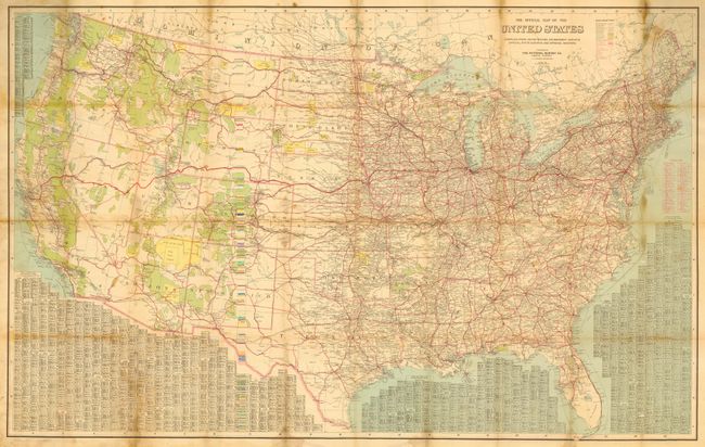
Auction 111, Lot 126
Subject: United States
National Survey Co.
The Official Map of the United States, 1916
Size: 49 x 31.2 inches (124.5 x 79.2 cm)
Estimate: $75 - $100
Sold for: $60
Closed on 6/8/2005
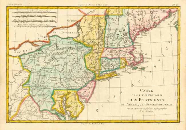
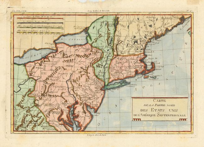
Auction 111, Lot 127
Subject: United States - Eastern
Bonne, Rigobert
Carte de la Partie Nord, des Etats Unis, de l'Amerique Septentrionale, 1775
Size: 12.5 x 8.4 inches (31.8 x 21.3 cm)
Estimate: $250 - $300
Sold for: $240
Closed on 6/8/2005
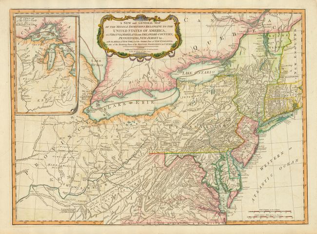
Auction 111, Lot 128
Subject: United States - Mid-Atlantic and Great Lakes
Laurie & Whittle
A New and General Map of the Middle Dominions Belonging to the United States of America, viz Virginia, Maryland, The Delaware-Counties, Pennsylvania, New Jersey &c., 1794
Size: 26 x 19 inches (66 x 48.3 cm)
Estimate: $1,500 - $1,800
Sold for: $1,000
Closed on 6/8/2005
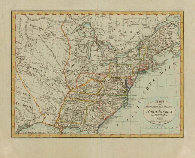
Auction 111, Lot 129
Subject: United States - Eastern
Weimar Geographisches Institut
Charte von den Vereinigten Staaten von Nord-America mit Luisiana, 1806
Size: 16.2 x 12 inches (41.1 x 30.5 cm)
Estimate: $375 - $450
Sold for: $275
Closed on 6/8/2005
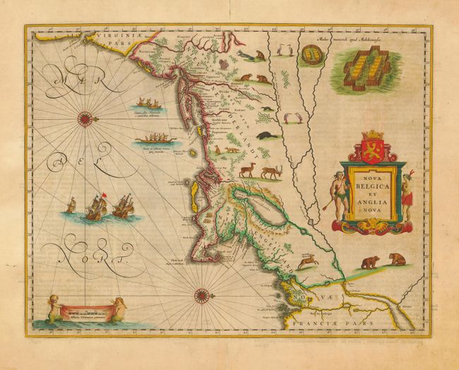
Auction 111, Lot 130
Subject: Colonial New England
Blaeu, Willem
Nova Belgica et Anglia Nova, 1662
Size: 19.7 x 15.2 inches (50 x 38.6 cm)
Estimate: $3,750 - $4,500
Sold for: $3,250
Closed on 6/8/2005
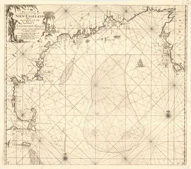
Auction 111, Lot 131
Subject: Colonial New England
Keulen, Johannes van
Pas-Kaart Vande Zee Kusten inde Boght van Niew Engeland Tusschen de Staaten Hoek en C. de Sable…, 1684
Size: 23 x 20 inches (58.4 x 50.8 cm)
Estimate: $3,250 - $4,000
Sold for: $2,000
Closed on 6/8/2005
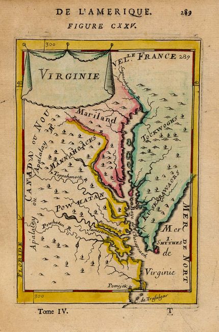
Auction 111, Lot 132
Subject: New England
Bonne, Rigobert
Carte de al Partie Nord des Etats Unis de l'Amerique Septentrionale, 1783
Size: 12.7 x 8.4 inches (32.3 x 21.3 cm)
Estimate: $180 - $200
Sold for: $190
Closed on 6/8/2005
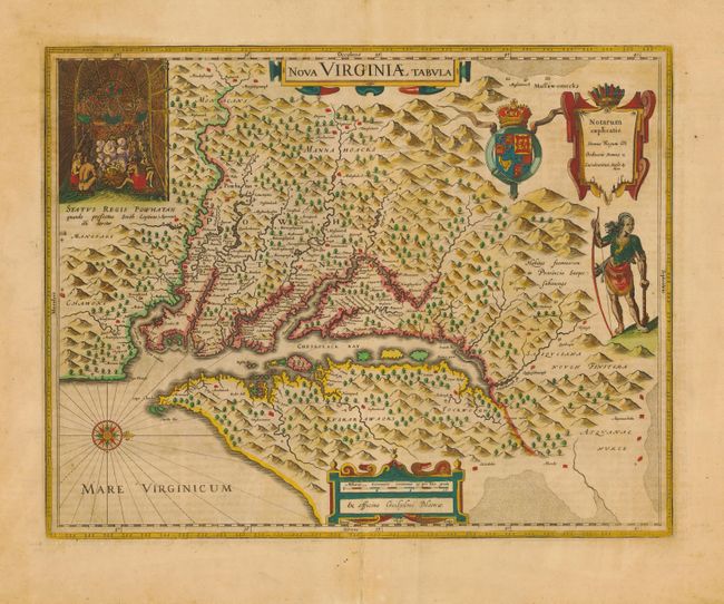
Auction 111, Lot 133
Subject: Colonial Mid-Atlantic
Hondius/Blaeu
Nova Virginiae Tabula, 1662
Size: 18.7 x 14.7 inches (47.5 x 37.3 cm)
Estimate: $2,500 - $3,250
Sold for: $2,400
Closed on 6/8/2005
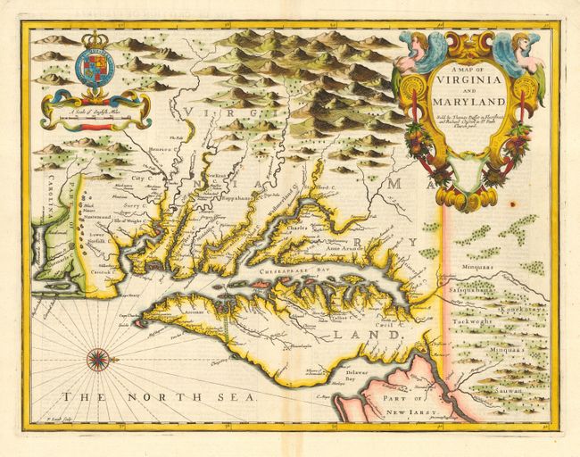
Auction 111, Lot 134
Subject: Colonial Mid-Atlantic
Speed/Lamb
A Map of Virginia and Maryland, 1676
Size: 19.2 x 14.9 inches (48.8 x 37.8 cm)
Estimate: $5,000 - $6,000
Sold for: $4,000
Closed on 6/8/2005
Auction 111, Lot 135
Subject: Colonial Mid-Atlantic
Mallet, Alain Manesson
Virginie, 1683
Size: 4 x 6 inches (10.2 x 15.2 cm)
Estimate: $275 - $350
Sold for: $400
Closed on 6/8/2005
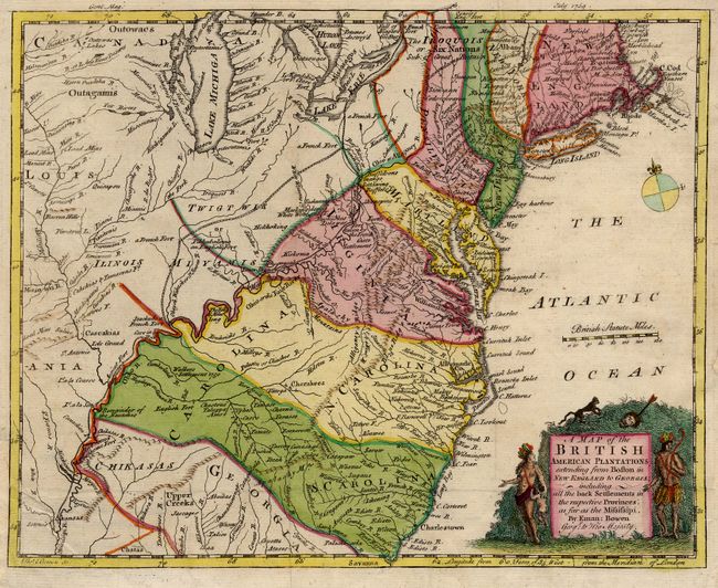
Auction 111, Lot 136
Subject: Colonial Mid-Atlantic
Bowen, Emanuel
A Map of the British American Plantations extending from Boston in New England to Georgia; including all the back Settlements in the respective Provinces, as far as the Mississipi, 1754
Size: 10.7 x 8.6 inches (27.2 x 21.8 cm)
Estimate: $400 - $500
Sold for: $600
Closed on 6/8/2005
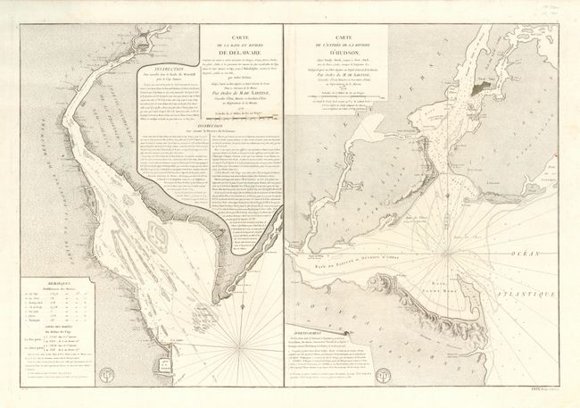
Auction 111, Lot 137
Subject: Colonial Mid Atlantic
Sartine
Carte de la Baye et Riviere de Delaware... [on sheet with] Carte de l'Entree de la Riviere d'Hudson…, 1778
Size: 34 x 23 inches (86.4 x 58.4 cm)
Estimate: $3,000 - $4,000
Unsold
Closed on 6/8/2005
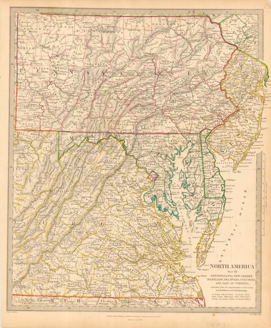
Auction 111, Lot 138
Subject: United States - Mid-Atlantic
SDUK Society for the Diffusion of Useful Knowledge
North America Sheet VII - Pennsylvania, New Jersey, Maryland, Delaware, Columbia and part of Virginia, 1833
Size: 12.3 x 14.7 inches (31.2 x 37.3 cm)
Estimate: $80 - $100
Unsold
Closed on 6/8/2005
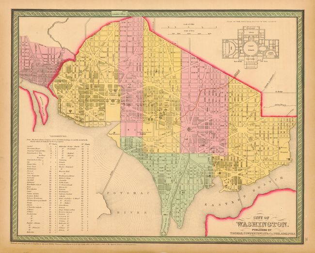
Auction 111, Lot 139
Subject: United States - Mid-Atlantic
Thomas, Cowperthwait & Co.
[Lot of 2] City of Washington [and] A New Map of Maryland and Delaware with their Canals, Roads & Distances, 1850
Size: 14.5 x 12 inches (36.8 x 30.5 cm)
Estimate: $150 - $200
Sold for: $170
Closed on 6/8/2005
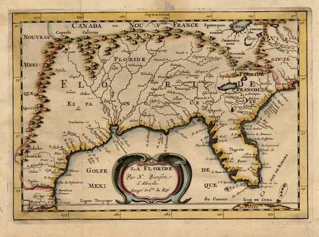
Auction 111, Lot 140
Subject: Colonial South
Sanson, Nicolas
La Floride, 1682
Size: 9.9 x 6.9 inches (25.1 x 17.5 cm)
Estimate: $600 - $650
Sold for: $475
Closed on 6/8/2005
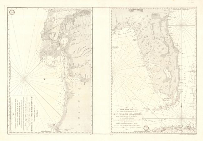
Auction 111, Lot 141
Subject: Colonial South
Sartine
Carte d'une Partie des Cotes de la Floride et de la Louisiane… [on sheet with] Carte Reduite des Cotes et de l'Interieur de la Presqu'ile de la Floride, avec le Detroit de Cette Presqu'ile et le Canal de Bahama, 1778-80
Size: 34.2 x 23 inches (86.9 x 58.4 cm)
Estimate: $3,000 - $4,000
Sold for: $2,200
Closed on 6/8/2005
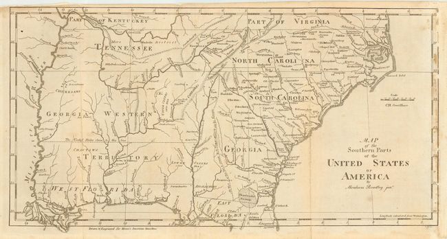
Auction 111, Lot 142
Subject: Southern United States
Bradley, Abraham Jr.
Map of the Southern Parts of the United States of America, 1797
Size: 15.1 x 7.6 inches (38.4 x 19.3 cm)
Estimate: $325 - $400
Sold for: $325
Closed on 6/8/2005
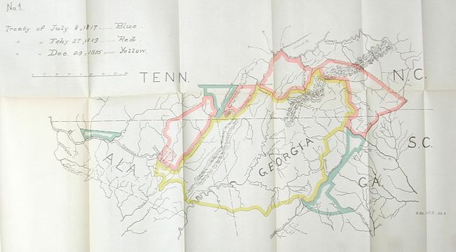
Auction 111, Lot 143
Subject: Southern United States & Oklahoma
U.S. Government
[Lot of 2 - Cherokee Nation], 1895
Size: See Description
Estimate: $100 - $150
Sold for: $210
Closed on 6/8/2005
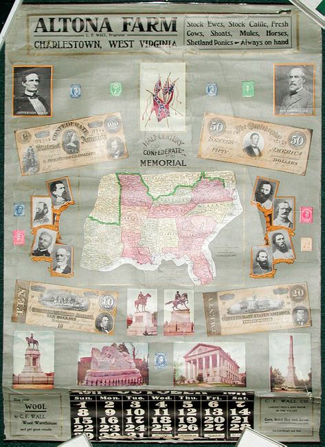
Auction 111, Lot 144
Subject: Southern United States
Half Century Confederate Memorial, 1911
Size: 21 x 29 inches (53.3 x 73.7 cm)
Estimate: $200 - $300
Sold for: $140
Closed on 6/8/2005
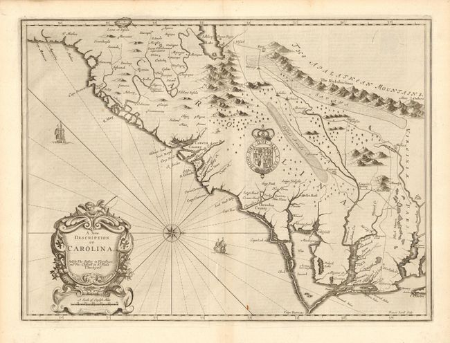
Auction 111, Lot 145
Subject: Colonial Southeast
Speed/Lamb
A New Description of Carolina, 1676
Size: 19.2 x 14.9 inches (48.8 x 37.8 cm)
Estimate: $5,000 - $6,000
Sold for: $4,250
Closed on 6/8/2005
189 lots
Page 1 of 4