Subject: Colonial New England
Period: 1662 (circa)
Publication: Atlas maior sive Geographia
Color: Hand Color
Size:
19.7 x 15.2 inches
50 x 38.6 cm
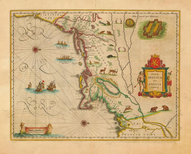
This important map, first issued in 1635, is one of the first to focus on the Dutch colony in North America and to name Nieu Amsterdam (New York). It is based on the manuscript of Andriaen Block (1614), a Dutch fur trader, who explored the area between Cape Cod and Manhattan and was the first to correctly delineate the longitudinal scale of the coastline and establish Manhattan as an island. The colony of Nieu Pleimonth is identified, as well as other English names along the coast, which were derived from Smith's map of New England in 1616. The map is oriented with west at top and is richly adorned with a variety of wildlife, including the first appearance of beavers, polecats and otters on a printed map. A large Mohawk village is shown derived from the White-de Bry engravings. It is further embellished with a large title cartouche flanked by two natives, sailing ships, canoes, and compass roses.
References: Burden #241; Goss (Blaeu) p. 164; Manasek #46; Van der Krogt (Atlantes) #9310:2.
Condition: A
Fine impression and old color with minor toning. Expert repair of centerfold in blank margins and some chipped edges, well away from map.