Subject: Colonial Mid-Atlantic
Period: 1676 (published)
Publication: A Prospect of the Most Famous Parts of the World
Color: Hand Color
Size:
19.2 x 14.9 inches
48.8 x 37.8 cm
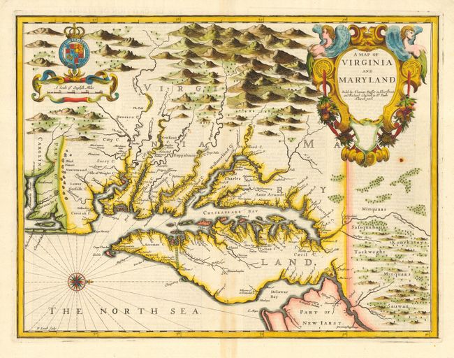
This famous map of the Chesapeake region is the last major derivative of John Smith's map of Virginia but is unique in that it also draws on the influential map by Augustine Herman of 1673 - thus becoming a transitional map between two important prototypes. The delineation of the land area follows Smith while the toponymic details are based on Herman. The plate was engraved by Francis Lamb in his vivid style with topography artistically depicted and large title and scale cartouches. The English text on verso provides a fascinating glimpse of colonial life. Speed's atlas was the first world atlas produced wholly in England. It was first published in 1627 without any maps of the American colonies. It was not until the last edition (47 years after Speed's death), by Thomas Bassett and Richard Chiswell, that the new maps of America, engraved by Francis Lamb, were added.
References: Tooley (Amer) p.170, Derivative 9, state 1.
Condition: A
Fine impression and later color. Bit of faint toning on bottom fold and one small rust spot else fine.