Subject: Colonial South
Period: 1682 (circa)
Publication: Curieus Aenmerckingen der bysonderste Oost en West Indische
Color: Hand Color
Size:
9.9 x 6.9 inches
25.1 x 17.5 cm
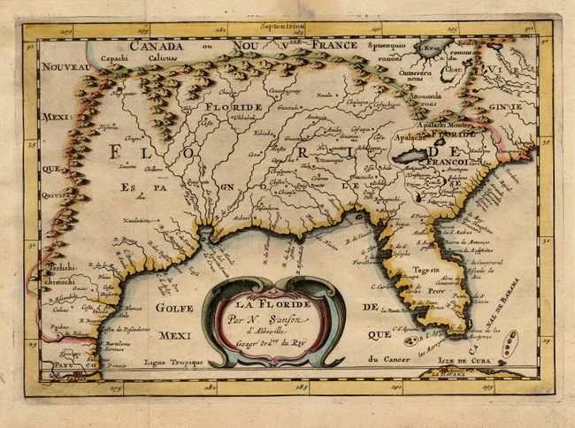
Detailed map showing the Spanish and French possessions in the southern part of North America. The map extends from the southernmost part of Virginia to the coast of what is now Texas. When first introduced by Sanson in 1657 this map was the first to use the name L. Erie in an atlas and to introduce several new rivers in Virginia. The French claims in the Carolinas are reasserted with the region named Floride Francoise. This issue is from an re-engraved plate published by Joannes Ribbius and Simon de Vries.
References: Burden #326; Cumming (SE) #53.
Condition: A
Some faint stains and a minor tear in margins, not affecting map.